Elevation: 9,980 ft
Prominence: 360
This peak is not in the book. Published November 2022
Peak 9980 is located east of the main north-south Smoky Mountains Crest and south of Smoky Lake. It is most easily reached via its east ridge from the Norton Lakes trailhead. USGS Baker Peak
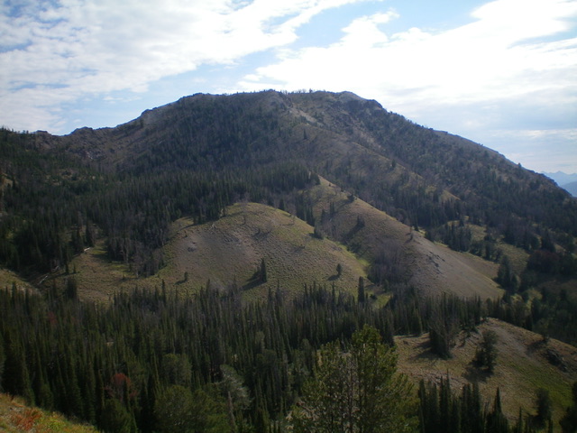
Peak 9980 as viewed from the west. My ascent route climbs the open shoulders in the center of the photo. Livingston Douglas Photo
Access
Same as for Peak 9335. This is the final leg of a 3-peak adventure that includes Peak 9335, Peak 9615, and Peak 9980.
West Face, Class 3
The Climb
From the 9,220-foot ridge saddle northeast of Peak 9615, continue along (then on the right/east side of) the ridge on a trail to reach a gully (and shoulder of scrub/shale) that leads right/east down to the crossing of a major dry gully that separates the ridge you are standing on from Peak 9980. The key to reaching Peak 9980 is to get across the massive gully while minimizing the elevation drop in so doing. Leave the ridge trail and descend the gully briefly then move onto the shoulder to angle over and cross the massive dry gully at the base of the west face of Peak 9980. Once across the gully, climb up two or three grassy shoulders (with pine forest nearby) that head northeast up to the summit ridge.
Climb up the second shoulder (steep grass/gravel with scrub and scattered pines) to intercept a northbound ridge of sorts that leads steeply to the summit ridge just left/northwest of the two potential high points. The upper section of the northbound ridge is Class 3 ribs which are necessary to make any headway up the very steep, loose scree/gravel. Once on the summit ridge, stroll southeast to the first summit hump (the uncairned north summit). Continue south to the cairned, official summit hump of Peak 9980. Ironically, the official south summit hump measures five feet lower than the unofficial north summit hump. Stand on both humps just to be sure. The two humps are only about 50 yards apart.
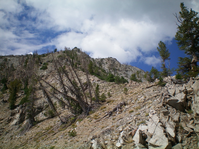
The upper section of the rocky, rugged northeast ridge (my descent route). Livingston Douglas Photo
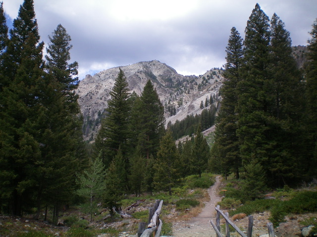
Peak 9980 (just left of center) as viewed from the Norton Lakes trailhead. Livingston Douglas Photo
East Ridge, Class 3
The Descent
From the south summit, descend northeast down the rugged ridge. The ridge is a mix of ridge pines and steep, rocky, loose terrain. It is tedious and not pleasant. You soon have a clear view of the parking lot for the Norton Lakes trailhead, the terminus for this ridge descent. The ridge slope eases and you reach gentle Point 9049. From Point 9049, descend east along the ridge into a problem area of ridge towers. Skirt these towers on their right/south sides on steep, loose ledges and chutes (Class 3). The side-hilling here is brutal. Regain the ridge after passing the towers and continue down the ridge through a mix of pine forest and rocky ridge outcrops.
Farther down, encounter a final ridge block and leave the ridge to descent right/southeast then east on steep gravel then forest (with underlying loose scree/gravel) to reach the Norton Lakes Trail a short distance from the trailhead. While probably the shortest route to the summit, ascending the east ridge would be difficult given how steep and loose the terrain is.
Additional Resources
Regions: Smoky Mountains->WESTERN IDAHO
Mountain Range: Smoky Mountains
Longitude: -114.65801 Latitude: 43.73129