Elevation: 10,004 ft
Prominence: 416
This peak is not in the book. Judi Steciak and Carl Hamke submitted the information for the first two routes found below. Steve Grantham likely made the first ascent in 2014. His route is also found below. Livingston Douglas added additional photos and a more in-depth description of the southeast ridge, which requires a significant amount of Class 3 climbing. Livingston’s photos show how rugged the southeast ridge is. He notes “Just getting up onto the southeast ridge takes some work. When I looked at the southeast ridge from the lake (and the cliff bands that block entry onto the ridge), I had little hope of getting this peak done via the southeast ridge. But I decided to persevere and try to get it done. And it did go. At Class 3+.” Elevation and prominence figures are based on recent LiDAR measurements. The USGS Quad shows an elevation of 9997. Updated November 2022
Peak 9997 is an attractive Sawtooth peak that sits just south of Peak 10027 and due east of Perfect Peak at the head of Cabin Creek. The peak is just shy of 10,000 feet, so if someone builds a tall cairn, perhaps it will qualify as a 10er. USGS Snowyside Peak
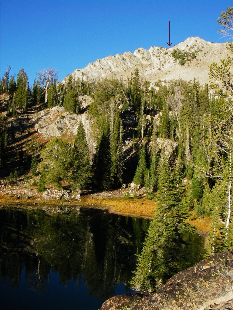
Peak 9997 as viewed from Lake 9078. The arrow points to the col in the Southeast Ridge. Steciak/Hamke Photo
Southeast Ridge and Northeast Ridge Routes by Livingston Douglas
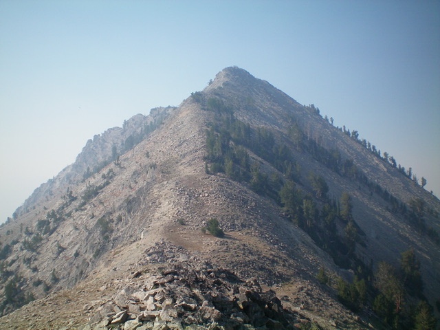
Peak 9997 and its rugged southeast ridge (skyline left of center) and gentle northeast ridge (right of center, coming at the camera). Livingston Douglas Photo
Access
This entry updates the book access entry [(A)(3)(b) Page 206]. From ID-75 about 1.5 miles north of Alturas Lake Road, turn left/west onto [signed] Cabin Creek Road/FSR-207. At 1.1 miles, turn left/south at a signed junction to stay on FSR-207. At 2.8 miles, turn right/west onto [signed] FSR-439 for the “Cabin Creek Trailhead.” At 3.1 miles, reach the large trailhead parking lot for the Cabin Creek Trail (7,170 feet).
Map Errors
Incredibly, the USGS topo map fails to show any of the well-beaten Cabin Creek Trail to Lake 8811.
Southeast Ridge, Class 3+
The Climb
From the end of the Cabin Creek Trail at the outlet to Lake 8811, cross to the south side of the outlet stream and follow a narrow use trail along the south side of the lake to the [dry] inlet stream drainage. Scramble southwest up the left/south side of the inlet stream drainage across easy scrub then through semi-forested terrain with scrub to reach a steeper face section of loose gravel and scrub. Continue heading southwest directly at the ridge crest, passing a dried-up tarn. Quickly reach the narrow, forested, rocky ridge crest at a saddle of sorts at 9,300 feet, just north of Point 9348.

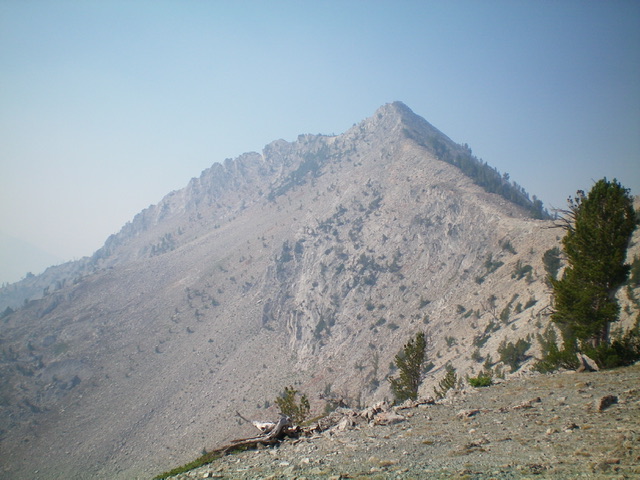
Peak 9997 (summit is at far right) and its rugged southeast ridge (skyline) as viewed from Lake 8811 on its east side. Livingston Douglas Photo
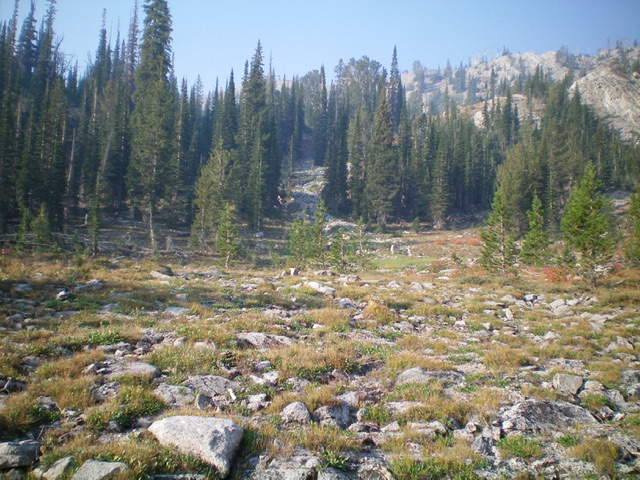
The forested gateway to the entry point onto the southeast ridge. Notice the mountain goats grazing in the meadow in the foreground. Livingston Douglas Photo
The southeast ridge is a tedious mess of ridge towers, rocky outcrops, ridge pines, and ups and downs. Once you reach the steeper ridge rock at about 9,400 feet, either climb a ridge tower/outcrop or skirt its left/west side on ledges to avoid the fierce exposure on the right/east side of the ridge. There are numerous ridge notches to work through. Either downclimb directly to the ridge notch or drop off the ridge to its left/west side and climb a steep chute back up to the ridge crest to reach the notch. Surprisingly, there are times when the ledges on the right/east side of the ridge crest work better and are not seriously exposed.
There is a short, knife-edged section of fin rock to navigate but the work is mostly Class 3 ridge rock and nearby ledges. The chutes are all loose scree/gravel but are usually short in duration. Once past the final ridge tower, the push to the summit is easy. Some of the ridge towers that look bad actually have easy drops (if any drop) to the next ridge notch. You just never know until you climb atop the tower/block and see how it plays out. The summit of Peak 9997 had a modest cairn on the narrow ridge crest summit, so I built it up a bit.
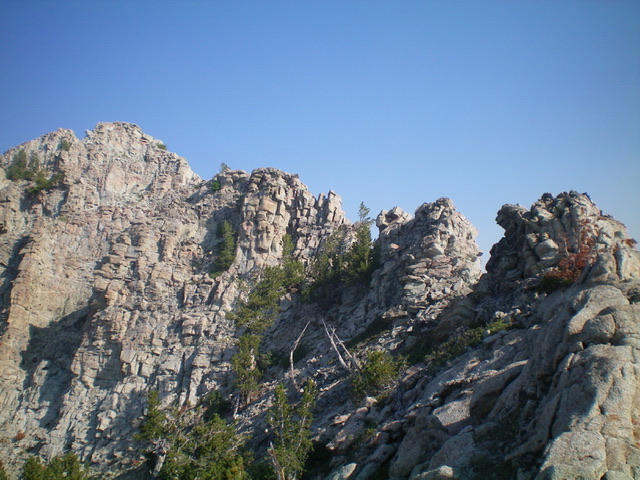
The rugged, choppy upper section of the southeast ridge. The summit is at far left. Livingston Douglas Photo
Northeast Ridge, Class 2+
The Descent
From the summit, descend the narrow, rocky ridge crest through Class 2+ ridge outcrops (high up) with loose shale on their sides. Midway down, the ridge rock is more stable. Scramble north up over a minor ridge point then descend northeast to a saddle at 9,580 feet. This is the connecting saddle with Peak 10027. It concludes the first leg of today’s 2-peak adventure. Peak 10027 is up next.
Looking back up the easy northeast ridge of Peak 9997. Livingston Douglas Photo
East Face and Northeast Ridge by Judi Steciak
East Face, Class 2
From Lake 9078 in the Cabin Creek drainage [(A)(3)(b)], walk up to the base of the East Face of the peak. Follow a line up through a group of trees. Below the summit cone, traverse south below rock ribs to gain a small col on the Southeast Ridge. Move west until you can gain the West Ridge and then the summit. Combine this with a traverse to Peak 10027 for a pleasant ridge walk.
Northeast Ridge, Class 2
Follow the approach to Peak 10027 (Page 202). Descend the Southwest Ridge of Point 9889 and enjoy a pleasant ridge walk up the Northeast Ridge of Peak 9997. Trend to the NW side of the ridge for easier footing near the summit. Descend the East Face for a loop hike.
Southeast Ridge, Class 3 by Steve Grantham
I like to call Peak 9997 “Penmyriad” (from the prefix “pen-” meaning “almost” plus “myriad” which literally means “ten thousand”). It’s the highest peak in Idaho that is under 10,000 feet. And I think it is actually conceivable that we (my girlfriend Chris Elrod and I and our dog Braxon) made the first ascent. I don’t recall finding any cairn or other evidence of prior climbs up there. We climbed via Cabin Creek and the southeast ridge. It was mostly Class 2 with maybe a little Class 3 near the top.
Additional Resources
Mountain Range: Sawtooth Range
First Ascent Information:
- First Ascent Year: 2014
- Season: Fall
- Route: Southeast Ridge
- Party: Steve Grantham and Chris Elrod
Longitude: -114.917 Latitude: 43.9188