Elevation: 10,523 ft
Prominence: 324
Climbing and access information for this peak is on Page 244 of the book. Margo Mandella added the Southeast Route route. Livingston Douglas added a photo. Elevation and prominence figures are based on recent LiDAR measurements. The USGS Quad shows an elevation of 10516. Updated January 2026
Phi Kappa Mountain has 296 feet of prominence, just 4 feet shy of being a ranked summit. Phi Kappa Mountain is located above the southeast fork of Summit Creek, near Trail Creek Summit. This mountain is often climbed with an ascent of Summit Creek Peak which is to the northwest. Phi Kappa Mountain’s accessibility from the main trail makes it a good off-trail peak choice if you just want to take in some views of surrounding Pioneer Mountain peaks without continuing on to Summit Creek Peak. Phi Kappa Mountain summit is about a 1-hour detour from the trail and back. USGS Phi Kappa Mountain
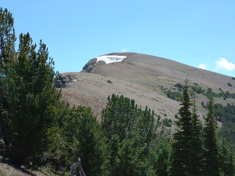
Phi Kappa Mountain. Dan Robbins Photo
Access
Take Trail Creek Road either from US-93 to the east or from Sun Valley to the southwest, to the marked Trail Creek Summit. There is a parking area on the southeast side of the pass. This is the parking area for the Summit Creek Trail/FST-053 [(A)(3)(a) on Page 258].
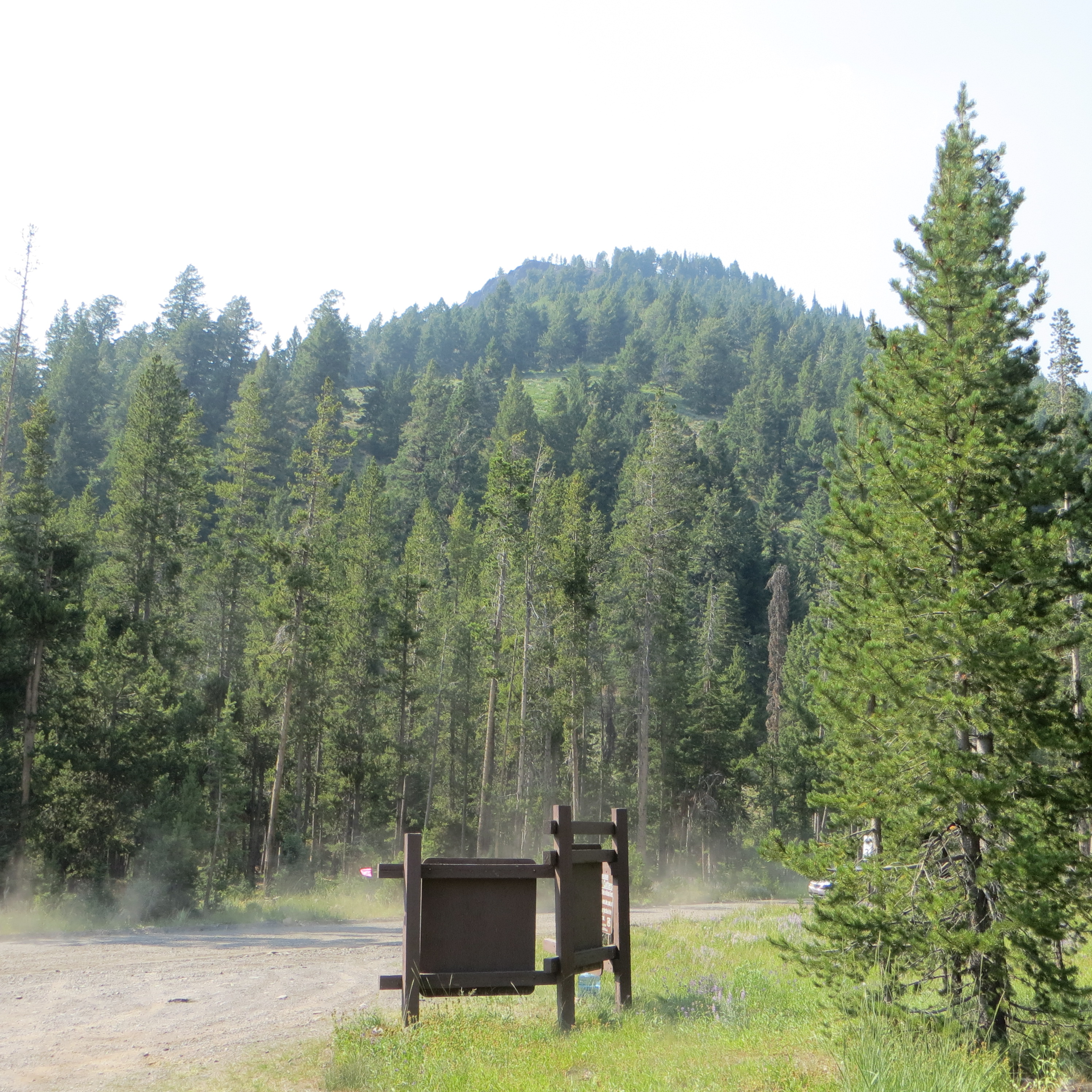
The Trail Creek Summit parking area. Steve Mandella Photo
Southeast Ridge by Margo Mandella
Southeast Ridge, Class 2
From the parking area, follow the Summit Creek Trail/FST-053 heading southeast. Take the trail as it parallels the southeast fork of Summit Creek all the way to the pass between Phi Kappa Mountain and Peak 10860. Leave the trail here and follow the Southeast Ridge, traveling northwest, to the summit of Phi Kappa Mountain. Enjoy the views!
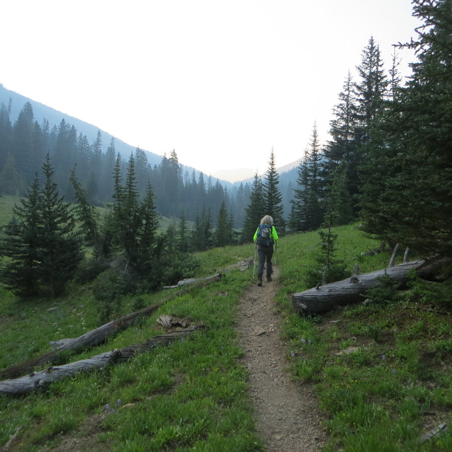
The well-beaten Summit Creek Trail. Steve Mandella Photo
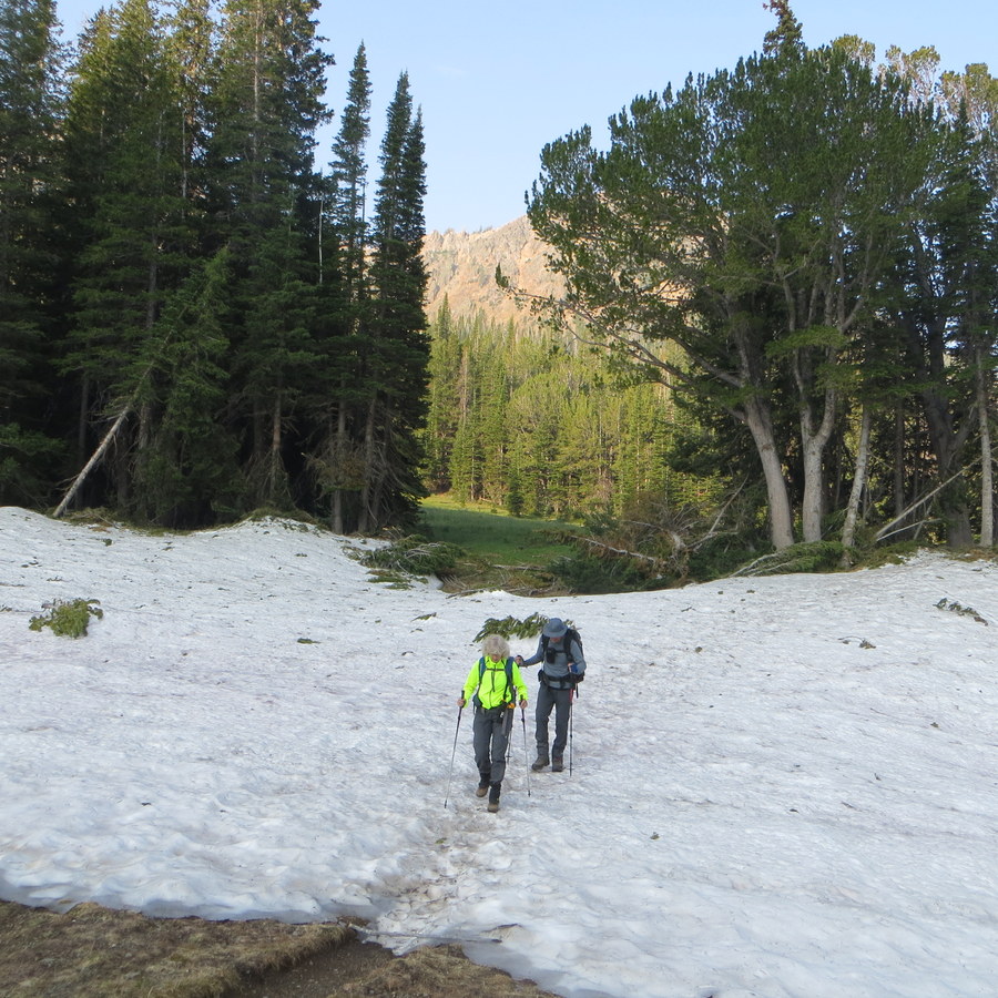
An August snow patch across the trail. Steve Mandella Photo
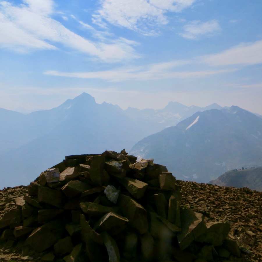
The summit cairn atop Phi Kappa Mountain, seen through wildfire smoke. Devil’s Bedstead, from the East Peak to the West Peak, is in the background. Steve Mandella Photo
Retrace your ascent route back down to the pass. Find the trail where you left it and hike back down to the parking area.
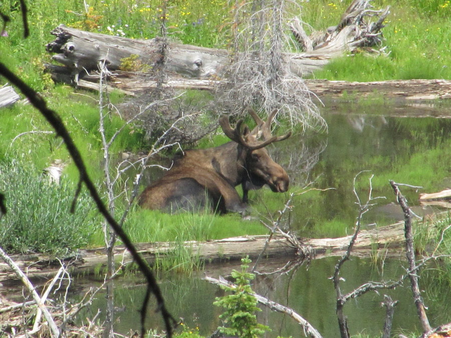
A bull moose in Summit Creek. Steve Mandella Photo
Margo Mandella provided her GPS track from her 2017 ascent with Steve Mandella and Bruce Dunham. Note the position of North arrow. Additionally, the track is in yellow. The blue line is the boundary between Custer and Blaine counties. Please note that the yellow track includes an ascent of nearby Summit Creek Peak and descends the Southwest Face of Summit Creek Peak to intersect the Summit Creek Trail.
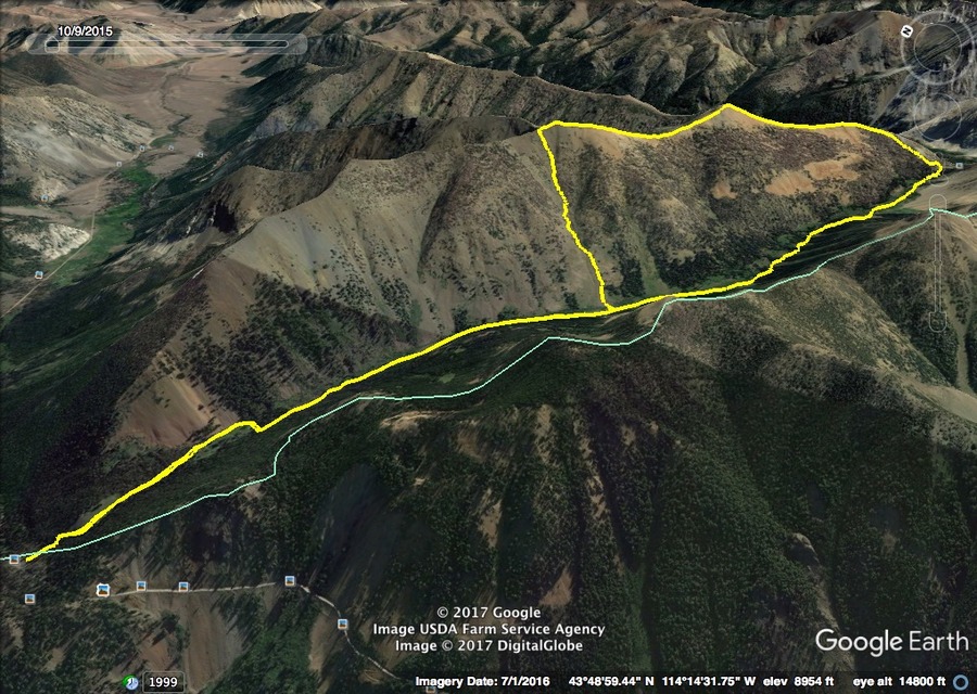
Phi Kappa Mountain and Summit Creek Peak. Margo Mandella’s GPS track.
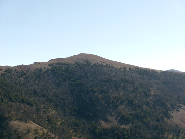
Phi Kappa Mountain as viewed from Peak 9740 to its southwest. Livingston Douglas Photo
Additional Resources
Regions: EASTERN IDAHO->Pioneer Mountains
Mountain Range: Pioneer Mountains
Year Climbed: 1989
Longitude: -114.20539 Latitude: 43.81489