Elevation: 5,981 ft
Prominence: 361

This peak is not in the book. Updated April 2018
Piute Butte is a rugged peak with an impressive basalt crown. It is located in the Western Owyhee Mountains on the second ridgeline east of US-95. The peak climbs above the east and west forks of Squaw Creek and sits due south of Dryden Peak. It is not an easy summit to reach due to private property in the Squaw Creek drainage. The shortest access to this peak is up Squaw Creek but that route is blocked by private property. Longer approaches with ups and downs must be used instead. USGS Piute Butte
Brett Sergenian has climbed the peak three times from US-95. His route involves a hefty climb up and over an intervening ridge line. You can use the link below to read Brett’s trip report. The easiest way to access the peak is via the Coyote Grade Road. This access is covered in detail on the Dryden Peak page. I climbed the peak from Rodeo Gulch by climbing over Dryden Peak, but it also possible to bypass Dryden Peak.
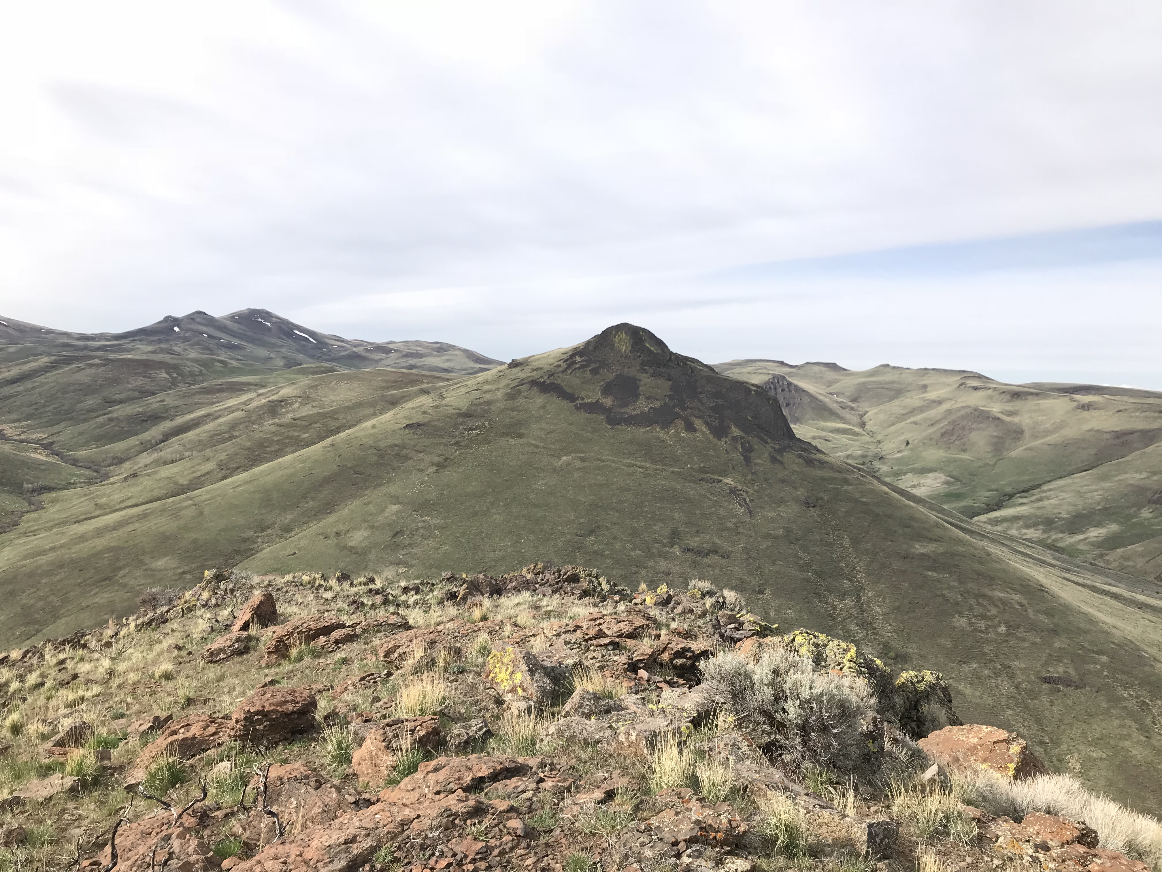
Piute Butte as viewed from Dryden Peak.
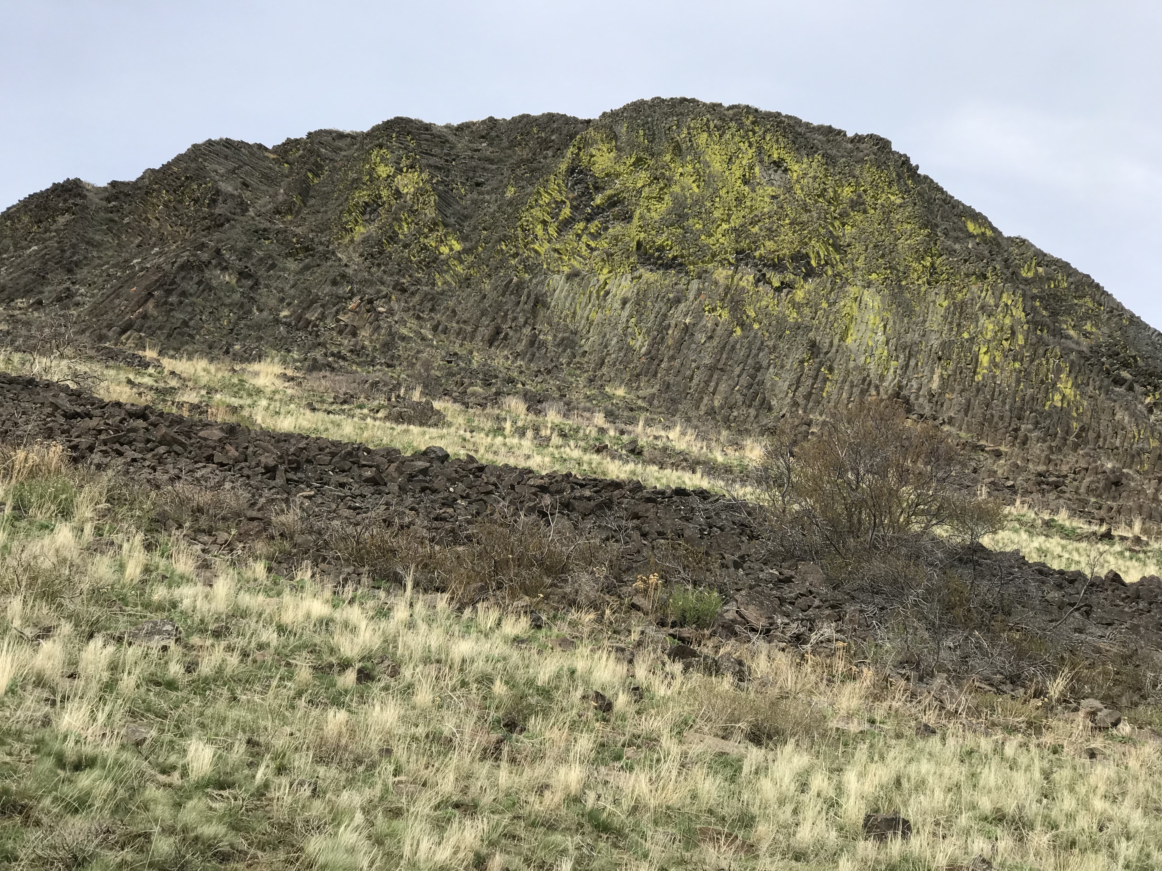
The East Face of Piute Butte. The notch is to the left of this photo.
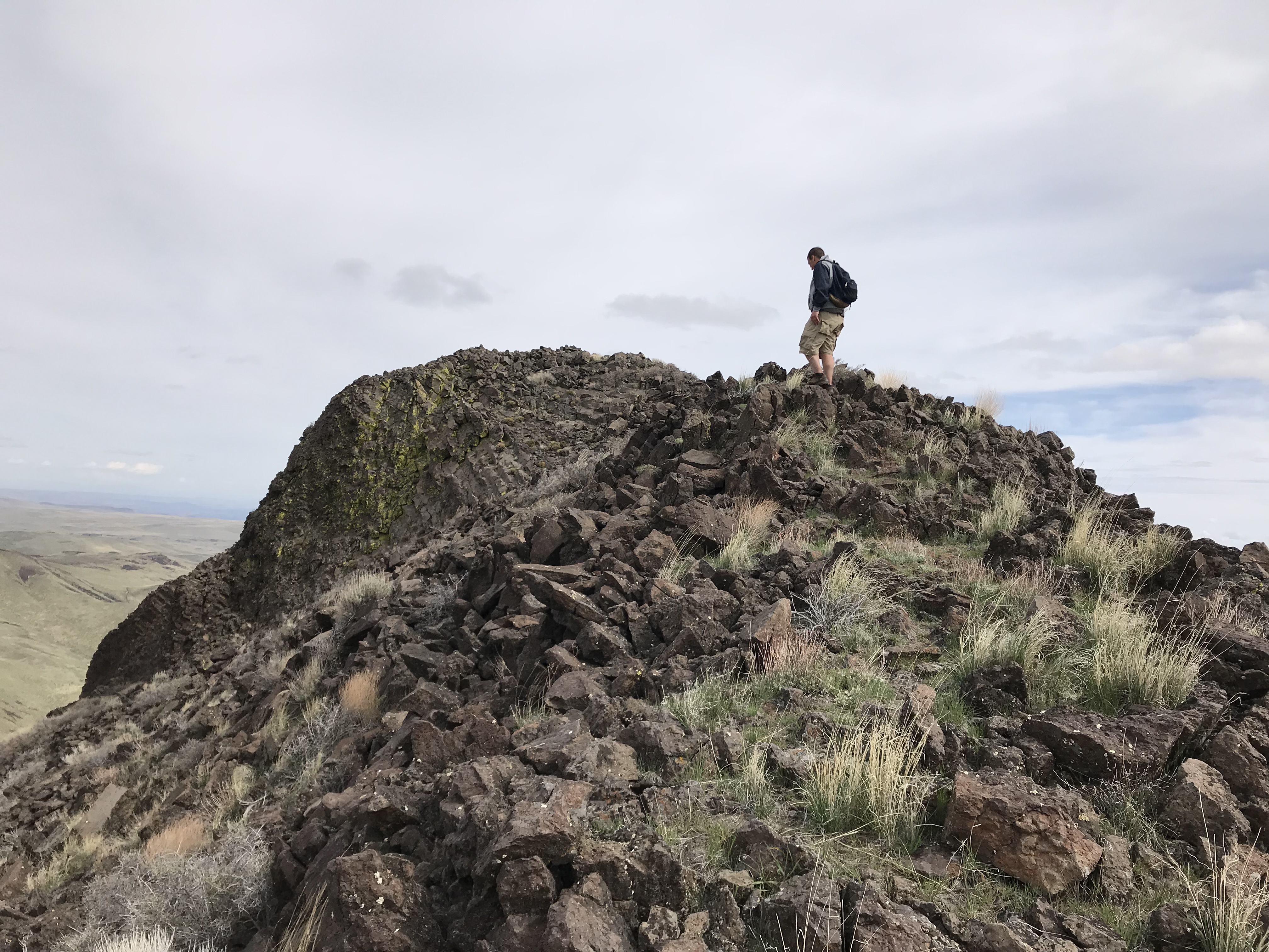
Brett Sergenian approaching the summit on the South Ridge.
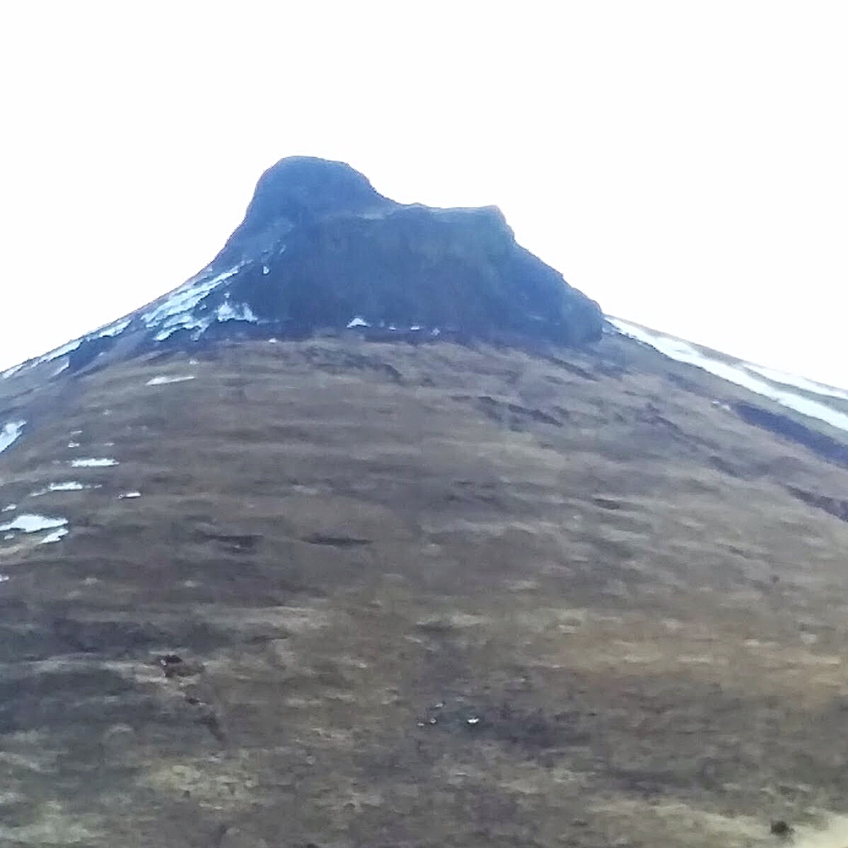
Piute Butte as viewed from the northwest. Brett Sergenian Photo
Access
Coyote Grade Road. See the Dryden Peak page.
South Ridge, Class 3
Piute Butte’s summit is crowned with an impressive block of columnar basalt with vertical or near vertical cliffs on three sides. The peak’s South Ridge provides the most feasible route to the summit. The ridge can be reached from either fork of Squaw Creek.
To climb the peak from the Coyote Grade Road and Rodeo Gulch, hike up and over Point 5440 and then descend down to the East Fork Squaw Creek. Note that there is a section of private land in the bottom of Pole Creek that must be avoided. Cross the East Fork Squaw Creek and then climb up toward the base of the East Face cliffs. Follow the base of the cliffs south until you reach the obvious notch on the South Ridge. Climb into the notch and then follow the ridge north to the summit. There is one Class 3 step along way. The route shown on the GPS covers 5.3 miles and 2,500 feet of elevation gain round trip.
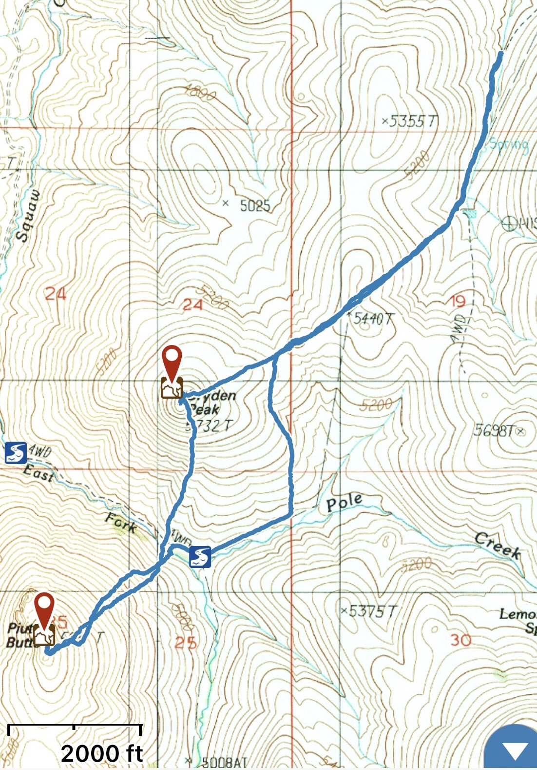
My GPS track for Dryden Peak and Piutte Butte.
Additional Resources
Regions: Owyhee Mountains->SOUTHERN IDAHO
Mountain Range: Owyhee Mountains
Year Climbed: 2018
Longitude: -116.88259 Latitude: 43.30769