Elevation: 7,460 ft
Prominence: 80
This peak is not in the book. Published November 2020
Point Lookout is a hump that overlooks Blacktail Canyon, which ascends from Fall Creek Canyon in the Caribou Range. This peak is literally a point on the southeast ridge of Peak 7637. There is no fire lookout atop this point and probably never was. Point Lookout can be reached as part of a combination climb of Point Lookout, Peak 7637, and Peak 7693 in a day hike from Fall Creek Road. USGS Point Lookout
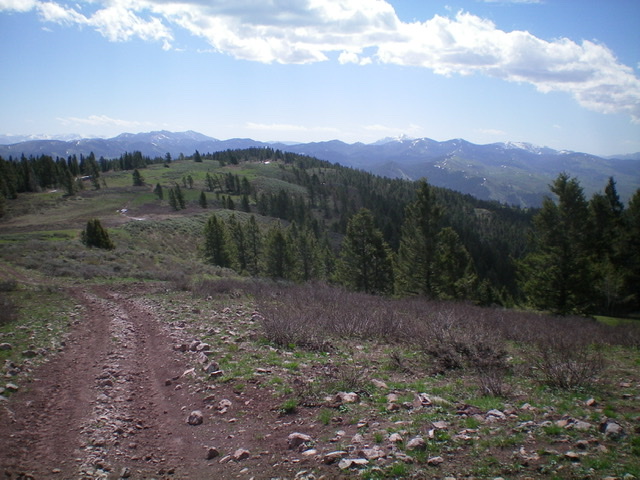
Point Lookout as viewed from the northwest along the ridge. The summit is on the forested hump left of center in mid-ground. The summit is on open ground behind the forest. Livingston Douglas Photo
Access
Park at the base of Blacktail Canyon Road/FSR-066 (5,710 feet) at its junction with Fall Creek Road. This junction is exactly 5.8 miles northeast of the junction of Fall Creek Road and Kepps Crossing Road. Alternatively, drive east on US-26 to a bridge crossing of the Snake River a few miles west of Swan Valley. Turn right/south onto [signed] Snake River Road and drive 1.2 miles to a [signed] junction with Fall Creek Road. Turn right/west onto Fall Creek Road and drive 8.0 miles to a junction with [unsigned] Blacktail Canyon Road/FSR-066. Please note that this junction is signed for “Blacktail Canyon” but has no road number or road sign. If road conditions allow, drive 0.8 miles up Blacktail Canyon Road to a dispersed campsite and park there to save some hiking mileage.
South Ridge, Class 2
The Climb
From the base of Blacktail Canyon Road/FSR-066, hike about 0.8 mile to a dispersed campsite at a fork in the canyon. Leave the road and follow a weak trail west up the Sawmill Creek drainage for 0.3 miles to a side drainage heading north. Bushwhack up this drainage for just over 200 vertical feet then leave the drainage to climb west to the crest of the south ridge of Point Lookout. Follow the somewhat ill-defined, rounded ridge north-northwest then north up a face to reach a better-defined ridge section heading northwest to the summit.
The terrain is open scrub and gapped sagebrush from the final drainage to the [upper] southeast section of the ridge crest. There is a short section of rock to scramble up over to reach the ridge crest. The final section of ridge heads northwest to the summit and is mostly easy, open scrub. The summit of Point Lookout has two USGS benchmarks but no summit cairn.
Northwest Ridge, Class 1
The Descent
From the gentle hump that is the summit of Lookout Point, follow the connecting ridge northwest to a saddle. There is an old 2-track jeep road (now ATV Trail#179) along most of this section of ridge. The connecting saddle is the base of the northwest ridge of Point Lookout. From here, you can continue northwest to the summit of Peak 7637 (a ranked summit) on FST-179 if you so desire.
East Ridge, Class 2
The Descent
From the summit of Lookout Point, descend the obvious (and open) east ridge, staying to the right/south of forested sections on the ridge’s north side. The east ridge terrain is mostly sagebrush with some areas of easy, short scrub. There are some game trails in the sagebrush to expedite the descent of the ridge. Thankfully, FST-179 (a rugged ATV road) awaits you there. FST-179 quickly gets you back down to FSR-066 and the final 0.8 mile down to its junction with Fall Creek Road.
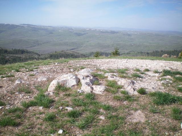
The bare summit of Point Lookout, looking south. Livingston Douglas Photo
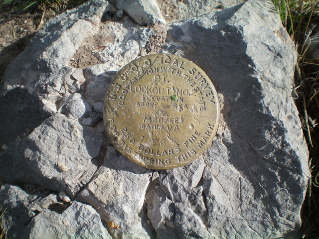
The USGS benchmark atop Point Lookout. Livingston Douglas Photo
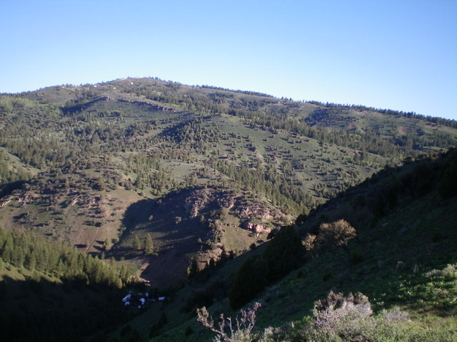
Point Lookout (left of center with a small patch of snow on it) and its LONG east ridge (right skyline). Livingston Douglas Photo
Additional Resources
Regions: Caribou Range->SOUTHERN IDAHO
Mountain Range: Caribou Range
Longitude: -111.51149 Latitude: 43.39749