Elevation: 8,697 ft
Prominence: 597
Climbing and access information for this peak is on Page 338 of the book. Please note that the book states the elevation at 8,715 feet, not 8,697 feet (LOJ and USGS topo map). Published January 2023
Red Mountain is located on a ridge crest at the head of Red Creek and Cave Canyon in the Big Hole Mountains. This is the first leg of a 2-peak adventure that includes Red Mountain and Peak 8619. The journey covers 11.8 miles with 3,325 feet of elevation gain round trip. Much of this climb is on MC trails. USGS Garns Mountain
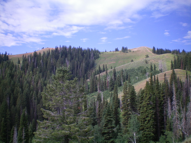
Red Mountain (dead center) as viewed from Peak 8619 to its northwest. Livingston Douglas Photo
Access
The Patterson Creek trailhead is located at the end of 6750W, west of Victor. To reach 6750W from ID-31 at Pine Creek Pass, follow these instructions. From Pine Creek Pass, drive 4.7 miles east on ID-31 to [signed] S2000W. Turn left/north onto S2000W and drive 0.9 miles to [signed] W8000S. Turn left/west onto W8000S (“Cedron Road” on the USGS topo map) and drive 2.5 miles west to a sharp right/north bend in the road. The road now becomes [signed] S4500W. Drive north on S4500W for 0.9 miles to [signed] 6750W. Turn left/west onto 6750W and drive 1.0 miles to the parking area and the start of FST-237, an ATV trail. Park here (6,225 feet). GPS coordinates: 43⁰37’23”N, 111⁰12’39”W.
Northeast Ridge, Class 2
The Climb
From the Patterson Creek trailhead, hike northwest up Patterson Creek on FST-237 then FST-218. After about 2.5 miles of hiking, reach an unsigned junction with the old Government Fork Trail. Go left/south onto the Government Fork Trail (still shown on the USGS topo map and still in decent shape) and follow it all the way up to a ridgeline and a “T” junction (unsigned) with FST-217. Make a note of this junction as you must find it on the descent.
Go right/northwest onto FST-217 (a MC trail) and follow the undulating trail northwest then west and drop to an 8,060-foot saddle at the base of the northeast ridge of Red Mountain. You will pass a junction with FST-235 on the way. From the saddle, follow FST-217 up to a flattish area at 8,420 feet where the trail heads right/west into the forest. Leave the trail here and follow a weak game trail up the left/east side of the northeast ridge. Leave the game trail as you near the summit and scramble right/west up through veg onto the narrow, rocky summit ridge. Follow the ridge crest a short distance left/southeast to reach the summit of Red Mountain. The summit has no cairn. No trails lead all the way to the summit or close to it as is erroneously shown on the USGS topo map.
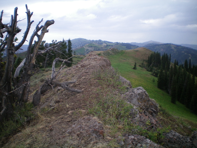
The ridge crest summit of Red Mountain. The hump right of center is the [lower] northwest summit. Livingston Douglas Photo
Northwest Ridge, Class 2
The Descent
From the summit, follow the narrow, rocky ridge crest northwest. Scramble 25 vertical feet up over the [lower] northwest summit hump (which measures at 20 feet lower than the true summit). Follow the open ridge northwest down short scrub and scree to intercept FST-217 at a signed junction where it crosses the ridge. Follow FST-217 northwest then west to the 8,300-foot connecting saddle with Peak 8619. This concludes the first leg of today’s 2-peak journey. Peak 8619 is up next.
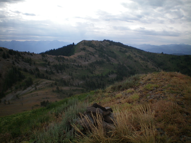
Red Mountain as viewed from the northeast. The summit left of center. The [lower] northwest summit is right of center. Livingston Douglas Photo
Additional Resources
Mountain Range: Big Hole and Snake River Mountains
Longitude: -111.2725 Latitude: 43.6297