Elevation: 8,740 ft
Prominence: 240

Climbing and access information for this peak is on Page 371 of the book. Published November 2020
Red Peak is a named peak on Red Ridge. However, it is not the high point. That honor goes to Red Benchmark to its south (8,952 feet). Red Peak is most easily reach via its northeast face and the Red Ridge Trail/FST-264 from the Long Gulch trailhead. Red Ridge is one of many named ridges in this part of the Caribou Range. USGS Red Ridge
Red Peak as viewed from the southeast. Livingston Douglas Photo
Access
From the [signed] turnoff on US-26 at the bridge crossing of the Snake River a few miles west of Swan Valley, drive south on Snake River Road for 7.3 miles to a [signed] junction with Long Gulch Road/FSR-059 (signed for Camp Ta-Man-A-Wis). Turn right/west onto Long Gulch Road and drive 4.1 miles to the large trailhead parking area for the Red Ridge Trail/FST-264 (a MC trail).
The trailhead is at the southeast end of the parking area. Camp Ta-Ma-A-Wis is a private camp and is next to the parking area. It is gated and has “No Trespassing” signs. The elevation at the trailhead is 6,900 feet. Please be aware that there is another trail (FST-059, an ATV trail) that leaves from the north end of the parking area. That trail is NOT shown on the USGS topo map.
Northeast Face, Class 2
The Climb
This climb is mostly Class 1. Hike up FST-264 for about ½ mile to a junction. Go right/east to stay on FST-264 (“Red Ridge Trail”) but be aware that the old signage indicates that the trail is FST-035 now (which it is NOT). There is an old jeep track heading straight/south here; ignore it. About two miles up from the trailhead, you reach a well-signed trail junction at about 7,900 feet. Go straight here to stay on FST-264. About ½ mile past this junction, you will cross an open saddle at 8,220 feet. You can climb the northwest ridge of Red Peak from here.
We are heading to the northeast face of Red Peak, so continue to hike along FST-264. After another 0.7 miles, reach an open saddle at 8,380 feet. This saddle sits at the base of the thickly-forested northeast face/ridge of Red Peak. Leave the trail here and head south (briefly) then southwest to scramble up a STEEP, brushy slope on the left/southeast side of the thick forest. After climbing 360 vertical feet, you reach the narrow, rock-and-forest, small ridgeline summit of Red Peak. There is a repeater on top. Due to the dense forest nearby, there are only partial views from the top.
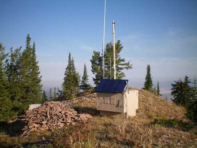
The summit of Red Peak. Livingston Douglas Photo
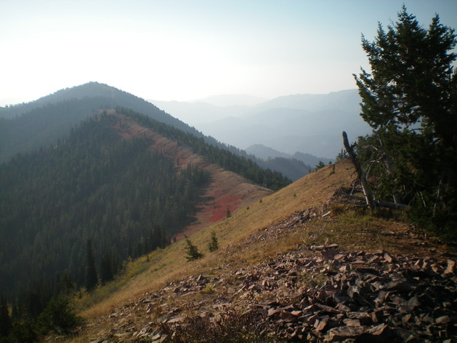
Looking southeast along Red Ridge from the summit of Red Peak. Red Benchmark is the most distant hump (left of center). Livingston Douglas Photo
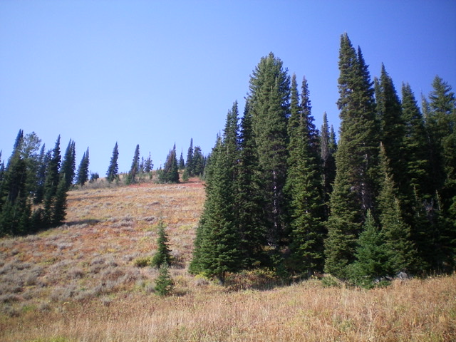
Looking up the STEEP northeast face of Red Ridge from the 8,380-foot saddle at its base. It is much steeper than the photo suggests. Livingston Douglas Photo
Southeast Ridge, Class 2
The Descent
From the summit, descend southeast on Red Ridge to reach a saddle at 8,500 feet. The terrain on this open ridge section is a combination of brush and embedded talus. It’s not too bad. The saddle is the low point between Red Peak and Red Benchmark. This concludes the first leg of today’s two-peak adventure. Red Benchmark is up next.
Additional Resources
Regions: Caribou Range->SOUTHERN IDAHO
Mountain Range: Caribou Range
Longitude: -111.31409 Latitude: 43.33701