Elevation: 7,930 ft
Prominence: 2,695
Climbing and access information for this peak is on Page 86 of the book. Updated September 2018
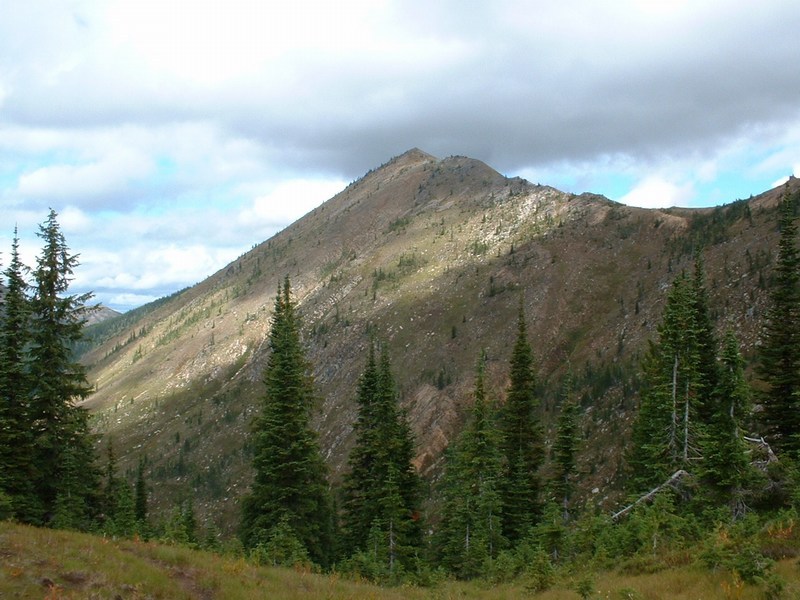
Rhodes Peak is not only one of the nicest peaks in the northern Bitterroots but is also a 2,000 foot prominence peak and is the high point of Clearwater County. As a result, it sees more ascents than many of its neighboring peaks, as county high pointers and prominence baggers seek it out. Access and hiking distances make this a challenging ascent. As a bonus, you can also bag Blacklead Peak, Williams Peak and Peak 7699 along the way. USGS Rhodes Peak
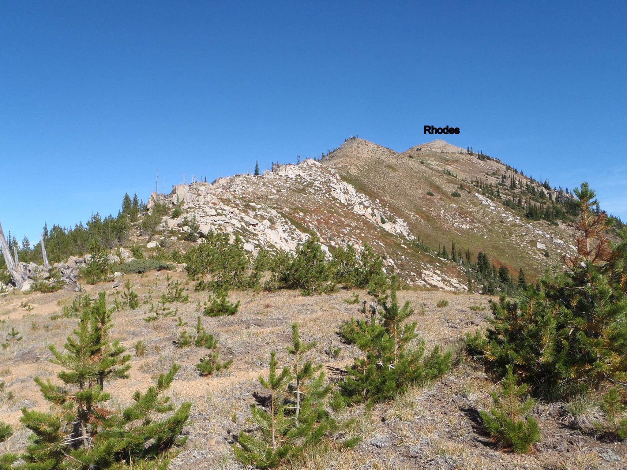
View from the saddle heading up the ridge to Rhodes Peak. Terri Rowe Photo
Access by Ken Jones
On US-12 in Idaho, find FSR-569 on the North Side. This point is roughly 10-15 miles west of Lolo Pass and the Montana border or roughly 70 miles east of Lowell, ID. It is just east of the turnoff to Powell Campground and Guard Station. Reset your odometer here. Follow FSR-569 (ignoring spurs on both sides of the road) to Papoose Saddle (7.0 miles). Continue straight ahead at the 4-way intersection onto westbound FSR-500. In approximately 12 miles (at Cayuse Junction), turn right onto FSR-581. In just over a mile (21.2 mile point) at a switchback in the valley bottom, you will find a parking area and the start of FST-35.
This looks like a good possible route on the map, but we were unable to find its upper end the way we went, so I don’t recommend it. Instead, continue on FSR-581 for another 6 1/4 miles to the saddle at 6,715 feet. The road is suitable for passenger vehicles to this point. Turn right and follow the steeper (high-clearance recommended) road up over Blacklead Mountain and down to the saddle on its North Ridge (my topo doesn’t show the extension of the road from the summit to the saddle, but it’s there on the ground), about another 1.5 miles. Park here.
South Ridge, Class 2 by Ken Jones
There are several trails leaving from the parking area. Take the one heading east, which drops into a basin. In about 3/4 mile, there is a junction. Keep left on the trail that generally contours between 6,400-6,600 feet for another 1-3/4 miles to Goat Lake. The mapped junction of FST-248 was not there, though we looked. The trail splits at Goat Lake, but the branches come together again soon. At the switchback on the West Side of Williams Peak, the trail joins an old mining road.
It peters out a bit where it crosses the South Ridge of Williams Peak, but occasional cairns will get you to obvious trail where it drops off the ridge to the northeast. At about 5 miles from the parking area, you’ll reach an unmapped trail junction in the saddle just east of Point 7038. Bear left and follow the now-steeper trail as it climbs to the saddle just south of Rhodes Peak. Easy cross-country travel, some on a use trail, will bring you to the summit and its register. Round-trip stats: about 12 miles with 3,200 feet of elevation gain.
A few photos by Terri Rowe from her September 2018 ascent of Rhodes Peak and Williams Peak.
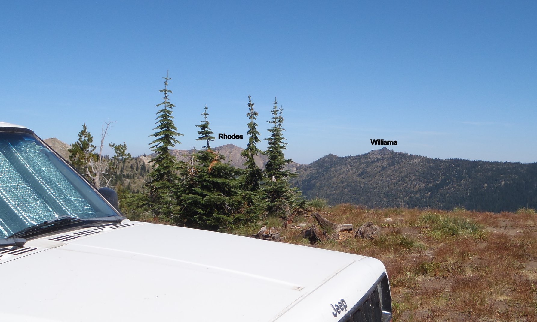
The view from the top of Blacklead Mountain where I parked the jeep at the trailhead. Round trip took just under 8 hours. Terri Rowe Photo
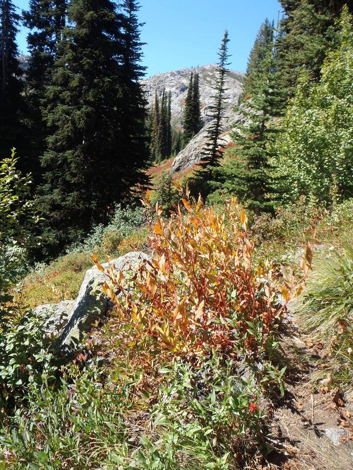
Fall colors starting. Goat Lake is below the peak in the distance. Lots of overgrowth makes the trail hard to see. Terri Rowe Photo
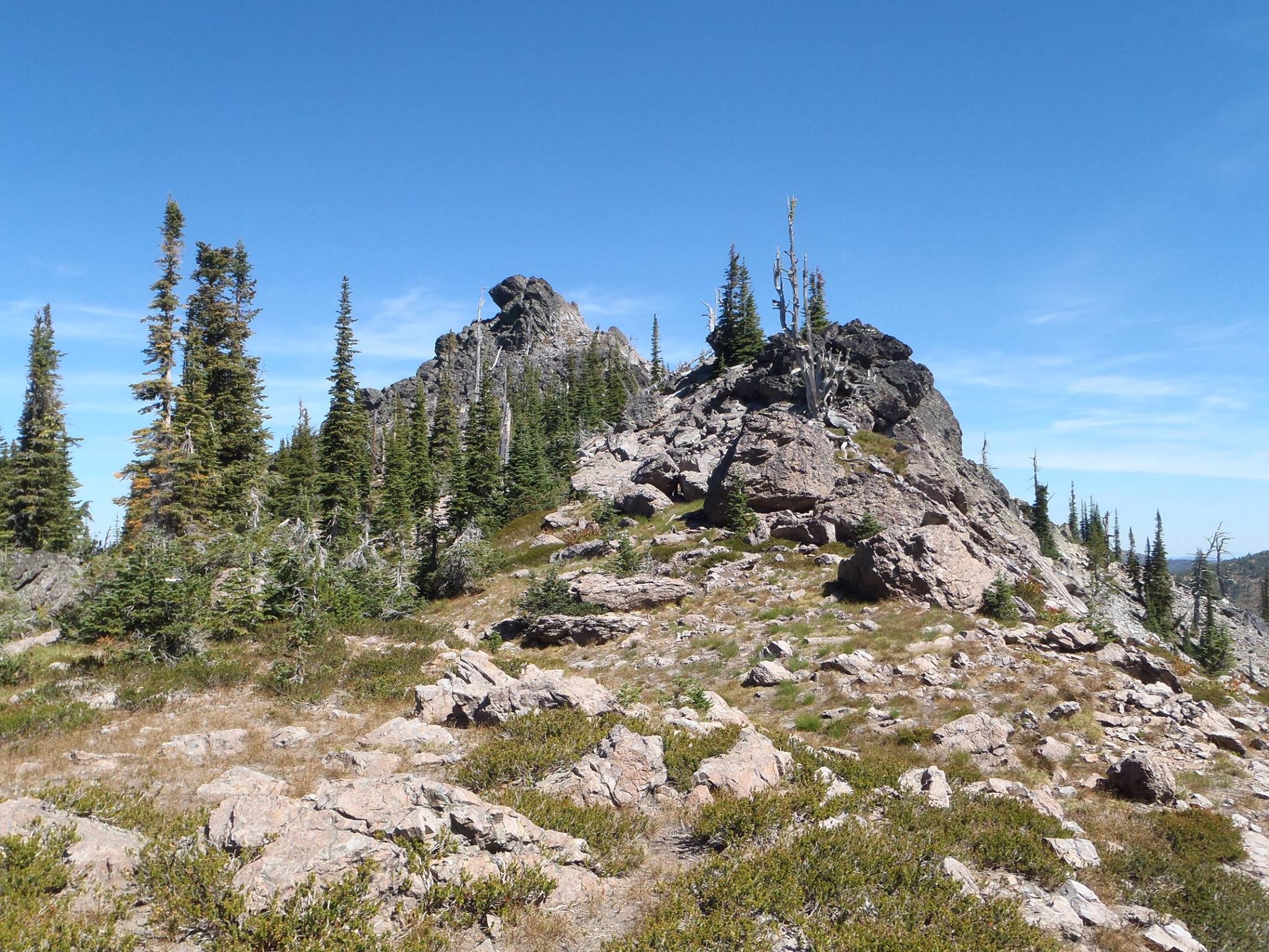
Getting close to Williams Peak. It is easier than it looks with just one Class 3 move.
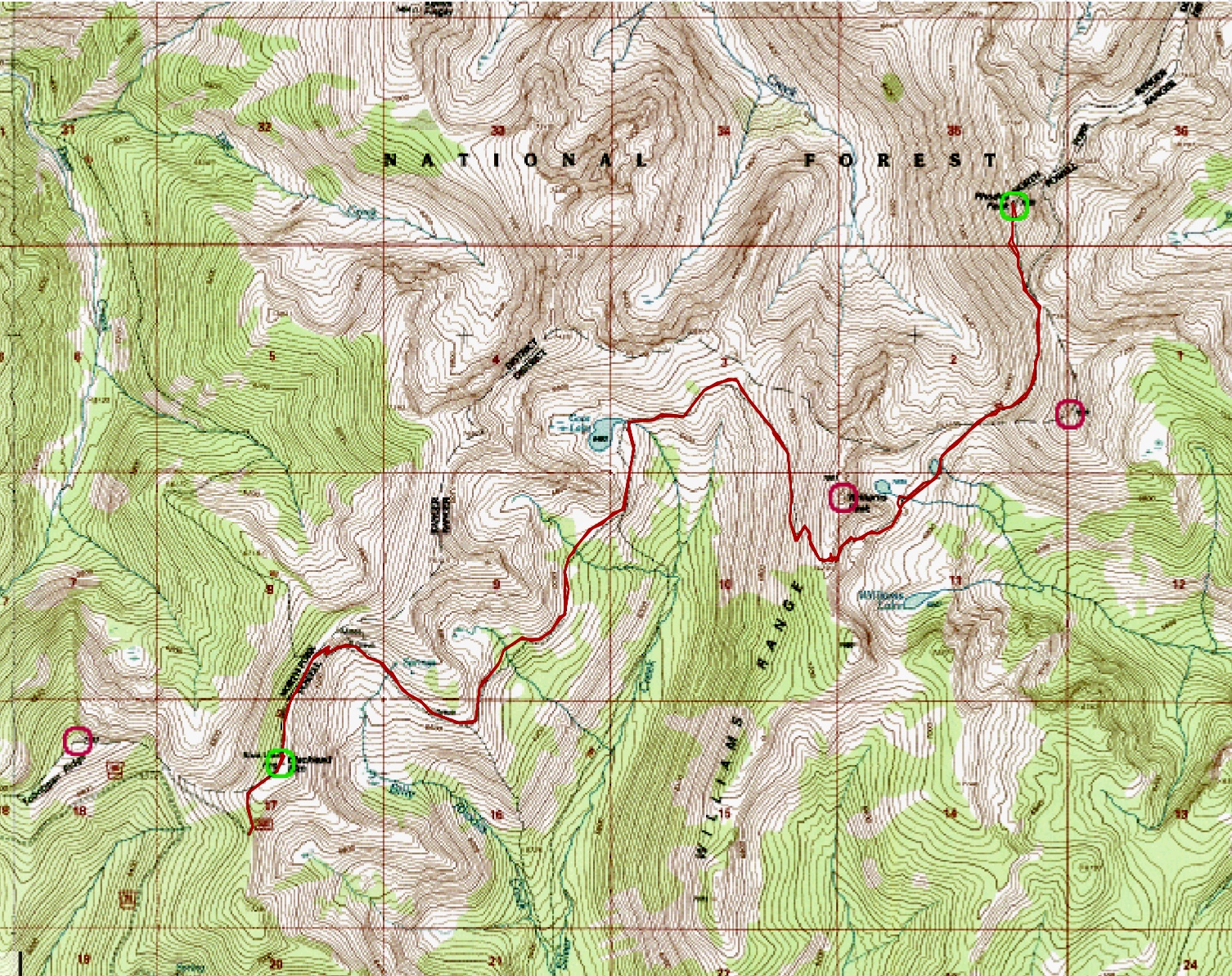
Steve Sheriff’s GPS track from peakbagger.com (link below) is the gold standard for finding your way.
Additional Resources
Regions: Bitterroot Mountains->NORTHERN IDAHO
Mountain Range: Bitterroot Mountains
Longitude: -114.7835 Latitude: 46.6749
Pingback: Idaho County High Points by Andy Martin - IDAHO: A Climbing Guide