Elevation: 6,705 ft
Prominence: 5
This peak is not in the book. Published November 2022
Ruud Mountain is hardly a mountain. It is merely a minor bump on the west ridge of Proctor Mountain. However, it is legitimately named and has the remnants of the first chair lift built in America leading to its summit. It is most easily climbed via the Proctor Loop Trail on the way to Proctor Mountain. USGS Sun Valley
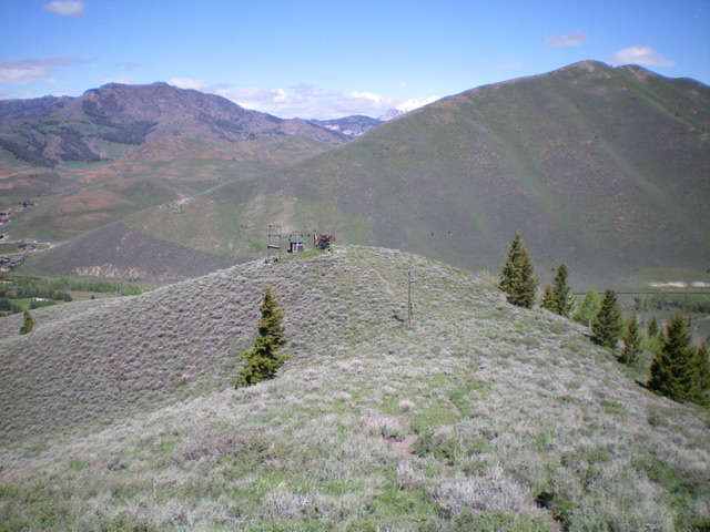
Ruud Mountain is this insignificant hump (in the foreground) with the top of a chairlift adorning it. Livingston Douglas Photo
Access
Park at the [popular] Hemingway Memorial trailhead parking area along Trail Creek Road north of Sun Valley. This trailhead is well signed and is located 1.6 miles north of the junction of Sun Valley Road/Trail Creek Road and Dollar Road in Sun Valley.
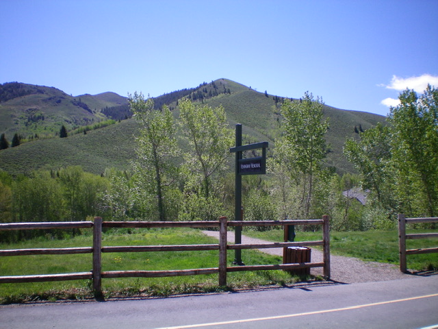
Ruud Mountain as viewed from the Hemingway Memorial (trailhead). Ruud Mountain is the minor hump just right of center, sitting below the more prominent hump in dead center (Point 7252). Livingston Douglas Photo
Northwest Ridge, Class 1
From the Hemingway Memorial trailhead parking area, hike east then south on the Proctor Loop Trail (not shown on the USGS topo map). The trail crosses boisterous Trail Creek on a good footbridge. The trail then leaves the creek drainage and skirts the left/east side of a rocky pinnacle and then drops 20 feet to an unsigned junction. Jog right here on an unsigned trail to quickly reach the crest of the northwest ridge of Ruud Mountain. The ridge crest trail comes up from Fairway Road (private property with no parking allowed along it). Head left/southeast up the trail (which is the Proctor Loop Trail) as it steeply climbs the crest of the northwest ridge. The trail soon reaches the top of a chairlift at a very minor bump on the ridge. Yes, this is the summit of Ruud Mountain. Bag it and continue up the Proctor Loop Trail to climb Proctor Mountain, the second peak in today’s 2-peak adventure.
Additional Resources
Regions: EASTERN IDAHO->Pioneer Mountains
Mountain Range: Pioneer Mountains
Year Climbed: 1997, 1999(2), 2001
Longitude: -114.33201 Latitude: 43.70589