Elevation: 7,102 ft
Prominence: 452
This peak is not in the book. Published January 2023
Sawmill Ridge is a magnificent ridgeline located on the west side of Grizzly Creek, deep in the Chesterfield Range west of Blackfoot Reservoir. It is most easily reached via a 2-track road that crosses the northwest ridge of Peak 6722 then drops into the broad Grizzly Creek Valley. This is the second leg of a 2-peak adventure that includes Peak 6722 and Sawmill Ridge (7,102 feet). The journey covers 11.0 miles with 2,225 feet of elevation gain round trip. USGS Grizzly Creek
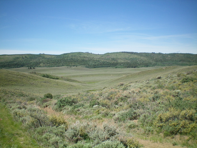
Sawmill Ridge as viewed from across Grizzly Creek to the northeast. Livingston Douglas Photo
Access
Same as for Peak 6722. This is the second leg of a 2-peak journey.
Northeast Shoulder, Class 3
The Climb
The northeast side of Sawmill Ridge is a convoluted mess of multiple shoulders and gullies, all of which are forested soon after they leave the valley floor. Navigation here is not easy and the terrain is often unfriendly to hikers. The line that I took is probably the most direct, and easiest, route to the summit of Sawmill Ridge. It ends only about 100 feet north of the high point.
From the road crossing of Grizzly Creek, follow the 2-track road as it heads northwest then west to reach an unsigned “T” junction at a sharp left/south turn (6,174 feet on the USGS topo map). Go right/northwest onto a 2-track road and follow it for about 0.5 miles to a well-beaten cattle trail that crosses the road. Leave the road here and hike left/southwest up the cattle trail into a wide gully in open terrain. The cattle trail leads right-ish/west up into a forest on the northeast shoulder of Sawmill Ridge.
Once on the shoulder, the cattle trail disappears. Scramble southwest up the crest through semi-open forest and open areas of thick sagebrush. Use an overgrown 2-track logging road on the ridge crest to make easier headway. When you see a lateral ridge above you that heads left/south toward the summit, navigate through brush, field grass, and blowdown to reach that ridge crest. Remnants of an old logging road will help a bit. Once on that ridge crest, follow the forested ridge south to just north of the summit hump.
Bushwhack up through a thick, steep patch of aspens to reach a headwall that blocks access to the final summit ridge just north of the summit rocks. Climb the steep headwall (Class 3) on steep, matted field grass (very slick) and face rock. Once atop the headwall, stroll left/south for a short distance to the high point of Sawmill Ridge. The summit is a gentle hump with a small cairn. There is another ridge hump just to the northwest that appeared to be of similar height, so I checked it out (just to be sure). It measured 10 feet lower by my altimeter readings.
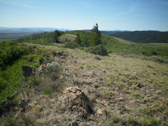
Looking southeast along Sawmill Ridge from the summit. Livingston Douglas Photo
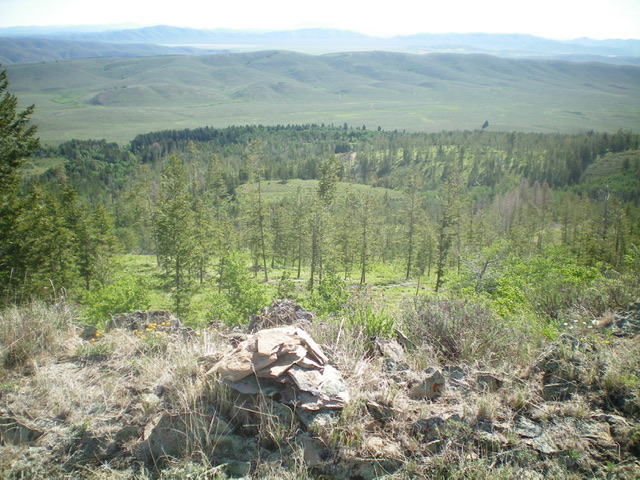
Looking down into the Grizzly Creek Valley from the summit of Sawmill Ridge. Livingston Douglas Photo
The Descent
Descend the northeast shoulder back to the 2-track road in Grizzly Creek Valley. This is not an easy task because visibility is limited due to the thick pine forest and a somewhat poorly-defined shoulder. When in doubt, keep descending northeast to intercept the 2-track road in open terrain. Follow the 2-track road right/southeast to the unsigned junction at 6,174 feet. Turn left/east at this junction and follow the 2-track road briefly. Leave the road soon after it bends right/southeast. Bushwhack left/northeast across a sagebrush ridge then descend to Grizzly Creek, another 2-track road, and the power lines.
Follow the 2-track road left/northwest as it tracks the power lines. You will soon reach an unsigned (but critical) junction with a weak 2-track that heads right/northeast up a dry gully. Leave the main/power lines road here and follow the weak 2-track up over the northwest ridge of Peak 6722. Continue to hike along this 2-track as it descends east then northeast back to Cow Camp Road and your parked vehicle.
Additional Resources
Regions: Blackfoot Mountains->Chesterfield Range->SOUTHERN IDAHO
Mountain Range: Blackfoot Mountains
Longitude: -111.84601 Latitude: 42.9461