Elevation: 8,620 ft
Prominence: 1,300
Climbing information for this peak is on Page 338 of the book. Margo’s original post has been supplemented by Livingston Douglas’ updated access section found below. Down the page you will find Neil Gleichman’s route up the peak’s face. Updated October 2023
Stouts Mountain is a distinctive summit that stands at the south end of the Big Hole Mountains. Steve and I chose the summit of Stouts Mountain from which to watch the Great American Eclipse of 2017. It did not disappoint. USGS Stouts Mountain
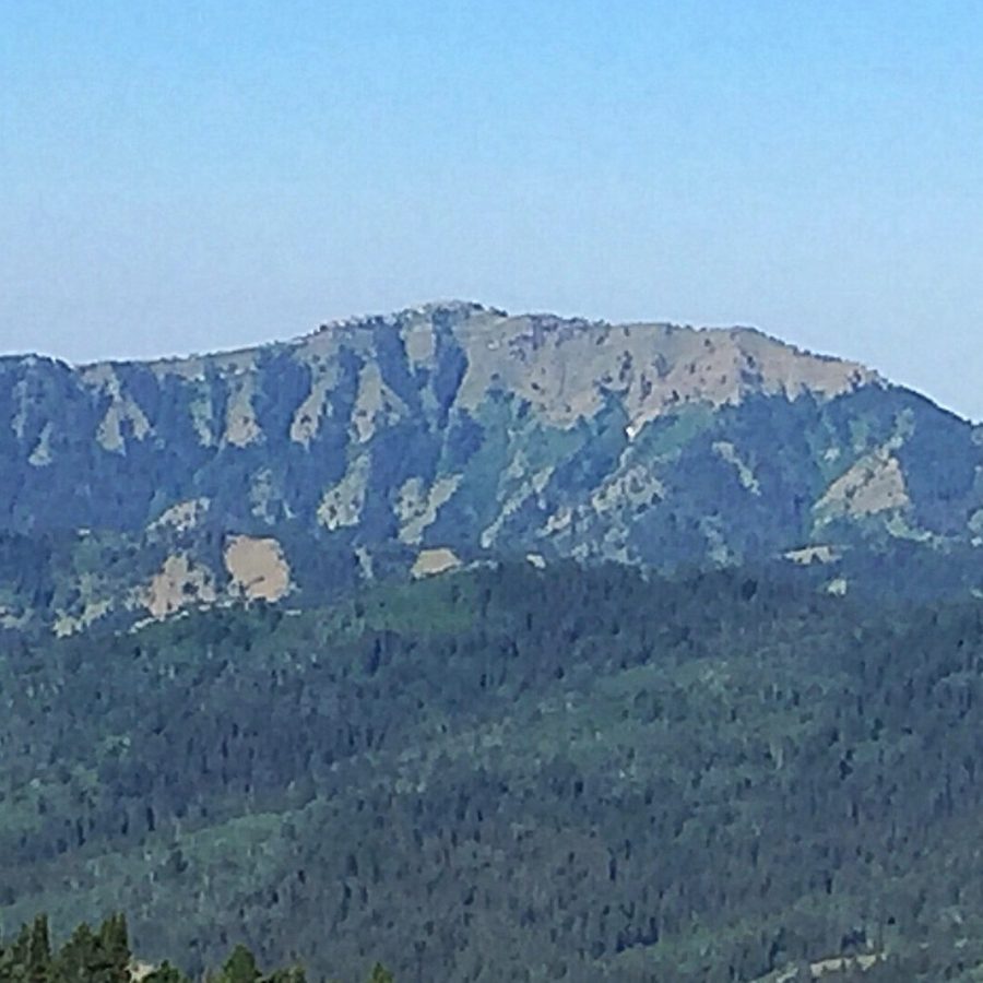
Stouts Mountain as viewed from Peak 7800. Tom Lopez Photo
Access Update by Livingston Douglas
The “trailhead” gate (and parking pullout) for the south/southeast ridge is located on the north side of ID-31:
- Exactly 7.0 miles east on ID-31 from the Swan Valley junction of US-26 and ID-31
- ¼ mile east of Pine Basin Camp (a large house/lodge on the right/south side of ID-31), which has an obvious bridge crossing Pine Creek to reach it
- 1.1 mile west of the turnoff for FSR-250 on ID-31
The massive power lines cross ID-31 just east of the “trailhead” gate and parking pullout.
The gate itself is a road closure gate. It is bright green and has “ST 65 68” written on it. The gate is more visible when driving west on ID-31 since the old, grassy 2-track jeep road is at a 45-degree angle to the highway and the old road is heading diagonally west. The pullout area is a good hard gravel surface under some trees along the north side of ID-31 at the base of the old 2-track road (just E of it). The elevation here is 5,760 feet. The roadside trees do make it a bit difficult to spot the old road when driving west on ID-31 until you’re right on top of it.
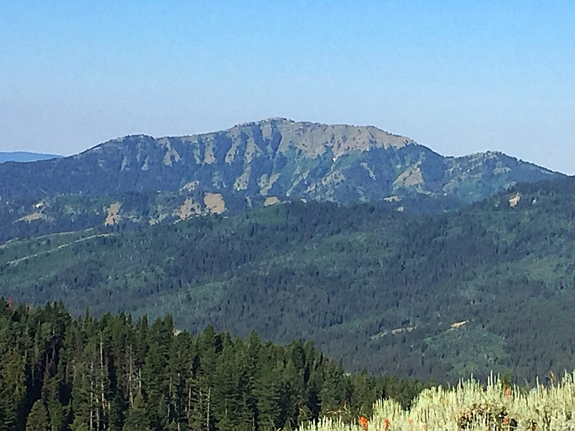
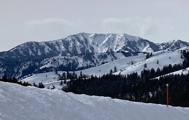
Stouts Mountain as viewed from Peak 7978 to its north. Livingston Douglas Photo
South-Southeast Ridge, Class 2
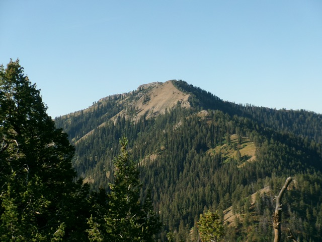
From the ridge, Stouts’ summit block (right) comes into view. Steve Mandella Photo
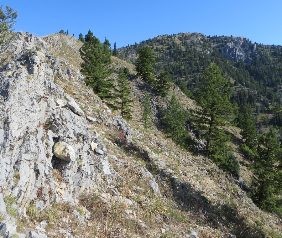
Starting at the gate, hike along an old ATV trail that parallels the highway and, briefly following transmission lines, traverses a short, eroded section of the mountain by one of the massive powerline poles. A short section of fence above the erosion and pole protects snowmobilers from this section in winter.
The trail narrows and contours around the fence and continues steeply upward to the ridge, with No Cut Timber Canyon to your east. This trail is discernible for most of the lower section of the mountain. On Google Earth’s 2015 image, the trail is more noticeable than we found it on the ground in 2017.
At one time, there was a popular recreation area/scout camp across the highway. Stouts was often climbed from the camp to a high point along the ridge where there are good views of the camp and the valley. From this viewpoint upward, the trail becomes less discernible. However, the upper mountain begins to come in and out of view through the trees as you climb, so your route will be obvious.
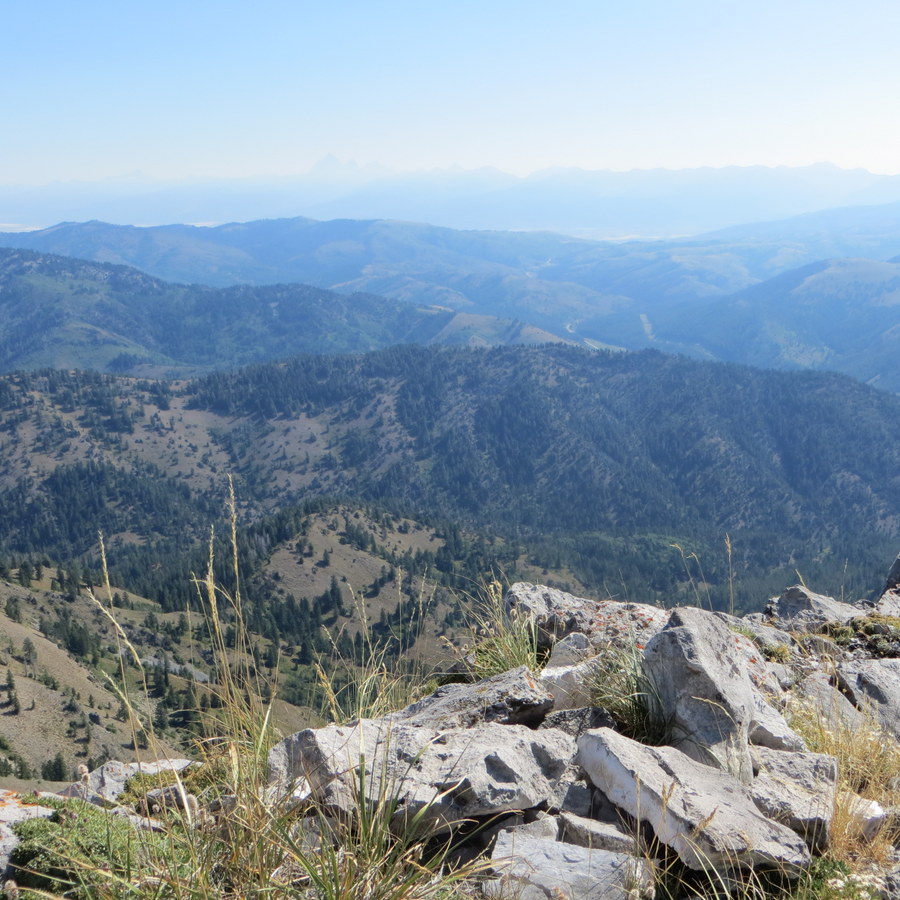
The summit cairn atop Stouts Mountain and a hazy view of the Tetons. Steve Mandella Photo
Along your way, you’ll encounter three small high points (7085, 7566, 7778) and a false summit around the 8,400-foot contour, before you reach the true summit. It’s easiest to climb over the tops of all these ridge points.
On the summit, enjoy views of Swan Valley to the south, the Snake River Canyon to the west, various Big Hole Mountains to the north, and the Tetons and Teton Valley/Victor, Idaho, to the east. Peek under the summit cairn rocks to find masses of ladybugs. Also on top, pay respects to Al Courchaine. His ashes and a marker were placed on the summit in 2011.
The Descent
Reverse your route, taking care not to end up on the nearby southwest ridge. No Cut Timber Canyon should continue to be directly to your east. If you do stray, you could end up in Swan Valley hiking along back roads to ID-31 and your vehicle for an additional six or seven miles.
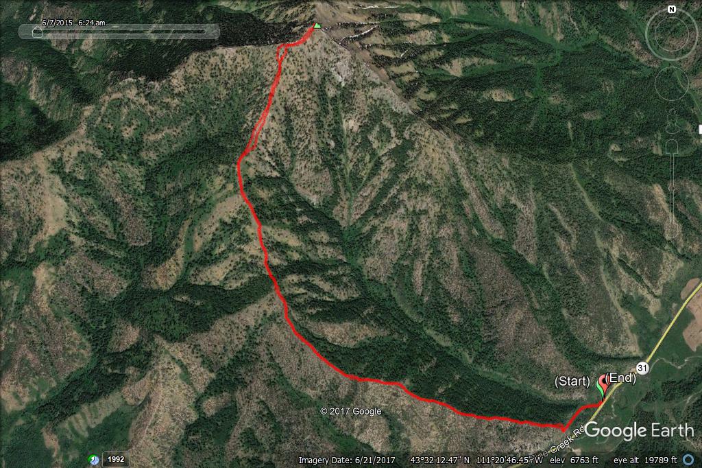
Stouts Mountain. Margo Mandella GPS Track
Trip Stats
5.89 miles round trip with 2,670 feet of elevation gain and one solar eclipse.
East Face Snow Climb by Neil Gleichman
Stouts Mountain displays a broad East Face toward Piney Pass and is visible from some points south of Victor. This east flank is nearly a mile wide and is characterized by a variety of couloirs separated by steep buttresses. The lower face in Gopher Canyon starts at a pedestrian angle but steepens consistently across its entire sweep until one nears the ridge where a limestone cliff band punctuates the prevailing westerlies to create a continuously corniced feature that forces the climber to find weaknesses that run 50 or 55 degrees at their easiest. This cornice is the crescendo to be certain. Nothing on the face is that steep but still, it must be dealt with.
The lateral boundaries of the face are topped by one very long ridgeline. To the north, (The ridge hooks east with survey points 7621 and 7019 (alas, more cornices).
Stouts East Face. Neil Gleichman Photo
The ridge running south off the summit and trending more eastward as it descends, provides the steepest cornices and the sharpest ridge that I know of on the mountain. This southern ridge sheds the waters of No Cut Timber Canyon and Gopher Canyon/Fleming Canyon.
The East Face, nearly bald on its northern half, transitions to moderately gladed in its center and becomes densely treed as it arcs south and east.
My goal was on the long (1800’) couloirs to the north. I crested the cornice along the North Ridge (about 200 meters north of the summit) and rimmed my way up the final stretch. I had abandoned crampons and donned snowshoes. It was past 9AM and in deteriorating snowpack under a strong sun, I sought escape by traversing the peak.
I thus continued south and then east down the ridge that would offer me a quick route to my car without any more steep and open slopes with avalanche anxiety. I was nearly 2 hours back to the car, 3000 feet below the summit.
Despite my patience waiting weeks for this plum to ripen, and thinking I was winning the game by departing the car before 6AM, I bit into sour fruit and realize that Spring has not made it to 7000 feet, yet. Firn and neve are only found in the cold headlamp hours and when the sun goes to work on the slopes, it is not corn snow that one finds but rather postholes and avalanche potential.
It’s mid-April but I await a more convincing Spring and a redo.
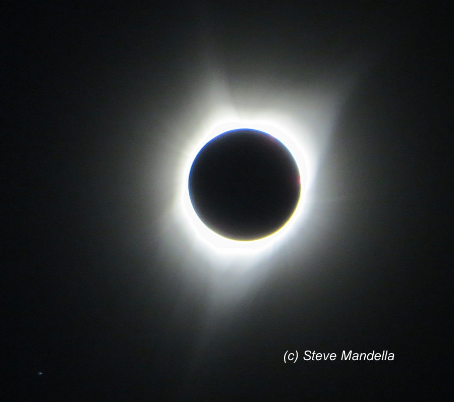
A total eclipse of the sun as viewed from the summit of Stouts Mountain. Steve Mandella Photo
Additional Resources
Mountain Range: Big Hole and Snake River Mountains
Longitude: -111.34909 Latitude: 43.54749