Elevation: 10,300 ft
Prominence: 320
Climbing and access information for this peak is found on Pages 335-336 of the book. Based on recent LiDAR measurements the elevation of this peak 10,279 feet with a prominence of 286 feet.
Livingston Douglas pointed out a few errors in the book, noting:
—The peak is on the USGS Targhee Peak quadrangle rather than the Targhee Creek quadrangle;
—The west ridge is more accurately described as the northwest ridge; and the scramble is actually a Class 2+ rather than Class 2 due to a prominent ridge cliff band that blocks the way.
Finally, Livingston has provided us with a new approach from the Montana side and an updated route description for the peak. Updated November 2024
One Idaho’s most picturesque peaks, Targhee Peak is located just west of Yellowstone National Park. As part of the greater Yellowstone ecosystem, it is prime habitat for grizzly bears. In fact, my climbing partners and I were charged by a young grizzly on the day the day we climbed the peak. We highly recommend that you visit the National Park Service’s Staying Safe Around Bears page before venturing into the Henrys Lake Range.
Targhee Peak
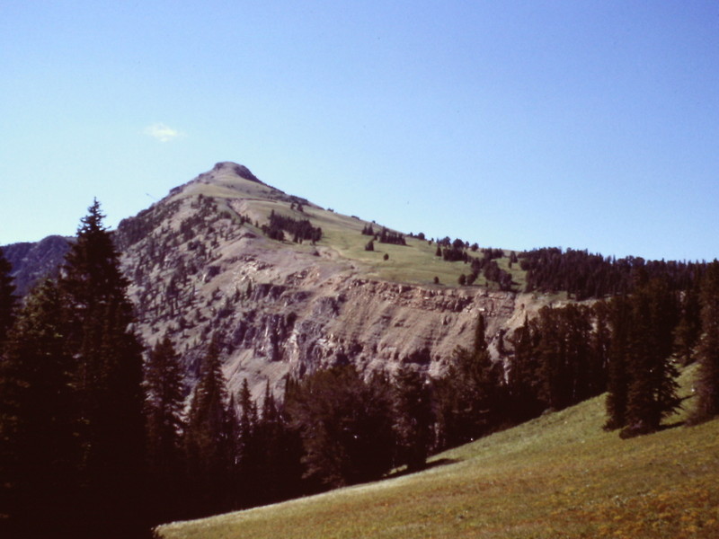
Targhee Peak as viewed from Peak 8883 to its southeast. Livingston Douglas Photo
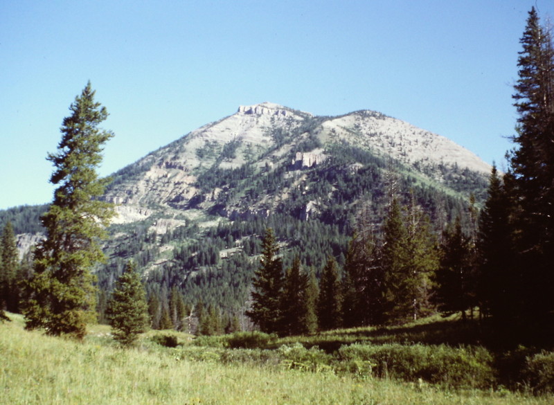
The summit of Targhee Peak from lower down on the east ridge.
Targhee Peak Update by Livingston Douglas
Montana Access
Mile Creek Trail (not discussed in the book). The Mile Creek Trailhead is located on the Montana side of Raynolds Pass. From Raynolds Pass, drive north on Highway 87 into Montana for 3.7 miles. Turn right/east onto Mile Creek Road. Set your odometer to 0.0. At 0.8 mile, you enter the national forest. At 1.0 mile, you reach the end of the road in an open-field gravel parking area. This is the Mile Creek Trailhead and it is signed. The elevation here is 6,820 feet.
Hike south on the Mile Creek Trail through open fields alongside Mile Creek. The trail begins on the west side of the creek, but soon crosses over to the east side. There is no footbridge here, but the creek is small and easy to jump across. After about a mile on the trail, you reach a trail junction with the Continental Divide Trail (CDT). From this junction, the CDT north goes to the right and leads up to Raynolds Pass. The CDT south goes straight/south and eventually leads to Targhee Pass and points beyond. Go straight here, as the CDT follows the Mile Creek Trail up to a saddle on the ridge that connects Black Mountain and North Targhee Peak. When you reach this ridge saddle (9,340 feet), you are about 5.75 miles from the Mile Creek Trailhead.
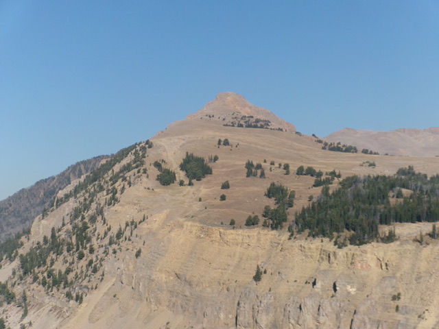
If you look closely, this saddle has a trail junction. The primary trail (the CDT) continues east/north; a weak trail goes west/south (Targhee Creek Trail). Follow the CDT east then north as it meanders around and switchbacks up the east side of a prominent ridge. This ridge is the long, south ridge of North Targhee Peak. The CDT reaches its high point when it crosses an open saddle (the “Targhee Divide”) on the northwest ridge of Targhee Peak. Targhee Peak sits off on its own, to the southeast.
Northwest Ridge, Class 2+
Please note that the book refers to the northwest ridge of Targhee Peak as the west ridge (page 335). It’s not quite the Class 2 walk-up that I expected it to be. From the point where the CDT crosses the northwest ridge (Forest Service sign here states that this is “Targhee Divide”), hike southeast on easy open terrain (broken shale) until you reach a prominent cliff band that blocks your way. Skirt the right-hand/southwest side of the cliff and quickly scramble up Class 2+ shale to regain the ridge crest. Navigate up over a few easier cliff bands to reach the flat, rocky outcrop that is the summit of Targhee Peak. The high point is at the southeast end of the narrow ridge spine.
Additional Resources