Elevation: 8,644 ft
Prominence: 1,224
This peak is not in the book. Livingston Douglas added a new route and photos. Updated November 2024
This Taylor Mountain, one of four Idaho peaks with this name, is the highest point in the Red Hills. The Red Hills are a subrange of the Lost River Range located between the Lost River Range’s crest and the Little Lost River Valley. This peak’s north face rises up abruptly over Dry Creek. USGS Red Hills
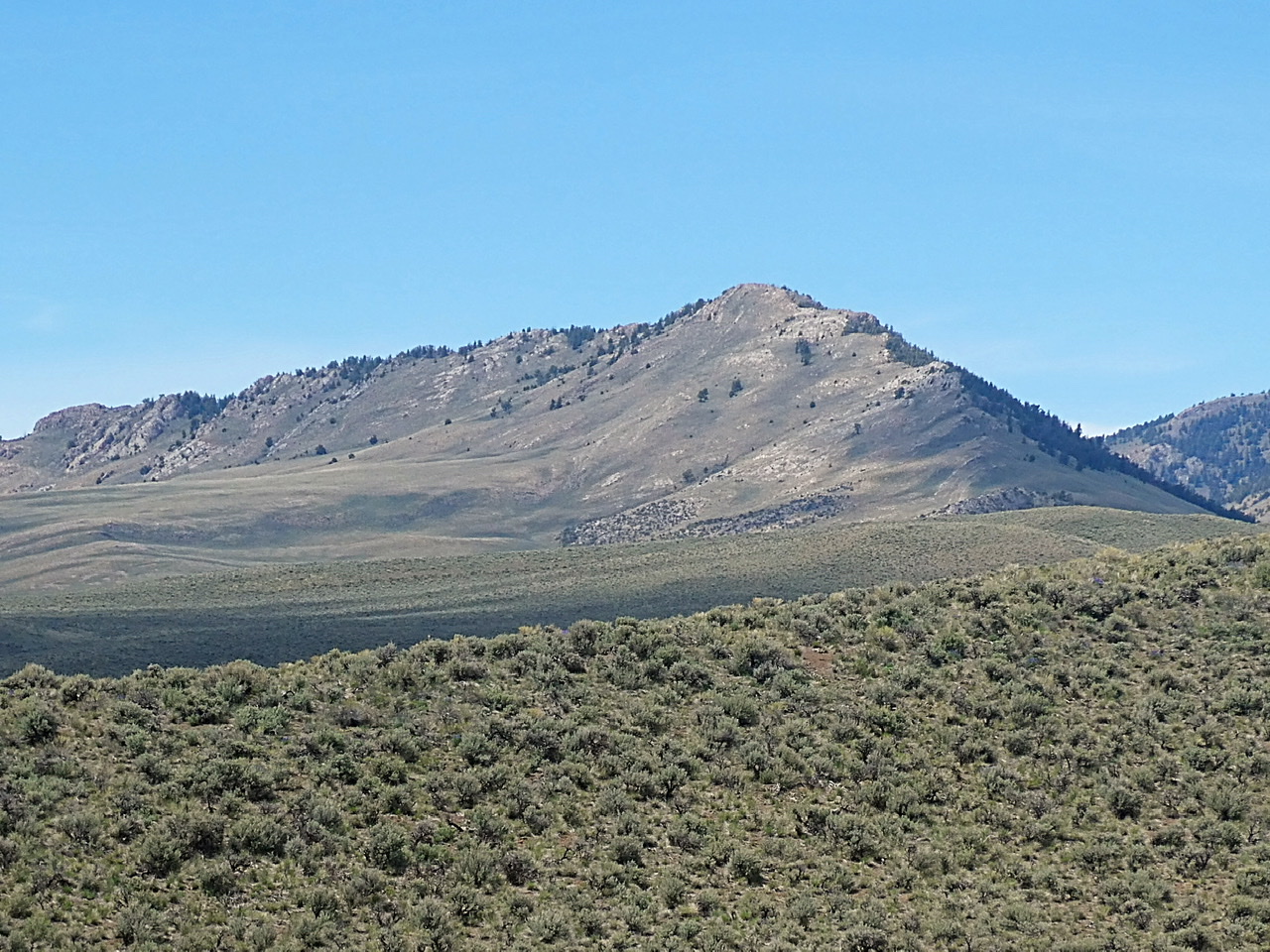
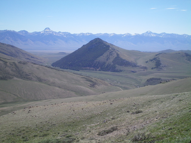
Taylor Mountain viewed from Red Hill. The southeast ridge is on the right.
Access
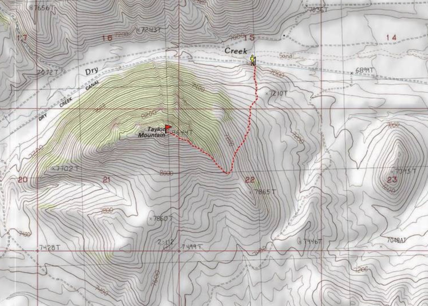
Primary access is from Dry Creek Road [(A)(6) on Page 290] or the Dry Creek Cutoff Road/Corral Creek Road [(A)(6.1) on Page 290]. The southeast ridge can be accessed from the northeast via the 4WD road shown on the map below.
Southeast Ridge, Class 2+
This route can be accessed from Dry Creek (as shown in the map below) or the Dry Creek Cutoff Road/Corral Creek Road (the highest access point). From the 7,400-foot saddle on the southeast ridge, climb to the summit. The route from the saddle is 2.2 miles and gains 1,200 feet in elevation (one way). The rock outcrops along the ridge are easily scrambled over or bypassed on the south side of the ridge.
The east ridge
If you want a longer climb, start at Dry Creek. Use the links below to read John Platt and Dave Pahlas’ trip reports for their mid-April climb from Dry Creek. John recorded their round-trip stats: 4.0 miles with 1,600 feet of elevation gain.
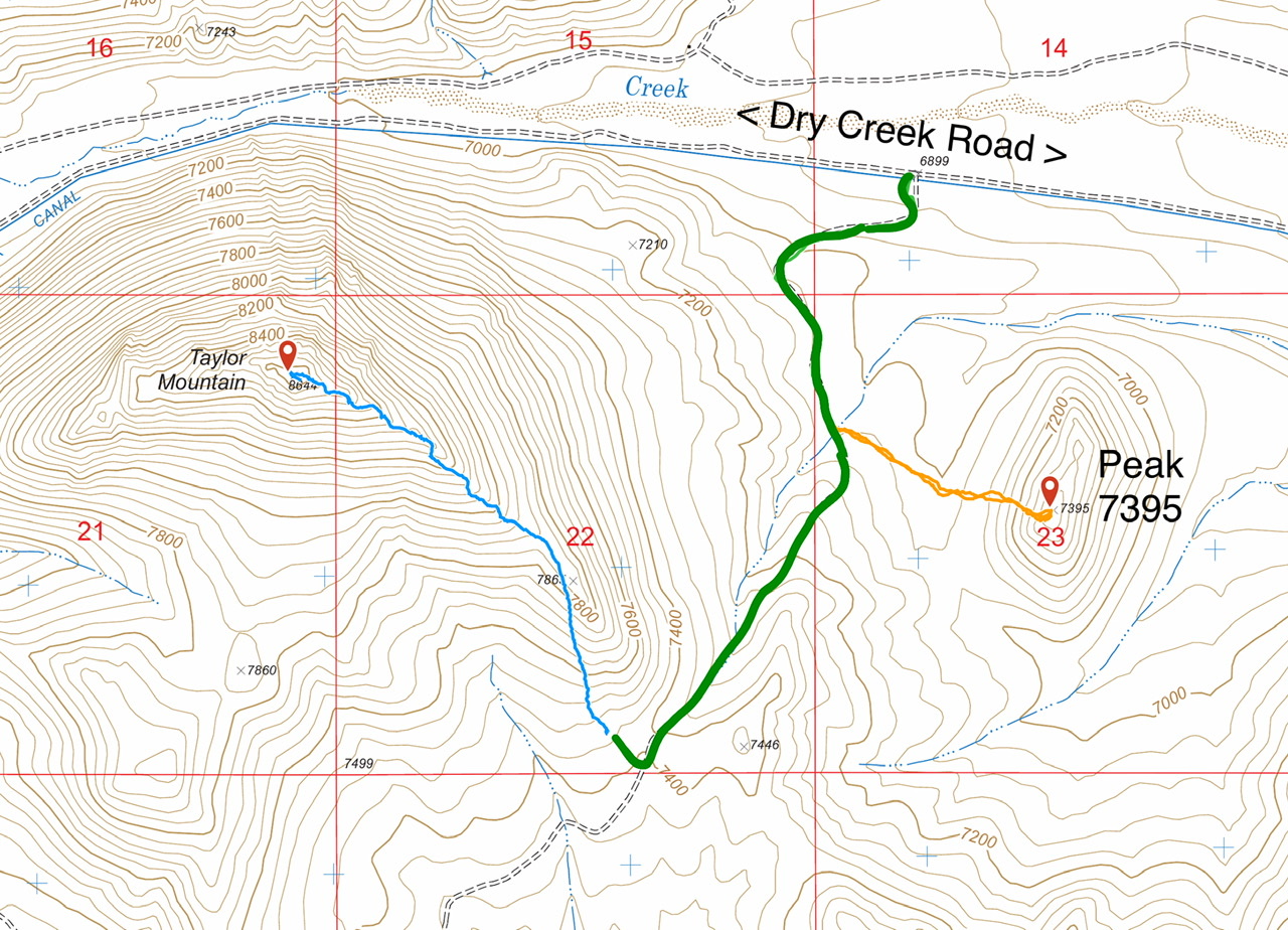
This map shows routes to Taylor Mountain and Peak 7395. The green line is the 4WD road.
Ridge Traverse from Peak 7395 and Southeast Ridge/East Face by Livingston Douglas
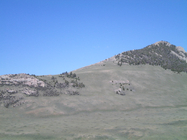
Taylor Mountain as viewed from the northwest. Livingston Douglas Photo
Ridge Traverse from Peak 7395, Class 3
The Ascent
This is the second leg of a 2-peak adventure that includes Peak 7395 and Taylor Mountain. This route joins the Lopez Route at a higher saddle (at 7,420 feet) where a 2-track road crosses the ridge. From the 7,060-foot connecting saddle with Peak 7395, bushwhack west up a nice shoulder where the scrub soon thins to almost nothing.
At about 7,300 feet, the shoulder turns hard left/south. Skirt the left/west side of Point 7446 and angle diagonally right/southwest through short scrub to reach a 2-track road just below a saddle. Follow the road briefly southwest up to the 7,420-foot saddle at the base of the southeast ridge of Taylor Mountain. Follow the southeast ridge (Lopez route) to the rocky summit.
Taylor Mountain and its long southeast ridge (skyline). The summit is at far right. The east face (part of my descent route) is right of center. Livingston Douglas Photo
Southeast Ridge/East Face, Class 2
The Descent
From the summit, descend southeast down the ridge to about 8,080 feet. Stay well below, and right/southwest of, most of the rugged ridge rock to reach a “U”-shaped notch on the ridge crest (visible from the valley floor). Leave the southeast ridge here and descend northeast down a magnificent slope of short grass/scrub with some underlying scree/gravel to reach flatter terrain below. Aim for the 2-track road and follow a cattle trail across the road and back down to the original bench.
Descend off this bench diagonally right/northeast on a cattle trail. Once down off the bench, bushwhack through gapped sagebrush to intersect the 2-track road. Follow the road briefly east then north back to the cattle pen and the junction with the Dry Creek Canal Road and your parked vehicle. If climbing only Taylor Mountain, this descent route makes for a magnificent ascent route.
Taylor Mountain (in mid-ground) as viewed from the west. Livingston Douglas Photo
Dave Pahlas’ GPS track
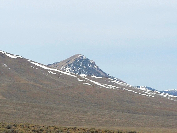
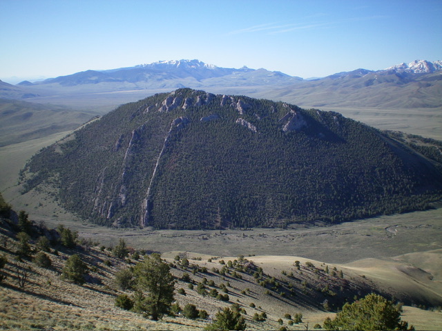
Taylor Mountain as viewed from Dry Creek. Dave Pahlas Photo
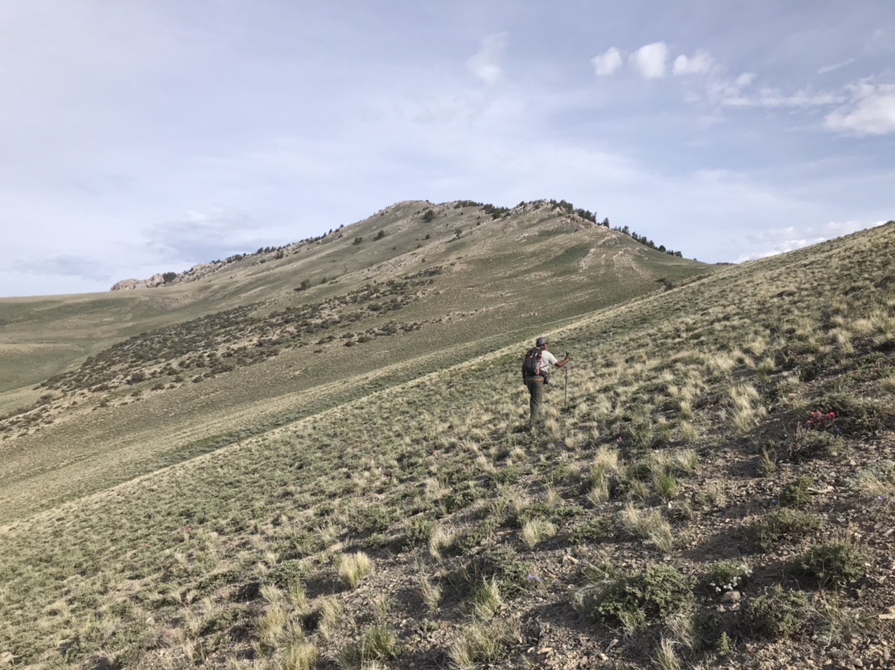
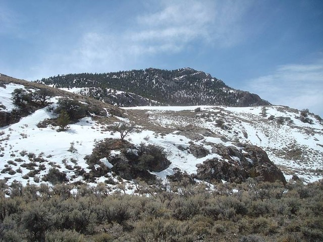
Taylor Mountain as viewed from the southeast. John Platt Photo
Additional Resources
Regions: EASTERN IDAHO->Lost River Range->Red Hills
Mountain Range: Lost River Range
Year Climbed: 2020
Longitude: -113.47869 Latitude: 44.18749