Elevation: 5,324 ft
Prominence: 224
Climbing and access information for this peak is on Pages 152-153 of the book. Livingston Douglas updated this page and added additional photos. Be advised that Google Maps directions for the Three Point Mountain Trailhead will take you to the wrong place. Updated October 2023
Three Point Mountain is at the southern end of the long north-south ridge anchored by Kepros Mountain in the north. Kepros Mountain is one of the popular Grand Slam Peaks. As a result, a lot of people combine an ascent of this peak as part of the trek to Kepros Mountain. This is an easy summit to grab early in the year. USGS Arrowrock Dam
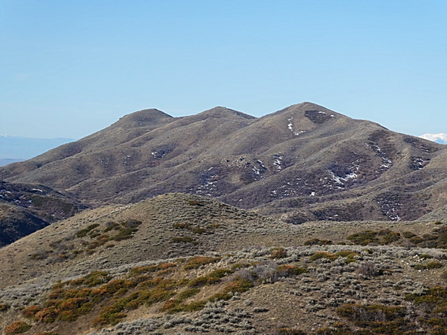
Three Point Mountain as viewed from Peak 5096
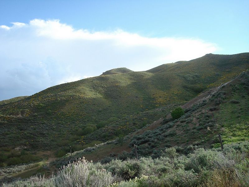
Three Point Mountain as viewed from the trailhead. Dave Pahlas Photo
Access
From I-84, use Exit 64 east of Boise. From the exit, take the well-paved road north through rolling hill country. Keep left at the only paved fork (which has signs for stores in Prairie, Idaho). Continue on this road, which soon turns to gravel, to Blacks Creek Pass, 10.8 miles from I-84. A large parking area is located on the east side of the pass and the trail starts on the west side.
North Ridge, Class 1
From Blacks Creek Pass, hike due west then northwest up the steep, rutted, sandy unofficial trail to an unsigned trail junction at the base of the final steep push west up to the ridge crest. Bypass #1 (for Kepros Mountain) goes right/north here. Go straight/west to reach the ridge crest and the north ridge of Three Point Mountain.
Once on the ridge crest, you find a “T” junction (unsigned). Yes, an unofficial trail follows the north ridge to the north/official summit of Three Point Mountain. And the trail heads north to intercept the unofficial trail to Kepros Mountain. From the “T” junction, follow the unofficial ridge trail south to the summit of Three Point Mountain. This summit has a large summit cairn but no visible benchmark. It may be buried under the summit cairn. Since there is an unofficial climber’s trail to the summit, I rate this climb as Class 1 rather than Class 2.
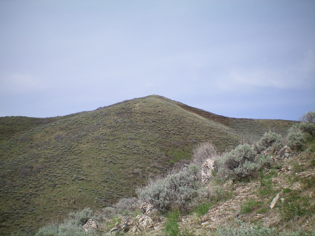
The north summit of Three Point Mountain as viewed from the east. Livingston Douglas Photo
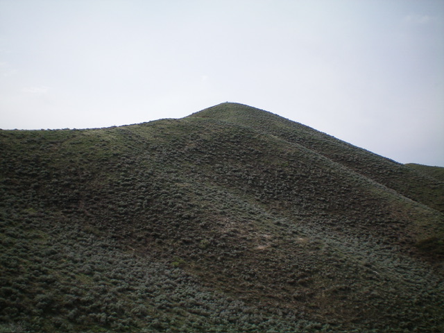
The north summit of Three Point Mountain as viewed from the north. Livingston Douglas Photo
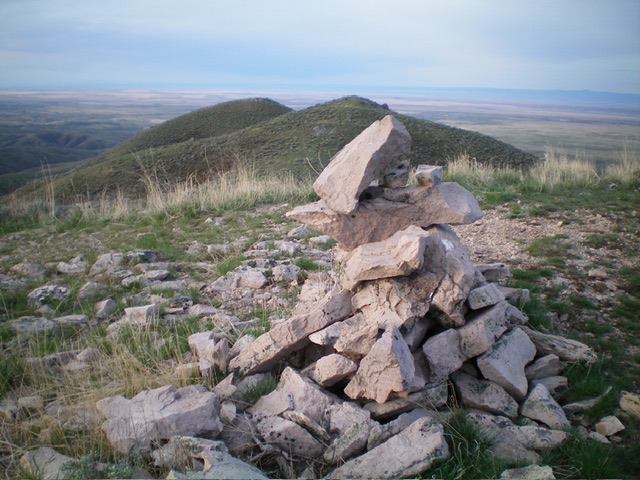
The summit cairn atop the official/north summit of Three Point Mountain with the middle summit (center) and south summit (left of center) in the distance. Livingston Douglas Photo
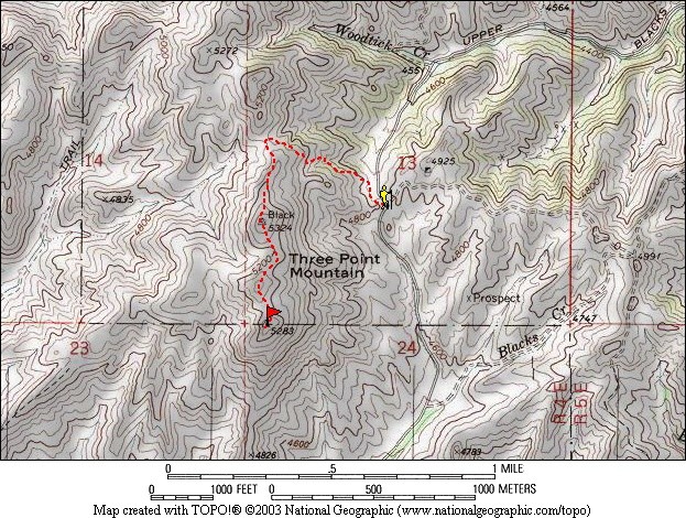
The route to Three Point Mountain. Dave Pahlas Map
Additional Resources
Regions: Boise Mountains->Danskin Mountains->WESTERN IDAHO
Mountain Range: Boise Mountains
Year Climbed: 1988, 2009
Longitude: -115.93429 Latitude: 43.50629