Elevation: 8,220 ft
Prominence: 680
Climbing and access information for this peak is on Page 371 of the book. Published November 2020
Tincup Mountain is a magnificent ridgeline mountain that towers over both Tincup Creek and Jackknife Creek. The easiest ascent route is via the Tincup Mountain Trail/FST-467 from ID-34, which gets you close to the summit but not all the way there. Combine a climb of Tincup Mountain with nearby Peak 8038 for a more worthwhile endeavor. USGS Tincup Mountain
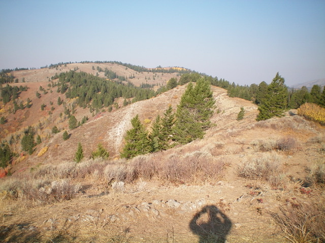
Tincup Mountain as viewed from the east. The summit is left of center on the edge of the forest line. Pardon my shadow. Livingston Douglas Photo
Access
From the east end of ID-34 (at a county road about a mile north of Freedom, WY), drive west on ID-34 for 8.9 miles to a [signed] junction with Bear Canyon Road/FSR-258. Turn right/north onto Bear Canyon Road and drive 0.2 miles to a large corral and parking area. Park here (6,255 feet).
South Ridge, Class 2
The Climb
The [signed] Great Western Trail (GWT) heads west from Bear Canyon Road at the large corral. It is a connector trail that joins the Tincup Mountain Trail/FST-467. Hike west on the GWT until it merges into FST-467. FST-467 is a narrow footpath/horse trail that is rarely on the crest of the south ridge. It moves from the right/east side of the ridge to the left/west side of the ridge at about 7,860 feet and has some ups and downs. Follow FST-467 north then northwest then north to reach a shoulder crossing at 8,020 feet. There is a fork in the trail here.
FST-467 (signed) goes left to drop a bit and skirt the west face of Tincup Mountain. A use trail goes right here and soon flames out. Follow the use trail briefly then bushwhack right/east through thick brush then a short strip of pine forest to reach the open, brushy right/east side of the ridge crest. In retrospect, it’s better to leave FST-467 at the shoulder crossing (before the fork in the trail) and follow the open terrain on the right/south side of the shoulder to more easily reach the south ridge with minimal bushwhacking.
Once on the crest of the south ridge, follow it north in open brush/sage (with decent gaps) to reach a forested ridgeline area with an initial hump. Drop slightly from this minor hump and continue north to the high point of Tincup Mountain. The summit is on a forested ridgeline and has a decent cairn with great views to the east and south. You can also see gentle Point 8184 to the north from here.
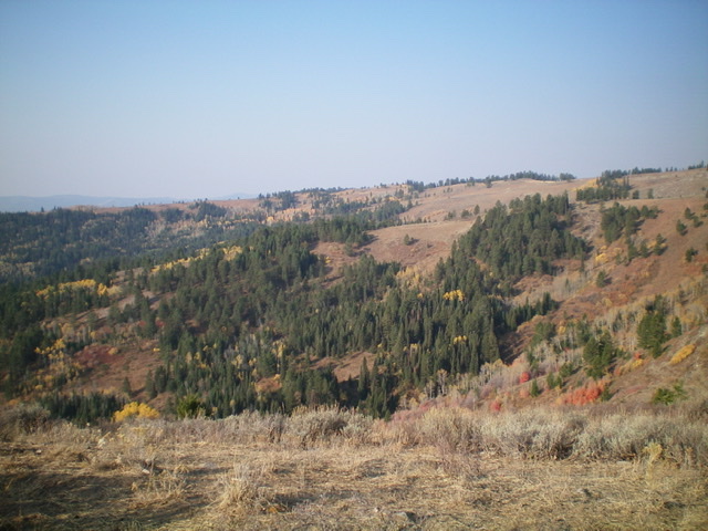
The mid-section of the LONG south ridge (in mid-ground, not the skyline) of Tincup Mountain as viewed from the east. Livingston Douglas Photo
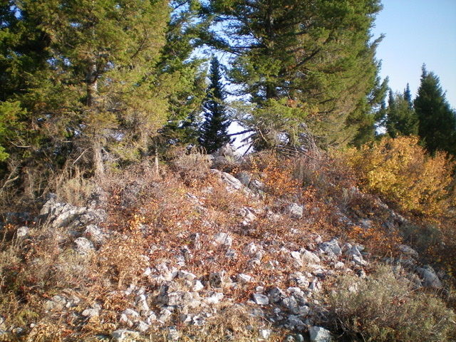
The semi-open ridgeline summit of Tincup Mountain. Livingston Douglas Photo
East Ridge, Class 2
The Descent
From the summit, backtrack a bit south on the ridge then descend open scrub slopes east to two minor saddles and humps. Find a use trail (FST-465) after reaching the top of the second hump (Point 7812). The terrain is now semi-open pine forest. Follow FST-465 on the south side of the ridge (contrary to the placement of the trail on the north side of the ridge on the USGS topo map) as it goes through thick brush. FST-465 is only a narrow foot/horse path but it helps in getting through this mess.
The terrain opens up again and the trail peaks out on a ridge corner where the ridge turns sharply right/south. This ridge corner is above the critical saddle at the base of the southwest ridge of Peak 8038. The saddle is not visible from here due to the aspen forest in between. Aim northeast at the [visible] southwest ridge of Peak 8038. You can see it through the trees. Descend northeast through the aspen forest, which has enough gaps that it isn’t too difficult to bushwhack.
You quickly reach the aforementioned saddle and find a trail crossing and a nice horse/hunter camp under some pine trees at the southwest edge of the saddle. This is the 7,620-foot connecting saddle between Tincup Mountain and Peak 8038. It concludes the first leg of today’s two-peak journey. Peak 8038 is up next.
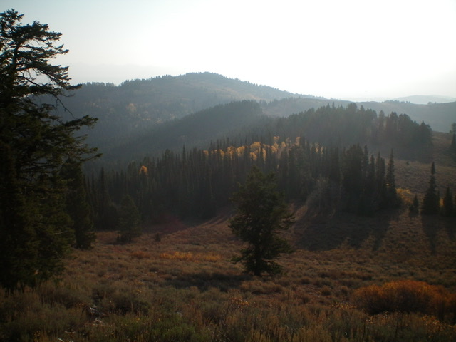
Peak 8038 (forested, left of center in the distance) as viewed from Tincup Mountain to the west. A rather undulating, semi-open ridge lies in between. Livingston Douglas Photo
Additional Resources
Regions: Caribou Range->SOUTHERN IDAHO
Mountain Range: Caribou Range
Longitude: -111.22501 Latitude: 43.01339