Elevation: 5,260 ft
Prominence: 240
This peak is not in the book. [Editor’s note: After stumbling around the summit area it was clear that the LOJ marker was not on the true summit. I moved the marker on the map I added to Livingston Douglas’ narrative to the location of the true summit. I also added the Northeast Ridge route and a photo.] Updated December 2023
This peak is located just across US-20 from Tollgate Butte. The peak has a large diverse summit area with several potential high points. USGS Long Tom Reservoir
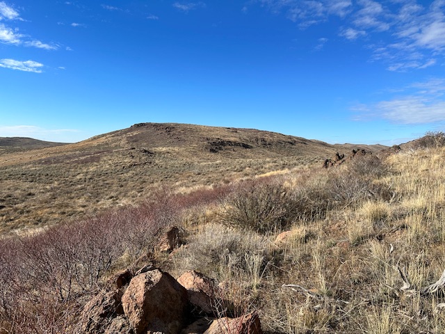
Looking up the northeast ridge of Tollgate Hill.
South Ridge, Class 2
Access
From the well-signed Tollgate Historical pullout on the north side of US-20, drive 1.2 miles east on US-20 to a jeep road on the right/south side of the highway. Park near this road junction (4,950 feet).
The Climb
Tollgate Hill is on the north side of the highway. From the road junction, you can see almost the entire route to the top of Tollgate Hill but you can’t see the summit. Cross to the north side of the highway and begin the climb. Head northeast up the steep open scrub, crossing a stiff cattle fence early on. May you be blessed with long legs. Aim for a prominent rocky outcrop on the south ridge. Scramble up through some large rocks/boulders (Class 2+) to reach the top of this rocky outcrop. You are now at the head of the south ridge but you are not on the summit as you can easily ascertain. Scramble northwest across rock-and-scrub terrain to reach the high point which is another rocky outcrop. There were no signs of previous ascent.
North Face, Class 2
The Climb
Park at an unsigned road junction and large parking area (4,932 feet) on the south side of US-20. GPS coordinates: 43⁰15’18”N, 115⁰32’40”W. This parking area sits at the base of the north face of Tollgate Butte. Bushwhack east briefly then south, heading directly at the summit ridge. The sagebrush slope isn’t too bad. After reaching the tilted summit plateau, scramble west up the ridge to reach the true summit.
Tollgate Butte has three potential high points in the summit area, which is at the west end of the summit plateau. All of these potential high points are rocky outcrops. The westernmost outcrop is about 5 feet too low. The central and eastern outcrops are of equal height. There is no summit cairn or benchmark atop any of them. The north face route is the most direct route to the summit and does not require a 4WD vehicle or a drive on a 2-track road that may be rough or rutted at times.
Northeast Ridge, Class 2
Follow Livingston Douglas’ access directions but park just after passing through the fence bordering US-20. Hike up and southwest through sagebrush to the summit area.
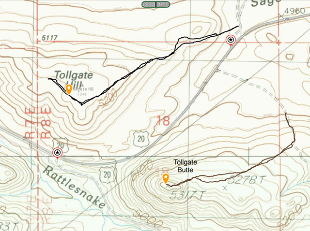
My GPS track for the Northeast Ridge route. The track covers 1.8 miles with 250 feet of elevation gain round trip. This included my walk from the true summit to a potentially higher point to the northwest.
Additional Resources
Regions: Boise Mountains->Danskin Mountains->WESTERN IDAHO
Mountain Range: Boise Mountains
Year Climbed: 2023
Longitude: -115.55550 Latitude: 43.25379