Elevation: 7,892 ft
Prominence: 272
This peak is not in the book. Livingston Douglas provided additional access and route information as well as a discussion of map errors which are set out down the page. Updated November 2019
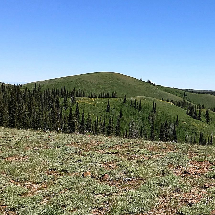
Trapper Peak is located north of Monument Peak. It is a cone-shaped summit which can be reached after a bumpy drive and a short hike. USGS Trapper Peak
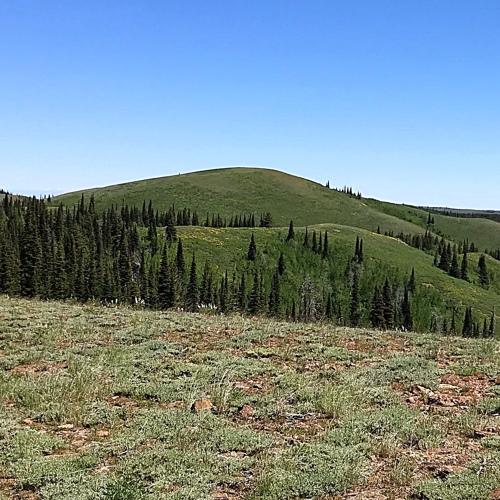
Trapper Peak as viewed from FS-538
Access
Roads of varying quality lead all the way to the base of Trapper Peak. The peak can be reached from I-84 at Exit 182 or from Oakley, Idaho [(A)(1) or (B)(1) on Page 347]. Google Maps works well when you are approaching from the freeway. Just search for Trapper Peak, Cassia County. This approach starts on Rock Creek Road/FS-515 which is paved until just past the Magic Mountain Ski Area. The unpaved road is improved and although bumpy in places, is passable when dry to passenger cars with good clearance until it reaches FS-2197 in 6.3 miles from the ski resort. A 4WD is necessary to drive up FS-2197 from FS-538. The road is particularly bad on the north side of Point 7801. It is 1.6 miles to the start of the hike up the peak.
West Slopes, Class 1+
Park at 1.6 miles at a junction. Walk downhill a short distance where an overgrown path leads north through the trees. Follow this path through the trees to the open ridge beyond. Turn right on an overgrown track that leads east and up to the summit. It is 0.4 miles with 285 feet of elevation gain from the parking spot to the summit.
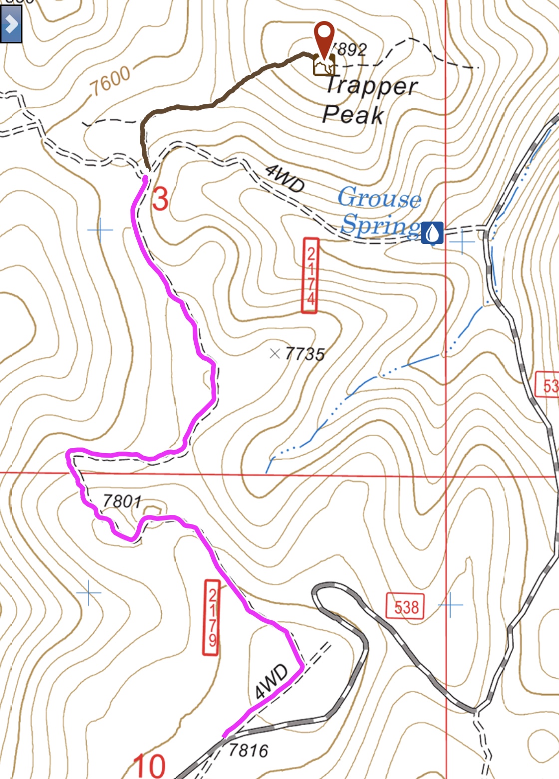
The road approach from FS-538 is shown in pink and the hike is in black.
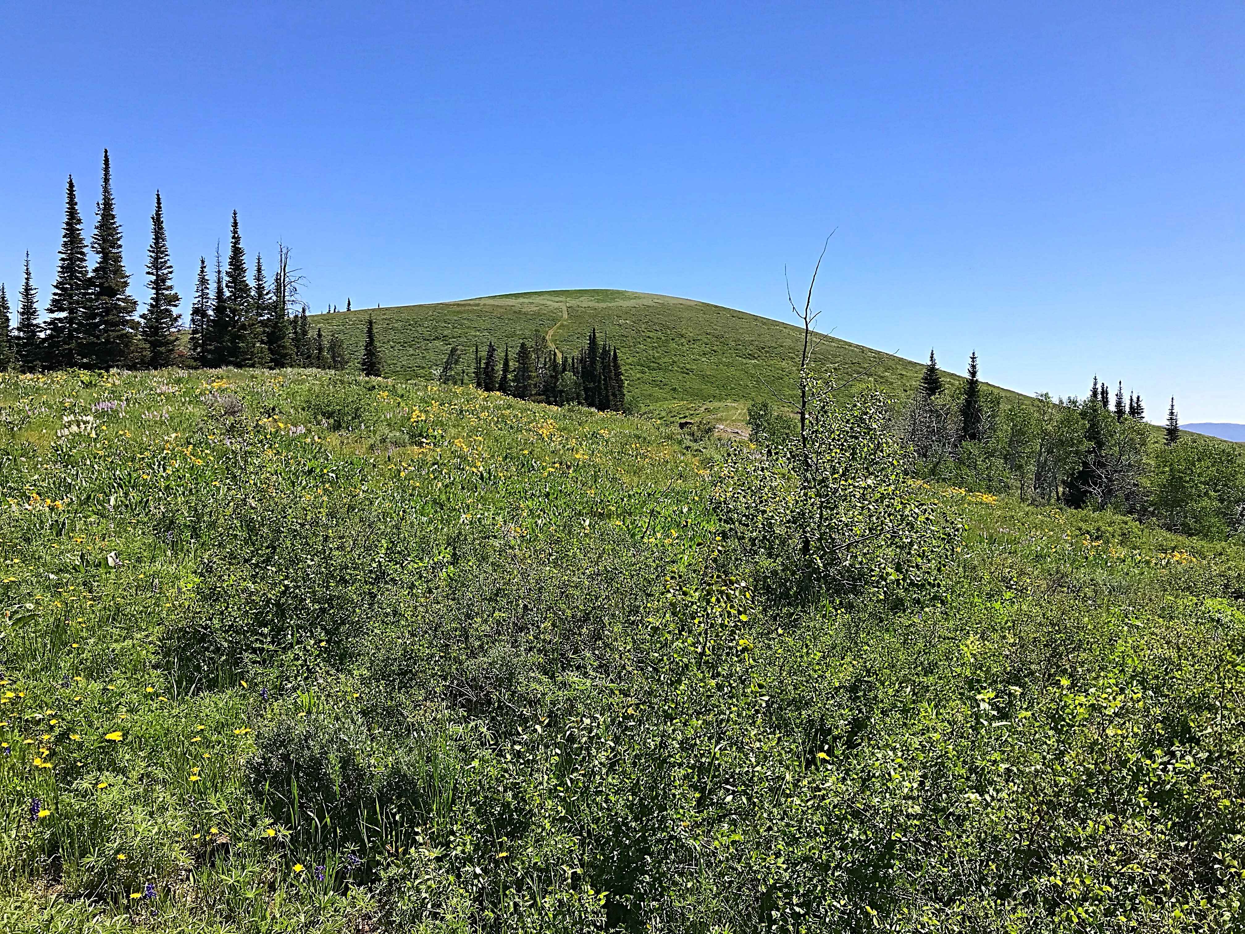
Trapper Peak’s west face. The seldom-used ATV track to the summit is visible.
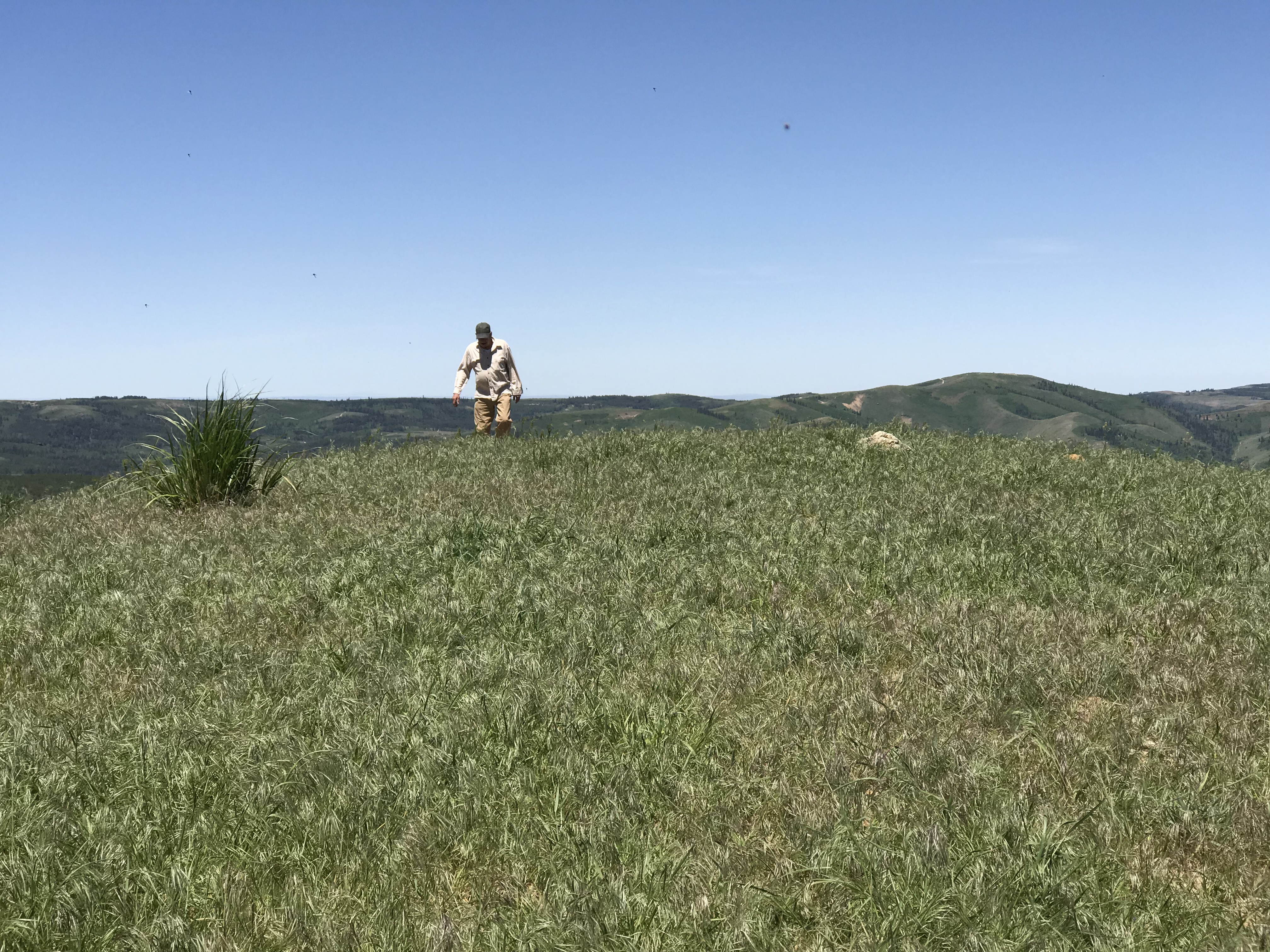
Jon Fredland on the summit.
Trapper Peak by Livingston Douglas
Trapper Peak is the 2nd-highest peak in the South Hills. Amazingly, this beautiful, pyramidal-shaped peak is an unranked point on the north ridge of Monument Peak, the South Hills’ highest mountain. Monument Peak lies only two miles to the south of Trapper Peak. Trapper Peak is home to a herd of elk, both cows and bulls. I heard, then saw, a few cow elk high on the east face. Better yet, I saw a couple of bull elk near the summit. This is a very special place. The views from the summit are spectacular. Trapper Peak is, hands down, my favorite peak in the South Hills.
Access
Park at the [signed] junction of FSR-533 and FST-174. This junction is located about a mile north of the junction of FSR-533 and FSR-538. The elevation here is 7,275 feet.
Southeast Shoulder, Class 2
From the road junction, hike briefly west (perhaps 0.1 mile or so) up FST-174 (an ATV road) to get past a section of thick aspens on the south face of Trapper Peak. Look for an opening through the aspens to begin the climb up the southeast shoulder. Once past the aspen grove, work your way up the face/shoulder through gapped sagebrush. Higher up, the shoulder is better defined and the climb becomes smooth sailing on easy short scrub/grass. The views of the valley floor open up as the early-morning sun warms your chilled exterior. In 20 minutes or so, you’ll be standing on the summit.
The summit of Trapper Peak had no summit cairn and no obvious USGS benchmark as it is supposed to have. I did find a small piece of rebar sticking out of the ground in the summit area and that was all. The summit high point is about 50-75 feet northwest of the rebar protrusion. I built a modest cairn atop the ground boulder that is on the high point of this peak. The views of the surrounding peaks and valleys/canyons are magnificent. Take some time to enjoy them.
USGS Map Errors on Trapper Peak
The USGS map shows a trail crossing west-to-east across the summit. No such trail exists anymore. The USGS map shows the elevation of Trapper Peak as 7,892 feet and my altimeter confirmed that figure with a 7,890-foot assessment. However, the USGS topo map shows the highest contour line at 7,840 feet, making the 7,892-foot figure impossible. I believe that the USGS map is in error and is missing the 7,880-foot contour line. Unfortunately, the Trapper Peak quadrangle has several of these types of errors.
Additional Resources
Regions: South Hills->SOUTHERN IDAHO
Mountain Range: South Hills
Year Climbed: 2018
Longitude: -114.20889 Latitude: 42.15239