Elevation: 8,930 ft
Prominence: 1,310
Climbing and access information for this peak is on Page 148 of the book. Updated August 2021
West Warrior Peak is located southeast of Swanholm Peak and northwest of the confluence of Swanholm Creek and the Middle Fork Boise River. USGS Swanholm Peak
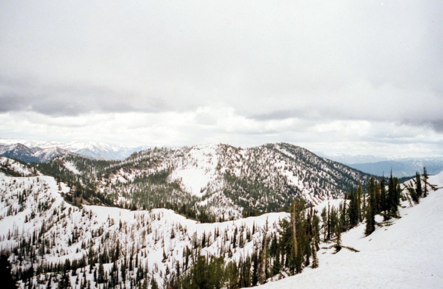
Warrior Peak as viewed from Swanholm Peak.
Access and Route Update
The access information in the book is still accurate with one exception. The road to Swanholm Peak lookout is gated at 6,200 feet and only open from June 15 till September 15. Additionally, even when the road is open it is a difficult route to drive. See the Swanholm Peak page for additional details. If you walk from the gate it is a round trip to West Warrior of 11.3 mile round trip with just under 4,000 feet of elevation gain. Use the link below to read Zach Vickery’s trip report.
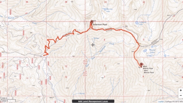
Zach Vickery’s GPS track.
Additional Resources
Regions: Boise Mountains->WESTERN IDAHO
Mountain Range: Boise Mountains