Elevation: 5,925 ft
Prominence: 385
This peak is not in the book. Livingston Douglas provided new route information for ascending the peak’s northeast face. Updated November 2019
Windy Benchmark is a broad plateau-like peak located south of Hill City. It took us a while to find the benchmark on the large, flat summit. We added three cairns in case anyone else wants to summit this brushy peak. USGS Dempsey Meadows
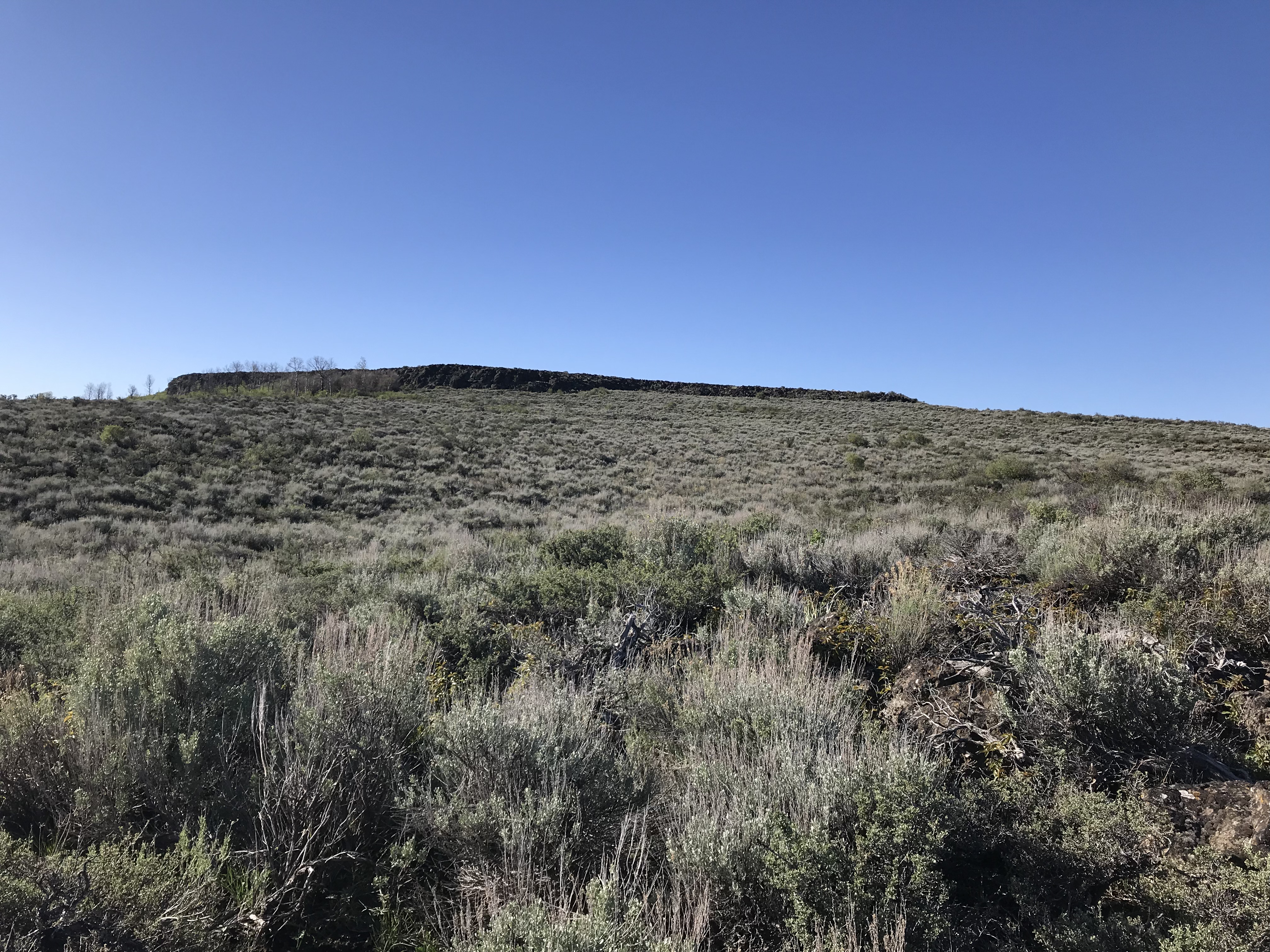
The summit is on the flat area above this line of cliffs.

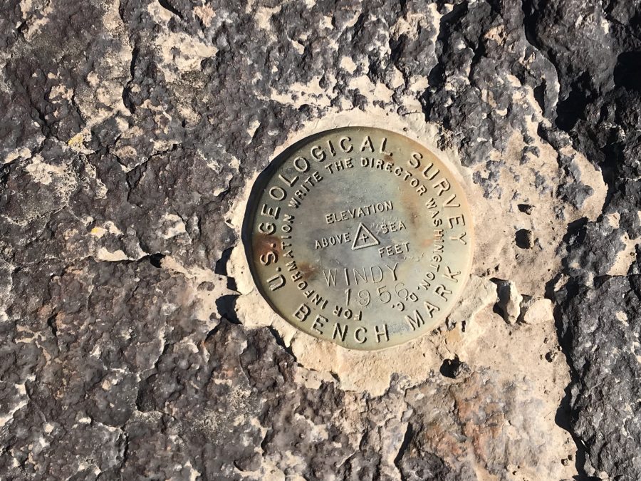
The summit benchmark
Access
Access the peak from Monument Gulch Road. This road is accessed from US-20 at Hill City. Turn south at the intersection in “downtown” Hill City which is signed for the Camas Prairie Centennial Marsh. Follow this road south until it reaches a “T” junction. Turn left and follow the next road east for a half mile to an unsigned junction. Turn right/south here. This is Monument Gulch Road. After crossing a pass and traveling 9.0 miles from Hill City, the road reaches a junction. Turn right and follow the road up to the peak’s north shoulder where there is room to park.
North Shoulder, Class 2+
From the parking spot, hike due north to the summit. There are a couple of rock bands and lots of brush to impede your climb. This route covers 1.5 miles round trip with 336 feet of elevation gain.
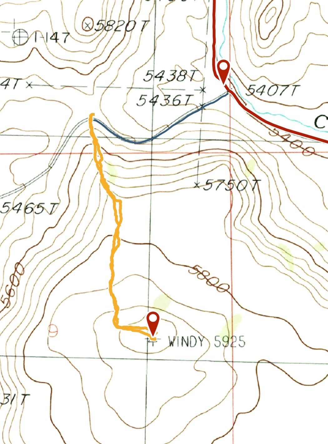
My GPS track
Northeast Face, Class 3 by Livingston Douglas
Access
From Hill City on US-20, drive south on the road signed for the Camas Prairie Centennial Marsh (Swamp Road/1300W) for 3.1 miles to a road junction. Turn left/east onto Stokes Road/600S and drive 0.7 miles to an [unsigned] road junction at the base of Monument Gulch. This is Monument Gulch Road. Turn right and drive south for 4.8 miles on Monument Gulch Road to an unsigned road junction (5,407 feet). Park in a pullout area on the right/west side of Monument Gulch Road.
The Climb
From the road junction, scramble south directly up the steepening slope of thick sagebrush and other awful scrub. You can follow the left/east side of a cattle fence initially to help you advance. Unfortunately, the fence turns right/southwest and ascends diagonally up the scrubby hillside. Leave the fence at this corner and bash your way up this thick mess. Worse yet, boulders join the mix and make the climb even more unpleasant. This is torturous terrain—the worst that I’ve seen in the Bennett Hills.
Just below the top of this initial face section, there is a headwall of large boulders (with brush mixed in) that must be climbed. It goes at Class 2+/3. You simply MUST use your hands here. Once on top of the cliff band, you are standing on a flat plateau. This plateau is wide and is a mix of scrub and ground talus/boulders. Very tedious but at least the sagebrush here isn’t as tall as was on the face you just climbed and you’re not scrambling steeply uphill.
Bash your way southwest across this brushy plateau then skirt a short section of aspens near the summit cap to reach the flat summit area. Wander around a bit to find the high point and USGS benchmark which is in the center of the summit cap. There are one or two small cairns nearby. I built a modest cairn atop the boulder that has the USGS benchmark in it, leaving the benchmark easier to find.
Additional Resources
Regions: Bennett Mountain Hills->WESTERN IDAHO
Mountain Range: Bennett Mountain Hills
Year Climbed: 2018
First Ascent Information:
- Other First Ascent: Northeast Face
- Year: 2019
- Season: Fall
- Party: Livingston Douglas
Longitude: -115.03209 Latitude: 43.17649