Elevation: 6,410 ft
Prominence: 460
Livingston Douglas pointed out a new development. “Sunset Cone is in a restricted area of Craters of the Moon National Monument. You must obtain a free, 1-day wilderness permit to climb in this area. The permit is available at the Visitor Center. Be sure to carry it with you when you do this climb.” Livingston has also added detailed hiking information for this cone. Updated December 2019
Sunset Cone is Peak #2 of the Craters 10-Pack.
Sunset Cone is located east of Grassy Cone on the north side of US-20 and across the highway from the Craters of the Moon Visitor Center. It’s a brushy but easy ascent from the highway. USGS Inferno Cone
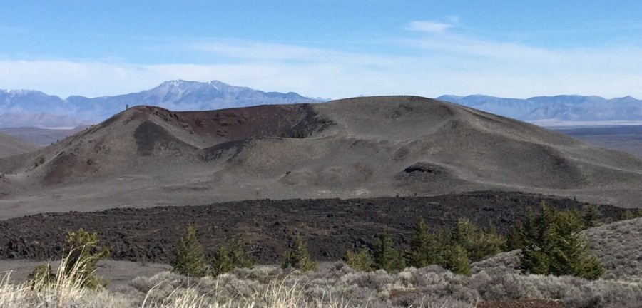
Sunset Cone as viewed from the parking pullout on US-20, about ¼ mile to the east. Livingston Douglas Photo
Access by Livingston Douglas
There are two options for parking your vehicle:
- There is a gated road at US-20 on the east side of Sunset Cone. This road heads north to a Group Campground. You are not permitted to drive on, or park along, this road. However, there is a large paved parking pullout on the south side of US-20 exactly 0.2 miles northeast of this gated road. For scrambles on the eastern flanks of Sunset Cone, this is your best option.
- Park at the Visitor Center and walk east along US-20 to the point from which you begin your scramble up Sunset Cone.
Look out for traffic when you cross the highway. Beware of snakes as you work your way up the sagebrush-covered slope. See the GPS track below. Expect great views of the local volcanic wonders, the Pioneer Mountains, the Lost River Range, and Big Southern Butte.
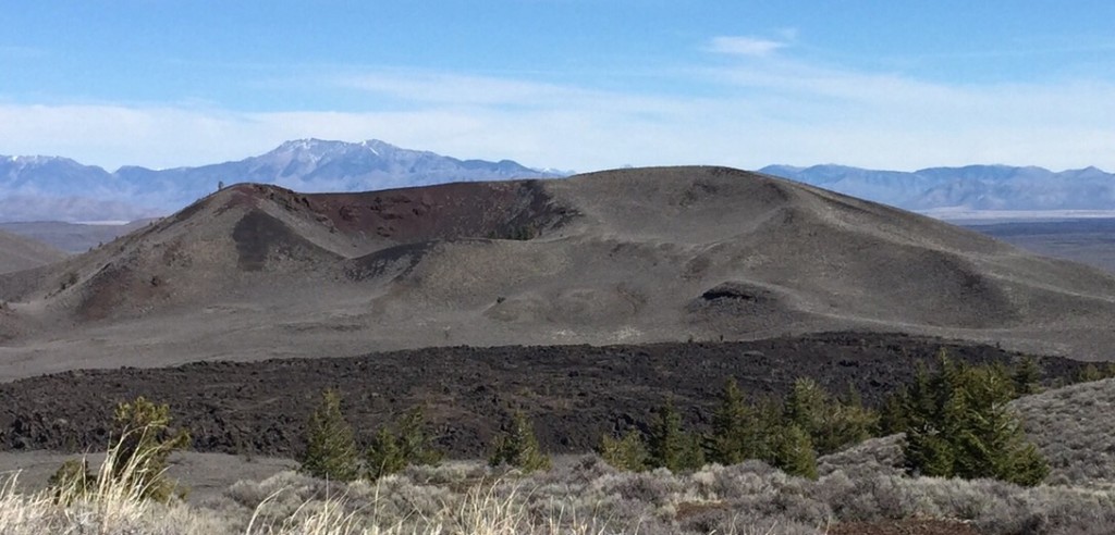
Sunset Cone as viewed from Grassy Cone
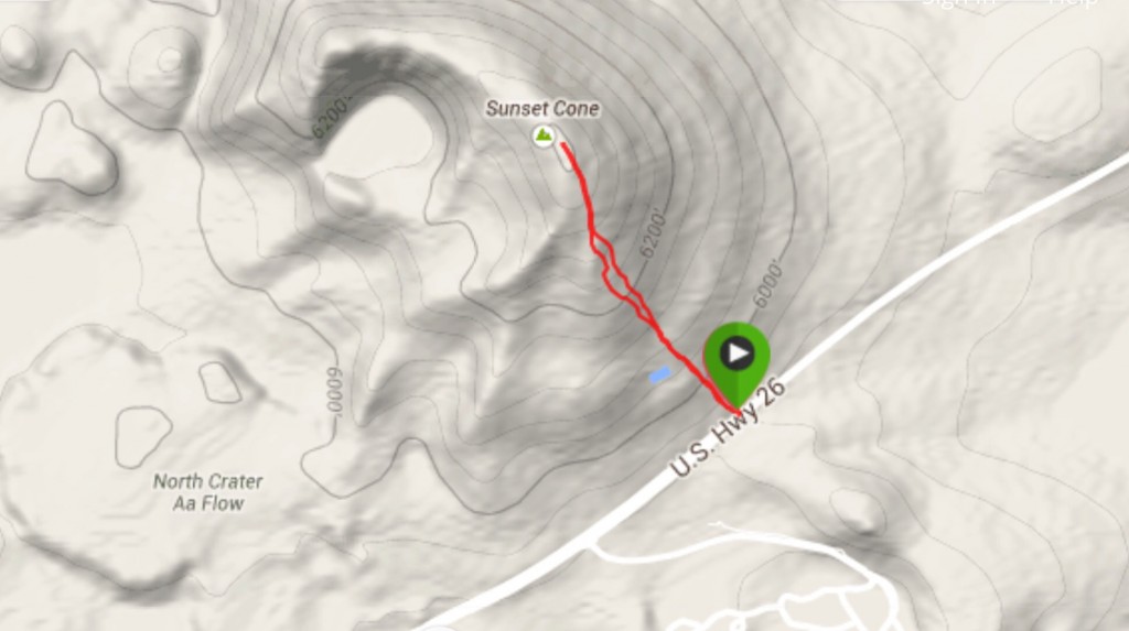
Here is my GPS track. You can follow it or find your own route on this gentle cone. Expect great views and watch out for snakes.
East Face and Southeast Face Routes by Livingston Douglas
East Face, Class 2
Access
From the entrance to Craters of the Moon National Monument, drive 0.8 miles east on US-20 to a large, paved pullout on the south side of the highway. The elevation here is 5,845 feet. This pullout is located 0.2 miles northeast of a gated, restricted road on the north side of the highway.
The Climb
From the large parking pullout, walk southwest on US-20 to the gated road on the north side of the highway. Wilderness permit in pocket, walk briefly up this road to reach the base of the southeast face. Leave the road and bushwhack west up through thick sagebrush and prickly brush to reach the summit. On the summit, you will find an antenna installation. Sunset Cone also has a USGS benchmark on its southeast face (Sunset Benchmark). There are two repeaters up here. There was no summit cairn so I built a small one.
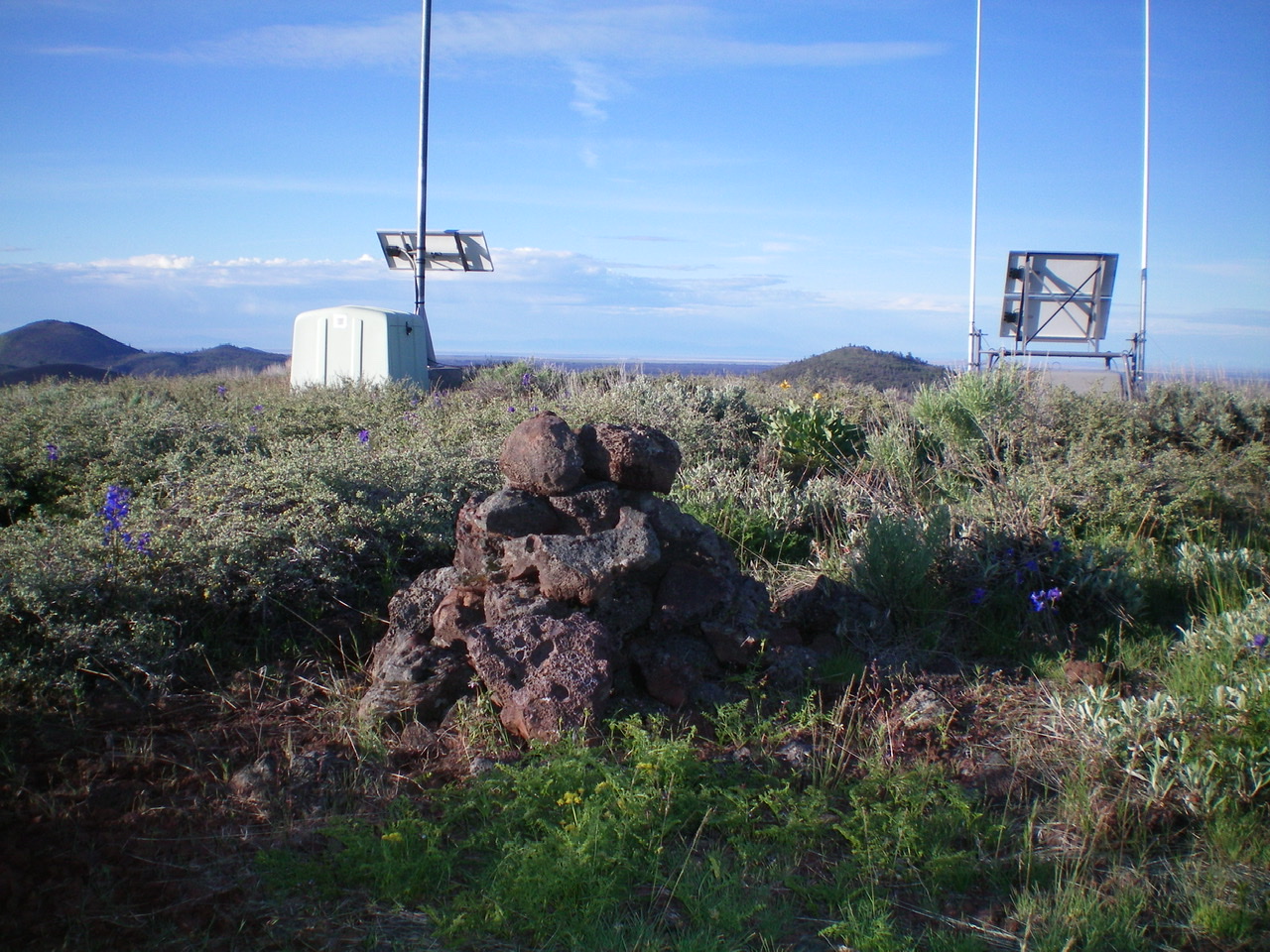
The summit cairn atop Sunset Cone with the two repeaters in the background. Livingston Douglas Photo
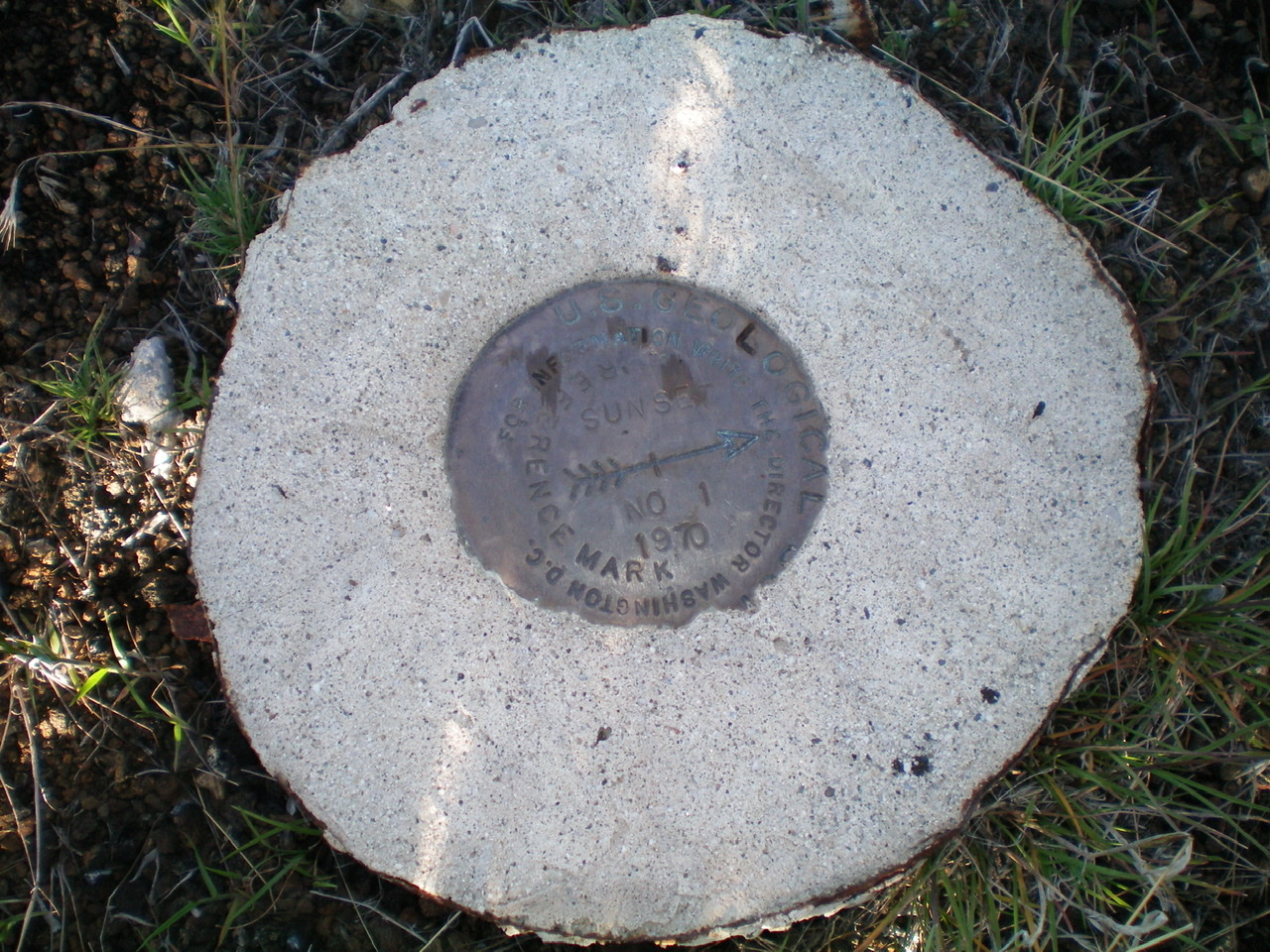
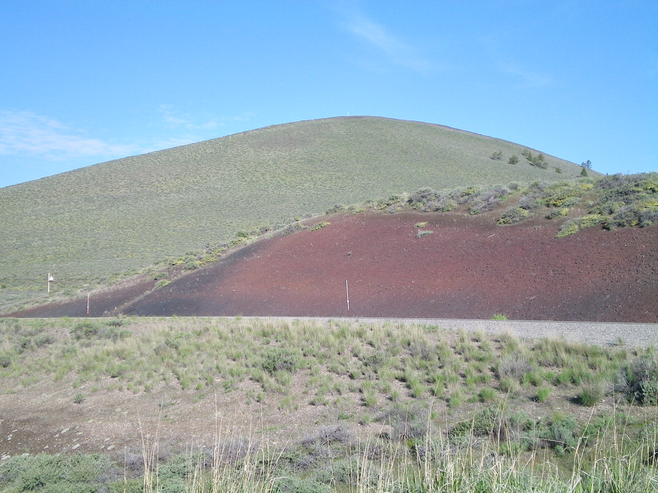
The USGS “Sunset” Benchmark on the southeast face of Sunset Cone. Livingston Douglas Photo
Southeast Face, Class 2
Access
Same as for the east face
The Descent
From the summit, descend the face southeast to find Sunset Benchmark. It is just above a gravel access road that cuts across the lower section of the southeast face. It is marked with a metal post (witness marker) that is visible if you look for it. The actual USGS benchmarks (two of them) are hidden nearby on the ground in the sagebrush, encased in concrete. After visiting the benchmarks, continue southeast through more sagebrush/bushes to reach the gravel access road. Follow the road northeast back to the main access road. Return to US-20 and walk northeast for 0.2 miles along the highway to the parking pullout.
Additional Resources
Regions: SNAKE RIVER PLAIN
Mountain Range: Snake River Plain
Year Climbed: 2015
Longitude: -113.56389 Latitude: 43.46829