Elevation: 8,082 ft
Prominence: 516

Climbing and access information for this peak is on Pages 106-107 of the book. The route in the book climbs Tripod Peak from the north. It is the shortest way to the summit. I added a GPS track showing the two north approaches and a link to John Platt’s trip report for the north routes. In 2013, I hiked Tripod Peak from the south on FST-131. This route is found below. Updated January 2020
Tripod Peak is a highly visible peak is located at the South End of the highest section of the West Mountains. This group of peaks includes Granite Peak, Snowbank Mountain and the Gem County High Point. USGS Tripod Peak
Tripod Peak as viewed from the trail leading in from the south. The south route is not in the book and is an 11.6-mile round trip hike.
South Route, Class 1
Access
To reach the trailhead, turn west off ID-55 at Smiths Ferry onto FSR-644. Keep right when you reach an intersection about 2 miles from ID-55. The road is now FSR-626. Follow this road to a saddle in a couple of miles. Turn onto the 2-track road described above. Take a map since these directions are lacking in exact mileages.
The Hike
This route covers 11.6 miles round trip with some ups and downs including crossing near the top of Peak 6805. With the exception of the beginning of the trail, it is easy to follow. The trail leaves FSR-626 as a 2-track road. Keep your eyes open for another road that almost immediately drops off this track to your right. Drop down the hill and you are soon on the trail. This route is a great way to reach the lookout which is operational during fire season.
North Routes
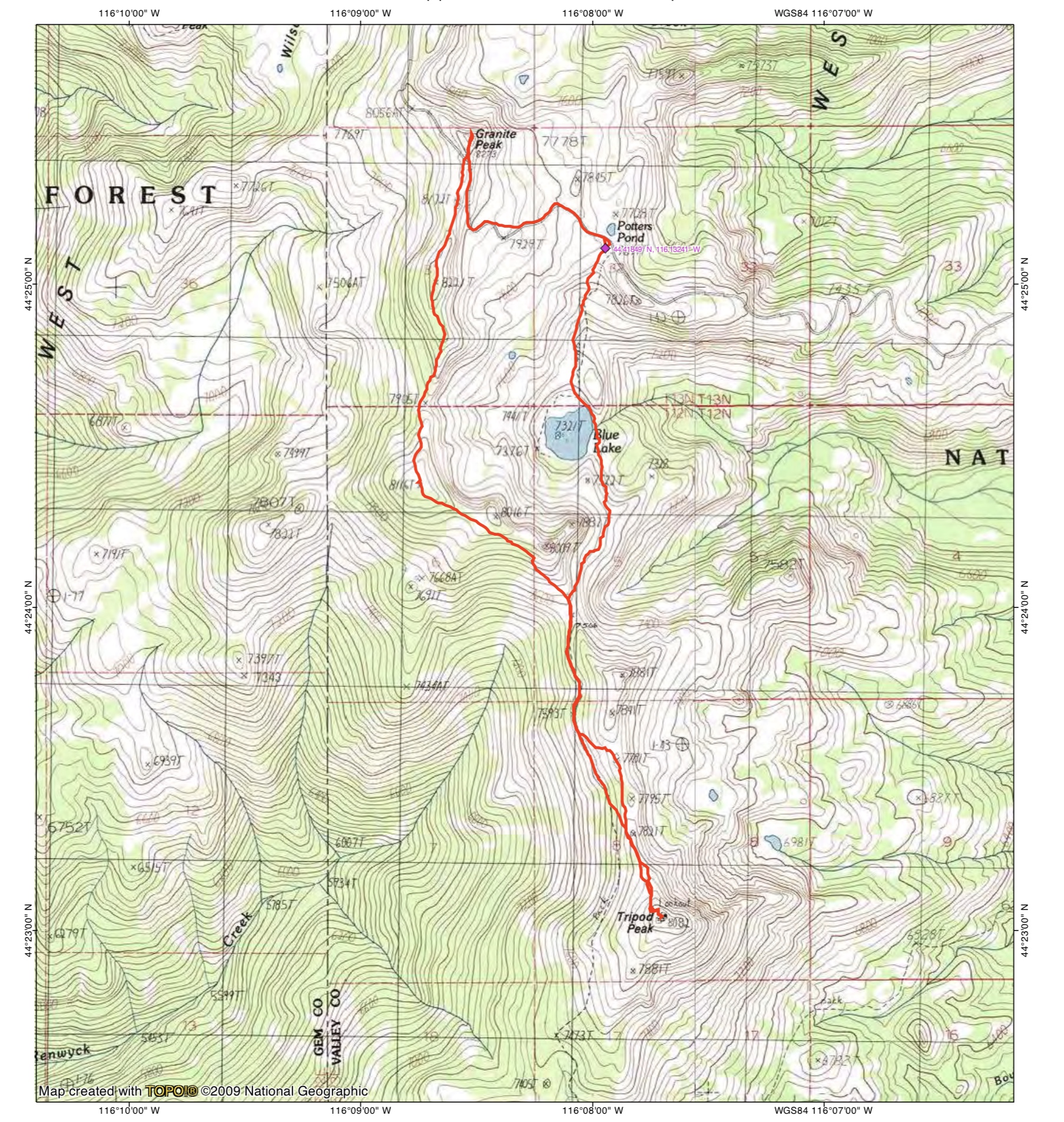
John Platt’s GPS track showing the two north routes. His loop covers 7.1 miles with 1,933 feet of elevation gain.
Additional Resources