Elevation: 6,998 ft
Prominence: 308
This peak is not in the book. Margo Mandella and Livingston Douglas provided the information on this page. I added my GPS at the bottom of the page. Updated July 2023
Bartlett Point lies southwest of Peak 6869 and southeast of Swensen Butte off Trail Creek Road, northwest of Mackay, Idaho. Per Rick Baugher’s report on Bartlett Peak, Bartlett Point is named after Jerome Bartlett, a native of West Virginia, who came to the Idaho Territory in the late 1880s to settle on 80 acres of land along the North Fork Big Lost River where they operated their upper ranch. The Bartletts operated their lower ranch along the Big Lost River at Bartlett Point. —Margo Mandella. USGS Chilly Buttes

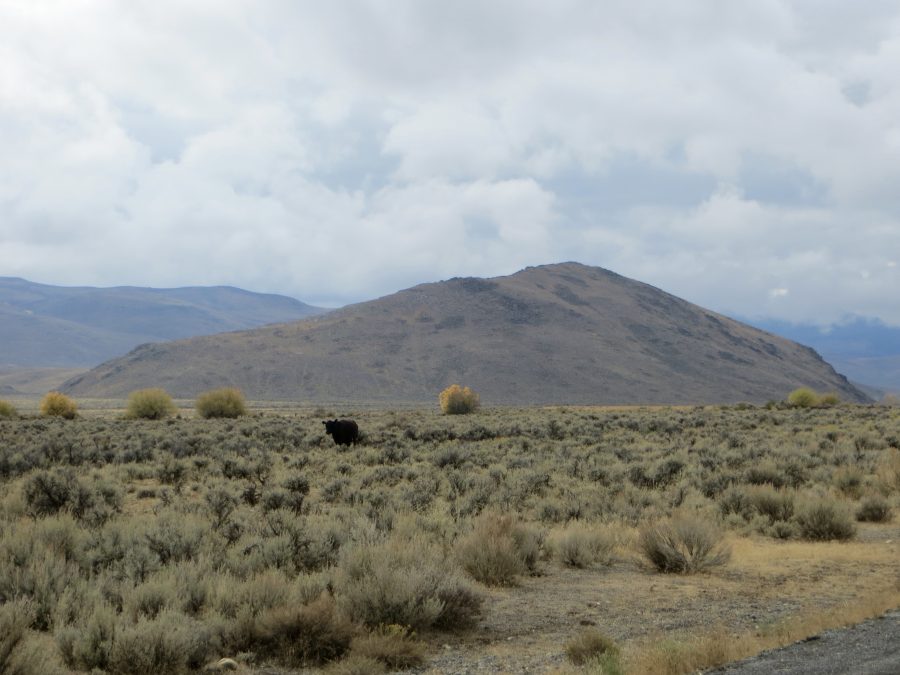
Bartlett Point. Steve Mandella Photo
Southeast Slopes, Class 2 by Margo Mandella
Access
From Trail Creek Road off US-93 (northwest of Mackay, ID), access the north entrance of Bartlett Point Road. Continue along the road until you’re in the vicinity of the peak. A jeep road traverses the base of the peak on public land. We accessed the jeep road at the south end of the peak as it was clearly on public land and was more direct than a jeep road from the north that lies on (unsigned) private land.
The highest point reached from the jeep road is along the peak’s southeast side. Here, you’ll see a faint jeep trail from the jeep road that heads up the peak’s southeast side. Park along this trail. The neighbors said they make their kids climb the peak to get cell phone service. So if you see a path of any sort to the summit, that might be why.
The Climb
From the jeep trail, it’s a short climb directly to the small rocky summit. Bartlett Point provides views of Swensen Butte and the Chilly Buttes, Peak 6869, the Big Lost River Valley, the Lost River Range and White Knobs Mountains.
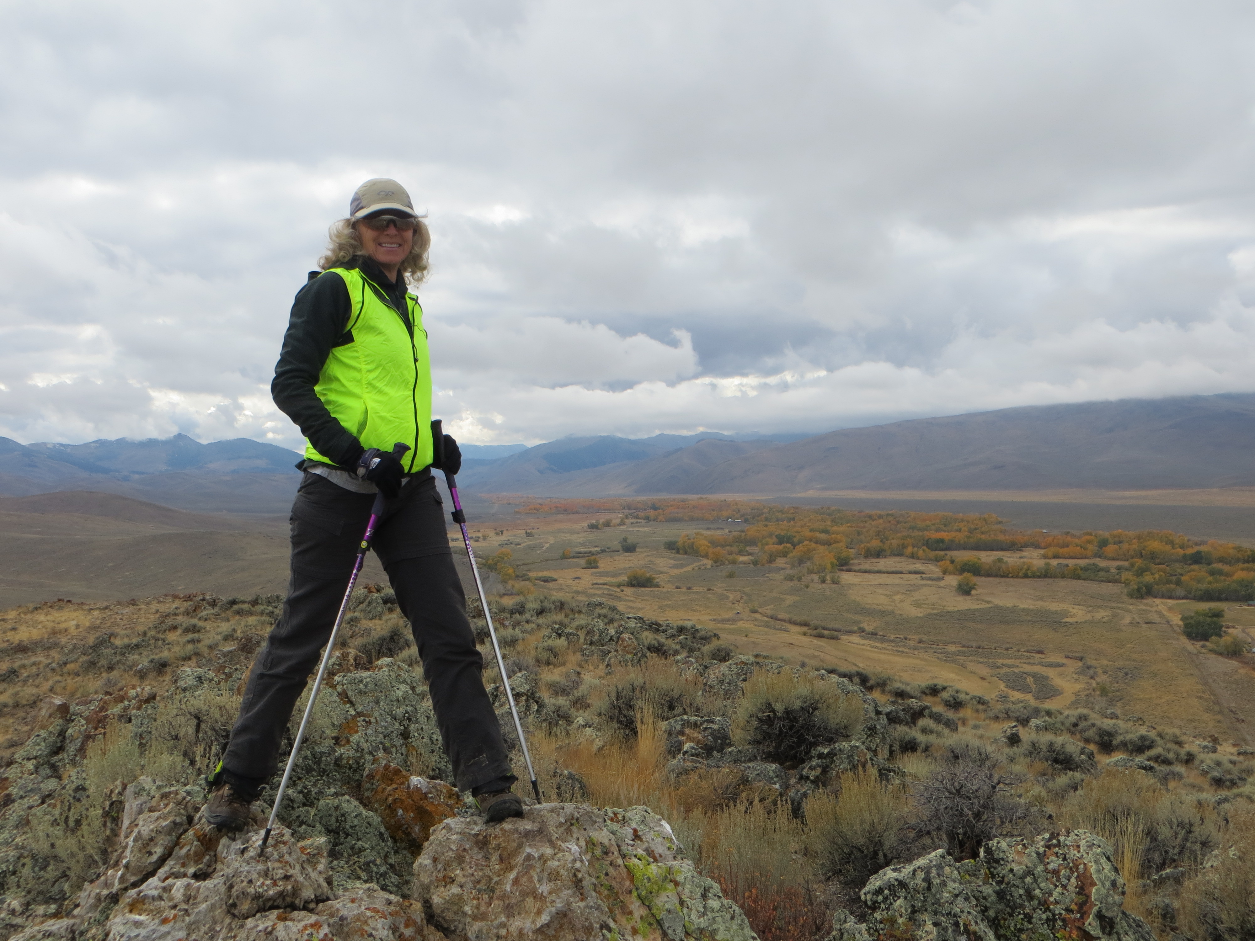
The summit of Bartlett Point. Steve Mandella Photo
Southwest Ridge, Class 2 by Livingston Douglas
Access
From US-93, drive 11.3 miles west on Trail Creek Road to the [signed] left/south turn for Bartlett Road. Drive 4.5 miles on Bartlett Road, weaving through cattle grazing on the road as necessary, to reach a road junction at the base of Bartlett Point. BLM Road #603 (signed) goes to the right/east here. Park in a large pullout at this junction (6,540 feet).
The Climb
From the road junction, scramble up the steep southwest ridge to the rocky summit area. The terrain on this climb is mostly easy grass/sagebrush with a talus hump at the top of the ridge. The summit area is somewhat elongated and flat. It is an area comprised of scattered large boulders and sagebrush, all mixed in. There is no summit cairn because there are no loose rocks with which to build one.
![The summit boulders atop Bartlett Point with the snow-capped [higher] Boulder Mountains in the background. Livingston Douglas Photo](https://www.idahoaclimbingguide.com/wp-content/uploads/8164642C-3B85-40E7-A6FE-088C73733A4B-scaled-e1575148056230.jpeg)
The summit boulders atop Bartlett Point with the snow-capped [higher] Boulder Mountains in the background. Livingston Douglas Photo
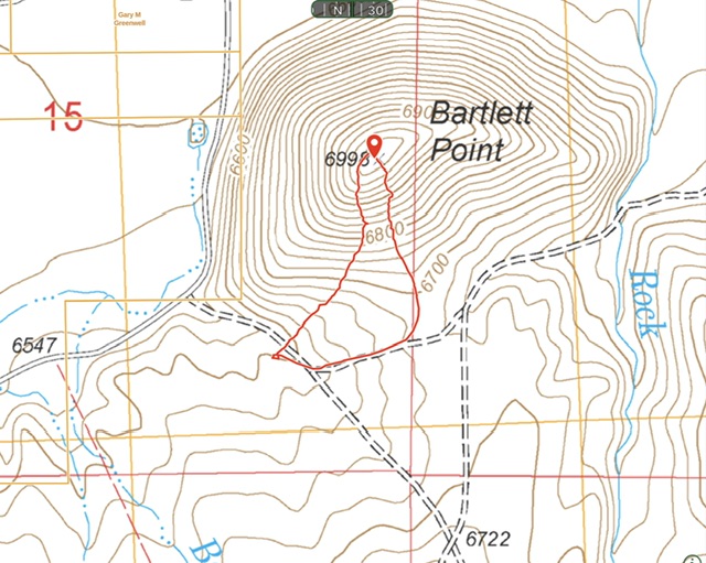
My route up and down Bartlett Point covered 0.8 miles with 437 feet of elevation gain. The eastern most line follows a two track which eventually climbs about two hundred feet up the peak’s southern slopes.
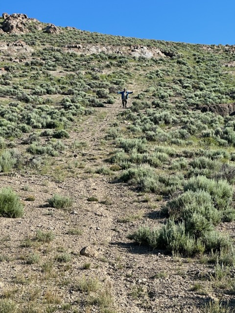
The two track that leads up the southern slopes ends at the rock outcrop at the top of the photo.
Additional Resources
Regions: EASTERN IDAHO->White Knob Mountains
Mountain Range: White Knob Mountains
Year Climbed: 2023
Longitude: -113.95011 Latitude: 44.02239