Elevation: 8,796 ft
Prominence: 963
This peak is not in the book. Margo Mandella provided the initial entry. Livingston Douglas added his day-hiking route and take on reaching this summit along with two other nearby peaks. His entry is found down the page. Updated October 2025
Black Mountain is located in the Big Hole Mountains, north of ID-31 as you head toward Victor, Idaho. We climbed Black Mountain on an overnight trip when we also climbed Peak 7978, Chicken Peak, Liars Peak, Piney Peak, and Peak 8619. All of these peaks are accessible from a well-traveled trail out of Fleming Canyon that is also popular for guided hunting and dirt bikes. There are no water sources along or near the trail except one small spring that was not flowing when we were there in late September. USGS Stouts Mountain
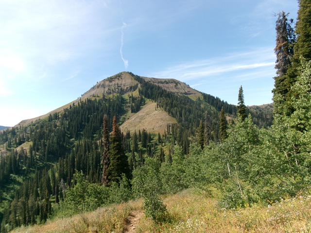
The Southeast Ridge Route on Black Mountain. Steve Mandella Photo
Access
To get to the Southeast Ridge approach for Black Mountain, first get to Fleming Canyon. As you travel toward Victor, Idaho on ID-31, the canyon is located on the north side of the highway. Specifically, the canyon is between Stouts Mountain and the West Piney Girls Recreation Camp. The canyon turnoff is not signed and is easily missed. Putting Fleming Canyon into Google Maps will get you close to the canyon’s jeep road [shown in Google erroneously as FST-270; this trail is actually FST-079].
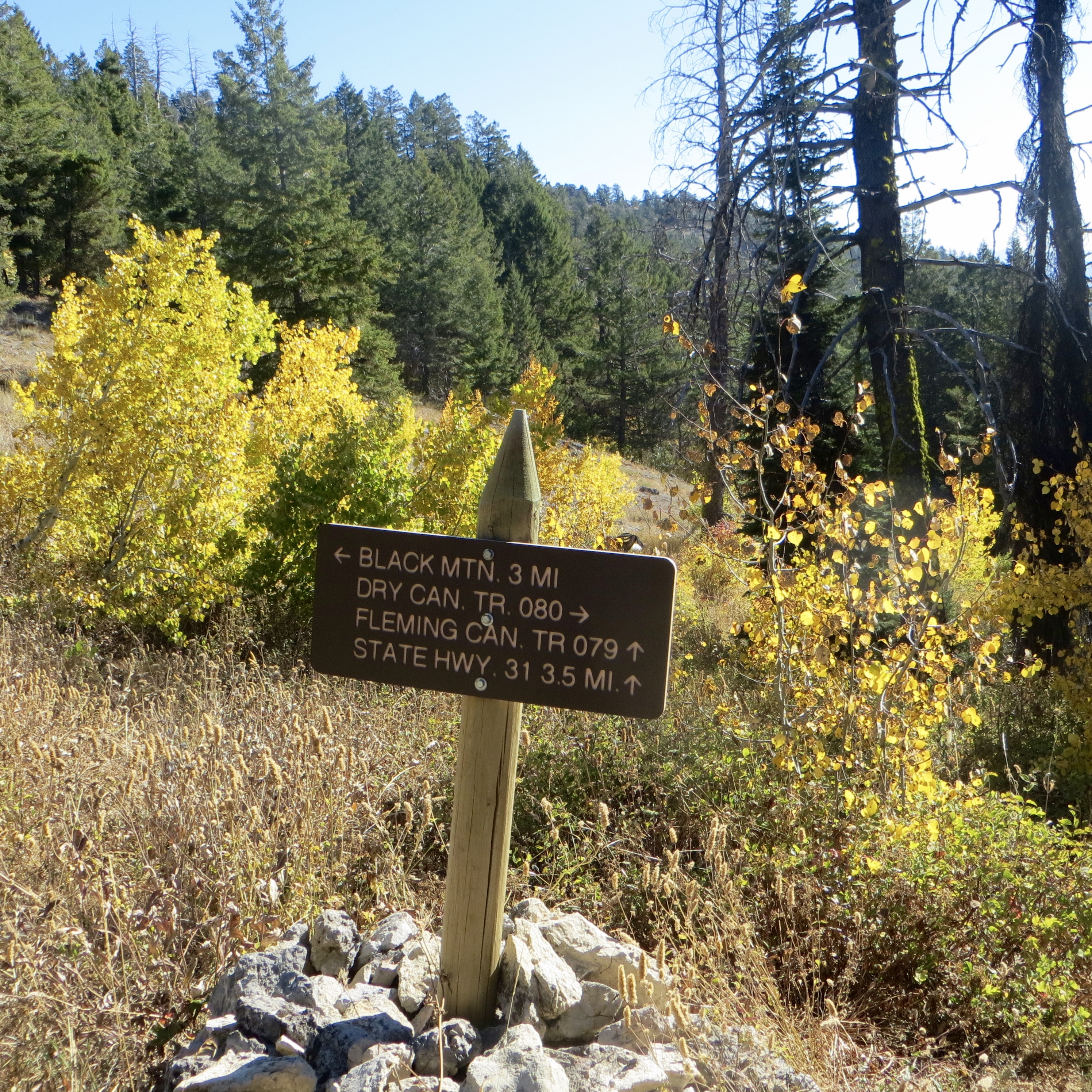
Trail signage. Steve Mandella Photo
If you have a 4WD vehicle, you can travel a good distance into the canyon, but you may need a high-clearance 4WD vehicle depending on conditions/time of year. There is no formal parking anywhere. To climb Black Mountain, follow this jeep road until it turns into a single track trail. Park wherever it is convenient. We parked near Gopher Canyon, but you can possibly get farther in, near Snowslide Gulch.
Southeast Ridge, Class 2
From where you park, hike on FST-079 farther into Fleming Canyon until you encounter a junction with the Dry Canyon Trail. Stay to the right to stay on FST-079. As you continue upward on the trail, you will encounter signage. At this point, follow the sign to continue to Black Mountain.
As you reach the summit area of Peak 7978, you will get a good view of Black Mountain’s Southeast Ridge. You will also see the main trail as it continues to traverse the east side of Black Mountain. You will have to bushwhack off of the main trail to reach the peak’s Southeast Ridge. You will want to move off the trail to the Southeast Ridge not long after your descent of Peak 7978, because the east side of Black Mountain only gets steeper as you continue on the main trail. Once you are on the ridge, continue on it to reach the nondescript summit. Enjoy big views of numerous Big Hole peaks and the Teton Mountain Range from this summit!
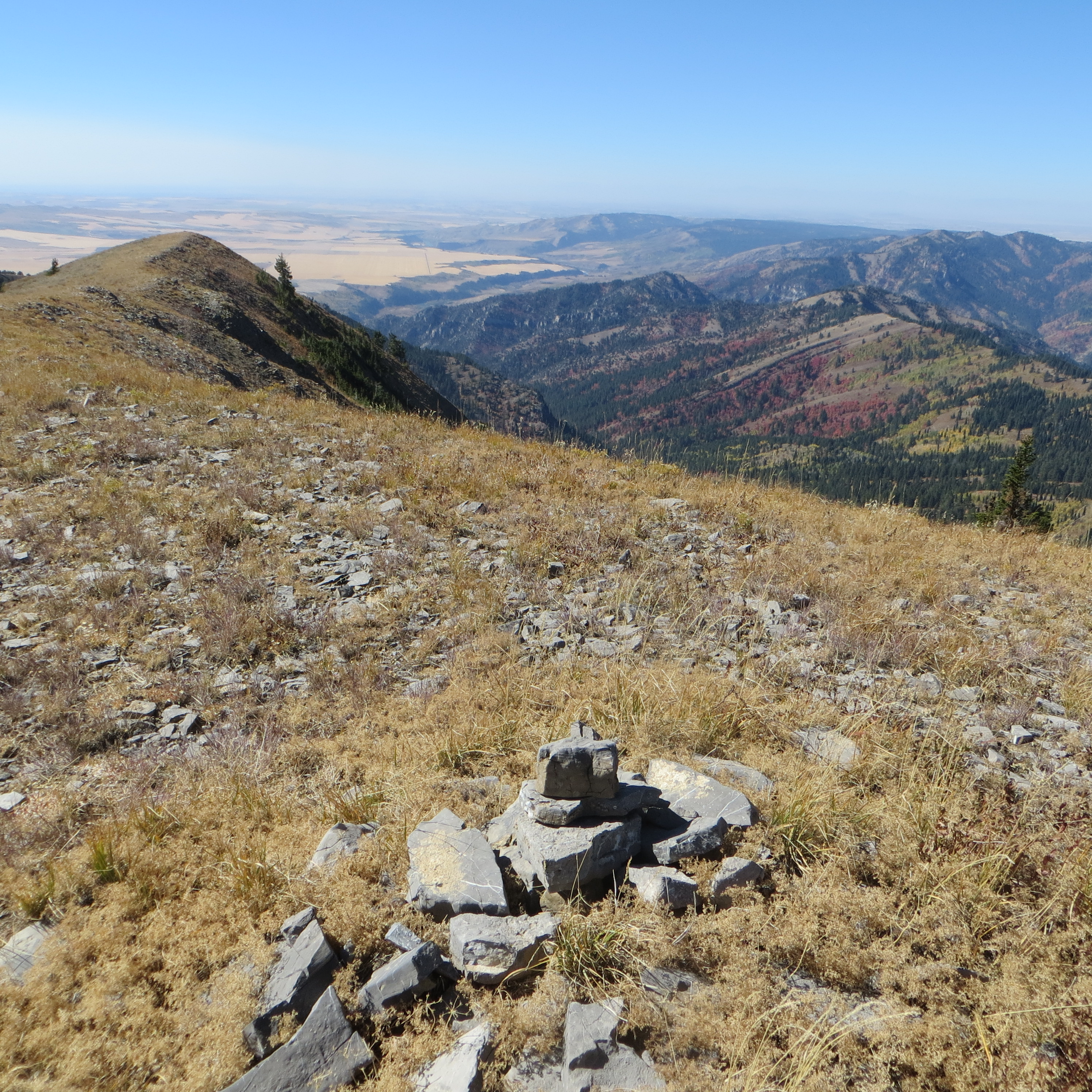
The summit cairn atop Black Mountain, looking along the peak’s west ridge. Steve Mandella Photo
Southeast Ridge and North Ridge by Livingston Douglas
Black Mountain and its steep north ridge (in center and left of center) as viewed from Chicken Peak to its north. The upper section is steep and rocky. The north ridge was my descent route. Livingston Douglas Photo
Black Mountain sits above the headwaters of both Black Canyon and Dry Canyon in the Big Hole Mountains. It is located due south of Chicken Peak (8,419 feet)) and is most easily reached from nearby Fleming Canyon Trail/FST-079.
Access
Same as for Peak 7978. This is the second leg of a 3-peak adventure that includes Peak 7978, Black Mountain, and Chicken Peak (8,419 feet). It covers 13.0 miles with 4,325 feet of elevation gain round trip.
Southeast Ridge, Class 2
The Climb
After passing the saddle at the toe of the southeast ridge, continue a bit farther along FST-079 as it follows the right/northeast side of the ridge. Leave the trail when it begins to move away from the ridge. Bushwhack west up onto the crest of the southeast ridge in steep-ish scrub and loose scree. Once on the ridge, scramble northwest up this surprisingly rocky ridge (initially).
Shelf rock (not too difficult) gives way to flatter, easy scrub with less rock. Continue northwest up the easy, open ridge to the bare, elongated summit area. The summit of Black Mountain has triangulation posts/wiring but had no summit cairn so I built a decent one near the rebar protrusion and the triangulation wiring. I stuck a small triangulation post in the cairn.
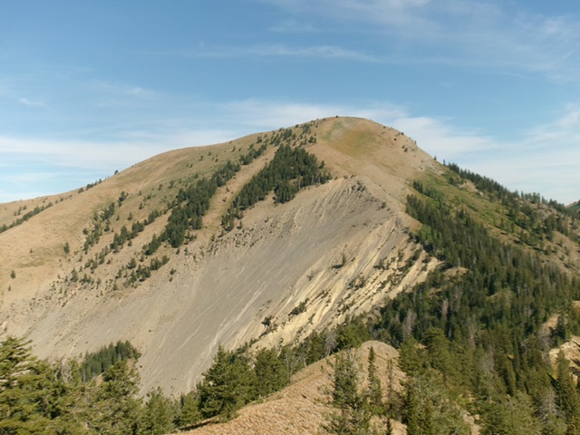
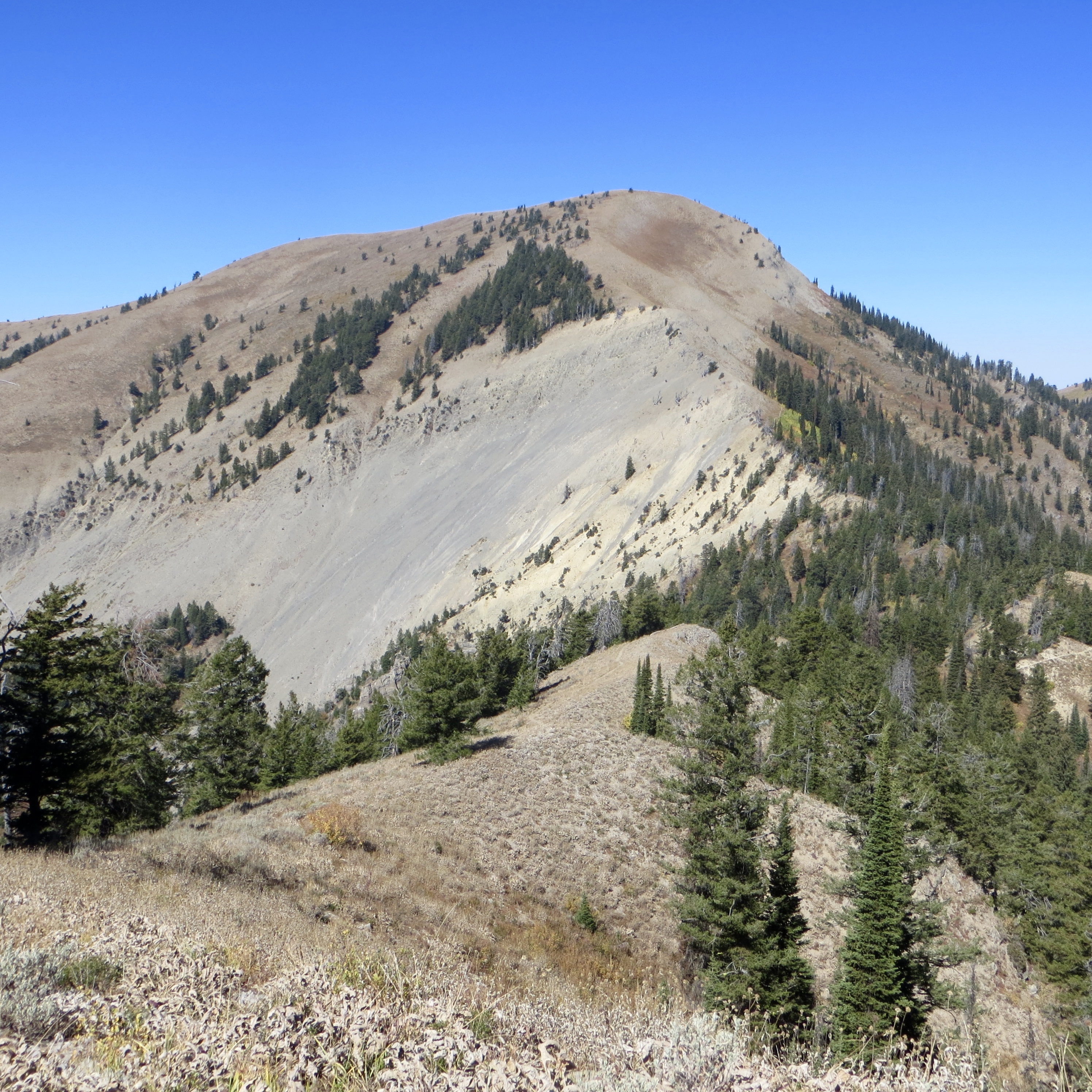
Black Mountain as viewed from Peak 7978 to its southeast. The southeast ridge (right of center then center) was my ascent route. Livingston Douglas Photo
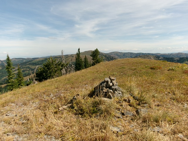
The gentle summit of Black Mountain, looking north at Chicken Peak. Livingston Douglas Photo
North Ridge, Class 2+
The Descent
From the summit, descend the rounded, open ridge/face of steep, loose scree and scrub with downed trees to work around. This is tedious Class 2+ work. Lower down, the terrain flattens but the thick pine forest (with a tall veg understory) takes over. While you can avoid this unpleasant stuff by moving to the right/east, that would move you away from the hidden, forested connecting saddle with Chicken Peak. Stay in the forest and deal with it.
But even I have my limits. The forest got so thick with blowdown and veg that I decided to stay just to the right/east of it in open scrub. I soon dropped to intersect FST-079 and followed it down then up to a saddle (of sorts) and a signed trail junction with the Black Canyon Trail (left). This IS the 7,833-foot connecting saddle with Chicken Peak. Contrary to the USGS topo map, the trail junction is IN this saddle, not above it. This concludes the second leg of today’s 3-peak journey. Chicken Peak (8,419 feet) is up next.
Additional Resources
Mountain Range: Big Hole and Snake River Mountains
Longitude: -111.36939 Latitude: 43.59401