Elevation: 8,689 ft
Prominence: 329

This peak is not in the book. Published October 2018
Liars Peak is located in the Big Hole Mountains above Fleming Canyon, which is off ID-31 as you head toward Victor, Idaho. We climbed Liars Peak as an overnight trip when we also climbed Peak 7978, Black Mountain, Chicken Peak, Piney Peak and Peak 8619. All of these peaks are accessible from a well-traveled trail that is also popular for guided hunting and dirt bikes. There are no water sources along or near the trail except for one small spring that was not flowing when we were there in late September. USGS Stouts Mountain
Liars Peak. Steve Mandella Photo
Access
To get to Liars Peak, first get to Fleming Canyon. As you travel toward Victor, Idaho, on ID-31, the canyon is located on the north side of the highway. Specifically, the canyon is between Stouts Mountain and the West Piney Girls Recreation Camp. The canyon turnoff is not signed and is easily missed. Putting Fleming Canyon into Google Maps will get you close to the canyon’s jeep road [shown in Google erroneously as FST-270; this trail is actually FST-079].
If you have a 4WD vehicle, you can travel a good distance into the canyon, but you may need a high-clearance 4WD vehicle depending on conditions/time of year. There is no formal parking anywhere. To climb Peak 7978, follow this jeep road until it turns into a single track trail. Park wherever it is convenient. We parked near Gopher Canyon, but you can possibly get farther in, near Snowslide Gulch.
Southwest Face Via Chicken Peak or Southeast Ridge, Class 2
From where you park, hike on FST-079 farther into Fleming Canyon until you encounter a junction with the Dry Canyon Trail. Stay to the right to remain on FST-079. As you continue upward on the trail, you will encounter signage. At this point, follow signs to Black Mountain. Continue past Black Mountain until you reach a bigger junction with signs for several trails around 7,800 feet.
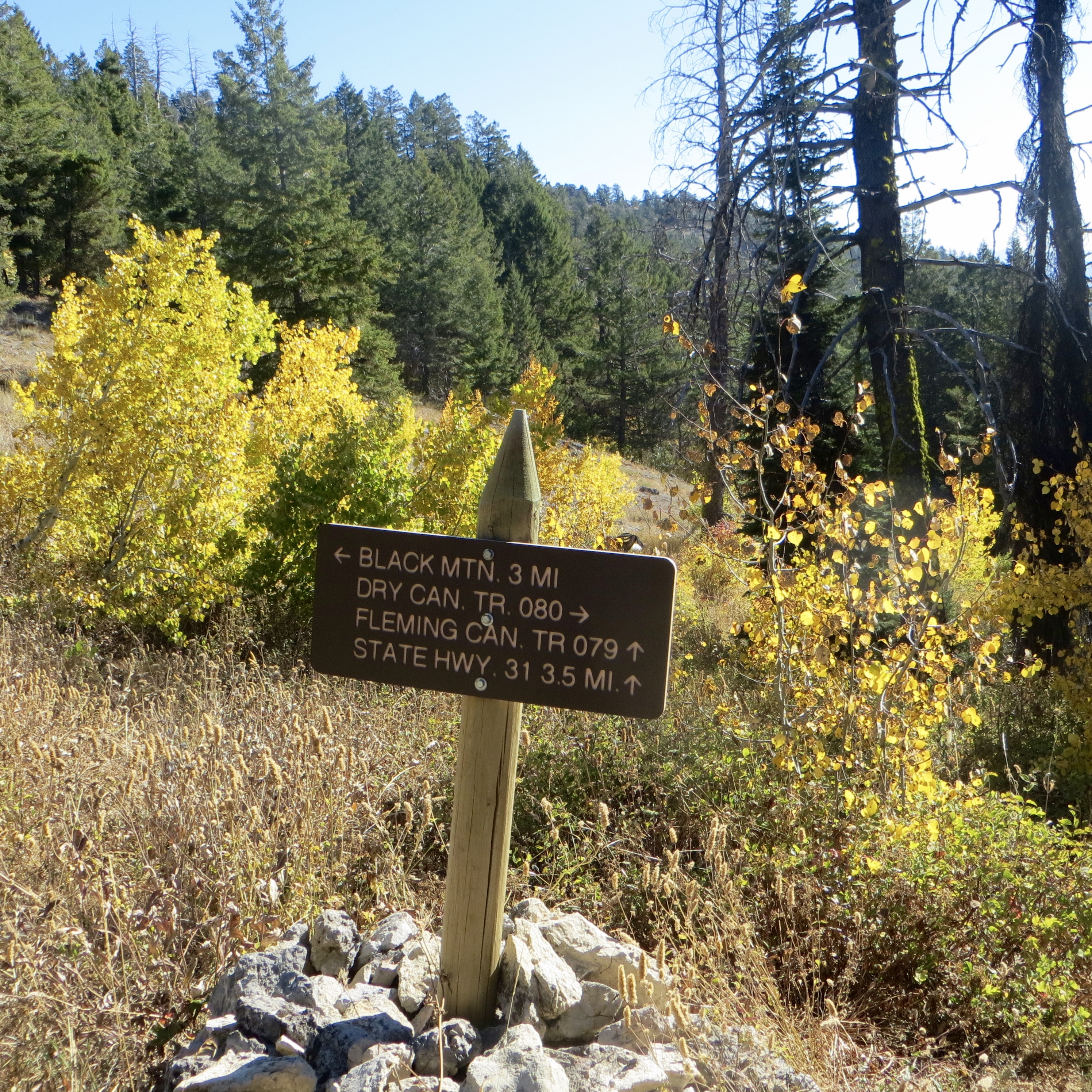
Trail signage. Steve Mandella Photo
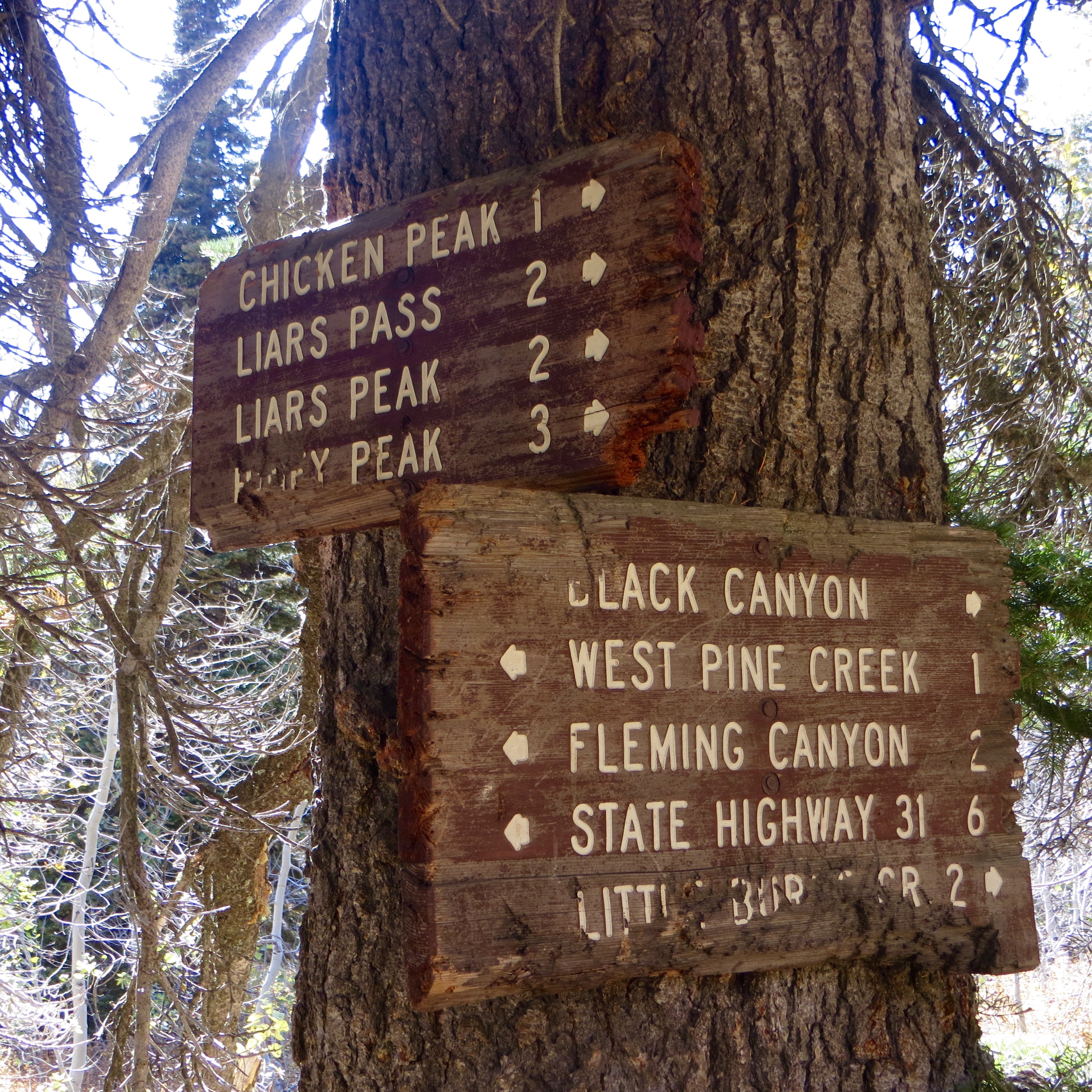
Junction sign. Steve Mandella Photo
From here, you are about a mile from the summit of Chicken Peak and two miles from the summit of Liars Peak. If you climb Chicken Peak (which is literally a few feet off the main trail), then from the summit connect back with the main trail, or bushwhack approximately 50-60 feet and catch the main trail on the northeast side of the peak. Descend the main trail until you can see off-trail options to ascend the Southwest Face of Liars Peak. The ascent is short and the footing is good.
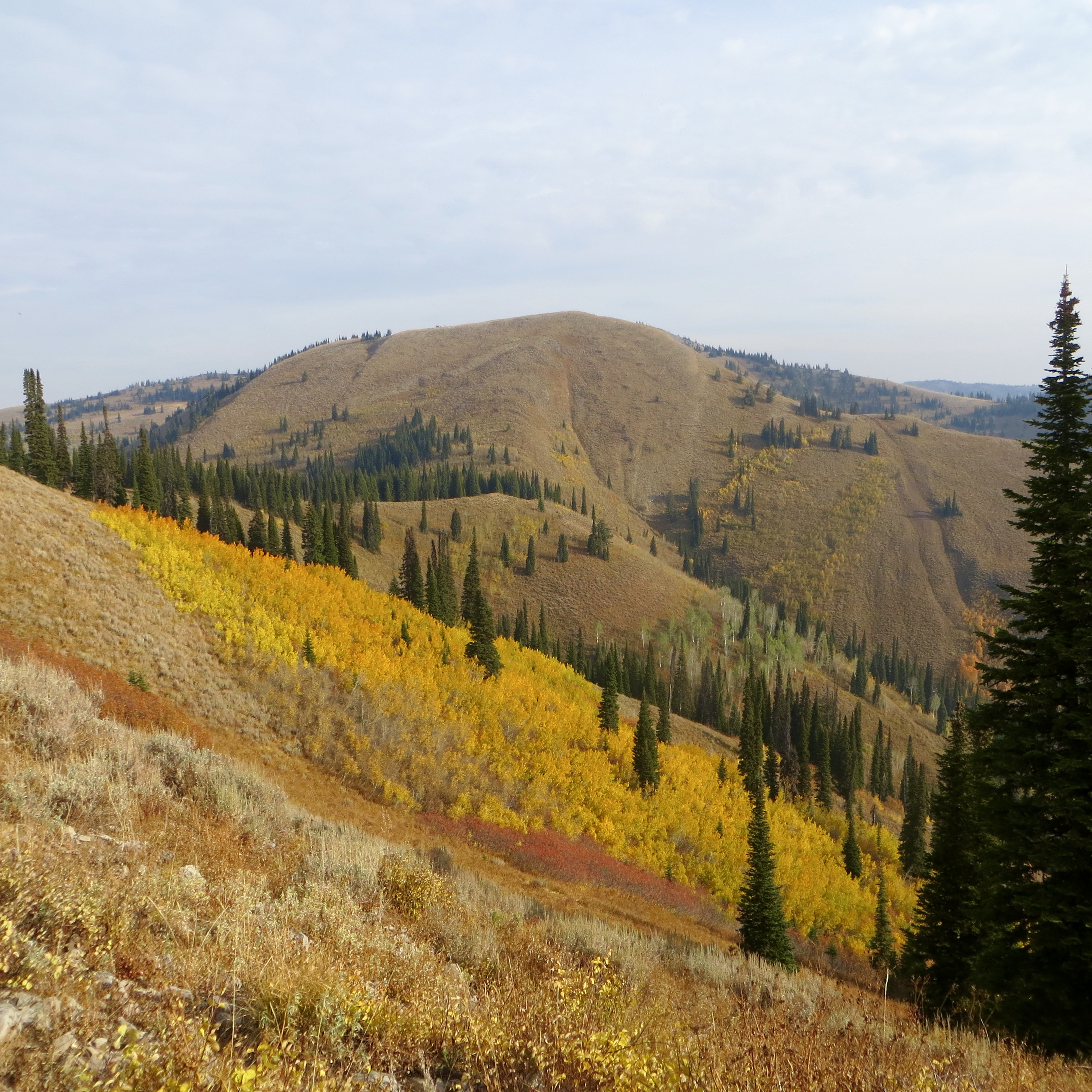
Otherwise, stay on the main trail around Chicken Peak and look for an off-trail option onto the Southeast Ridge of Liars Peak. Either approach is about the same grade. From the summit of Liars Peak, enjoy views of nearby Big Hole peaks and the Teton Mountain Range.
Big Hole Peaks. Steve Mandella Photo
Additional Resources
Mountain Range: Big Hole and Snake River Mountains
Longitude: -111.36269 Latitude: 43.61909