Elevation: 6,586 ft
Prominence: 606

This attractive Pocatello Range peak is not in the book. Access is the main problem confronting climbers. Thanks to Livingston Douglas and the Pocatello BLM office, we now have a clarification and verified access point. Updated November 2019
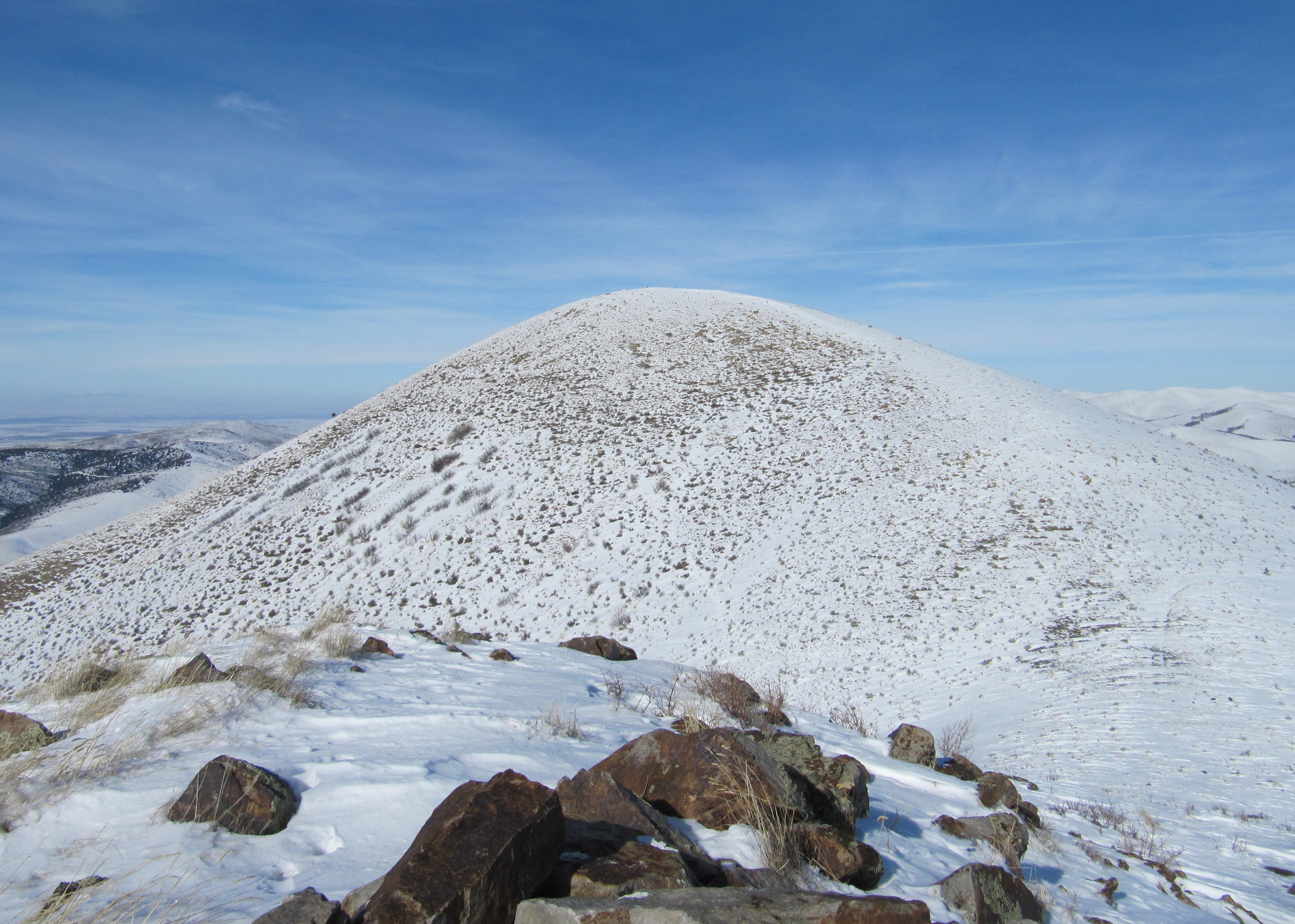
Camelback Mountain sits due east of Pocatello and north of Chinese Peak in the appropriately-named Pocatello Range. From Pocatello’s west bench, the peak looks like a camel laying down, with its “head” the far-most right bump in the photo and its summit on the middle bump. The peak is located on BLM land that is surrounded by private land. USGS Moonlight Mountain
Camelback Mountain as viewed from Pocatello’s west bench. Steve Mandella Photo
Southwest Ridge, Class 2 by Livingston Douglas
Access
The only public access to Camelback Mountain is on its southwest ridge from a small triangle of BLM land that crosses Buckskin Road. The junction of Parks Road and Terry Street is where Buckskin Road originates. From this junction, drive east on Buckskin Road for exactly 2.0 miles and park on the left/north side of the road near a telephone pole. This spot is just across the road from a large home with a lengthy driveway coming in from Buckskin Road.
The private driveway meets Buckskin road about 70 yards west of this point and you pass it on your drive here. Prior to reaching the driveway entrance, there is a private dirt road on the north side of Buckskin Road at a bend in the road. Park near the telephone pole in the field grass on the north side of Buckskin Road, across the road from the large home. The BLM boundary line is just west of this telephone pole (see attached Google Earth photo). The elevation here is 5,440 feet.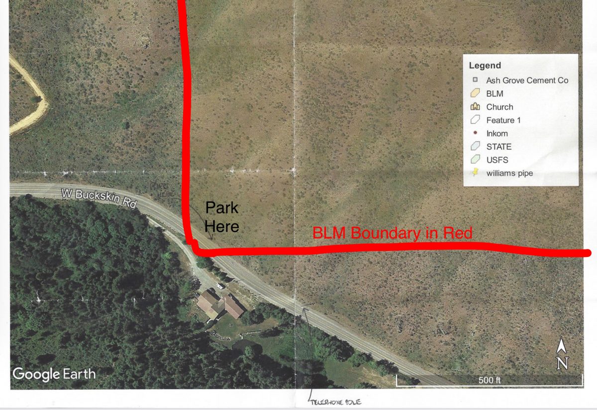
The Climb
From the parking spot, walk west just past the telephone pole and look for an opportune place to climb up onto the steep sagebrush above the road. Bushwhack northeast straight up a steep sage/grass slope to reach a hump with an old 2-track road on its crest. On the USGS topo map, this is Point 5880+. From this vantage point, you have a magnificent view of the large home (and long driveway) alluded to earlier. These folks have really “made it,” as they say, because they have their own little pond in the backyard, which you can see from up here!
Continue northeast along the easy scrub of the open ridge, following the 2-track road down to a saddle, losing 85 feet of elevation in the process. Although the old road is badly overgrown with field grass about halfway down the ridge to this saddle, it still has some usefulness. From the saddle, scramble northeast up a steep slope of sagebrush to reach the cairned south summit (Point 6440+). Descend 120 vertical feet northeast on an old 2-track road to reach another ridge saddle.
From here, the ridge bends left/north and has a weak 2-track road leading to the summit. The summit of Camelback Mountain has a large cairn and two USGS Benchmarks in separate ground boulders. Both the south summit and the true summit are just humps with short scrub on them, but there is some loose scree/gravel in the tracks of the old 2-track roads along the ridge crest, so be careful, particularly when descending ridge sections on the aforementioned roads.
Retrace your steps back to the first scrub hump and then descend the steep scrub back down to Buckskin Road and your awaiting vehicle. Be sure to remain on BLM land on this final section of descent. Don’t wander off too far to the left/east or right/west. Many thanks to Dan Rainey of the Pocatello BLM office for providing me with excellent beta (and a Google Earth Map) to accomplish this climb while remaining entirely on BLM land.
The summit of Camelback Mountain as seen from the camel’s head. Margo Mandella Photo
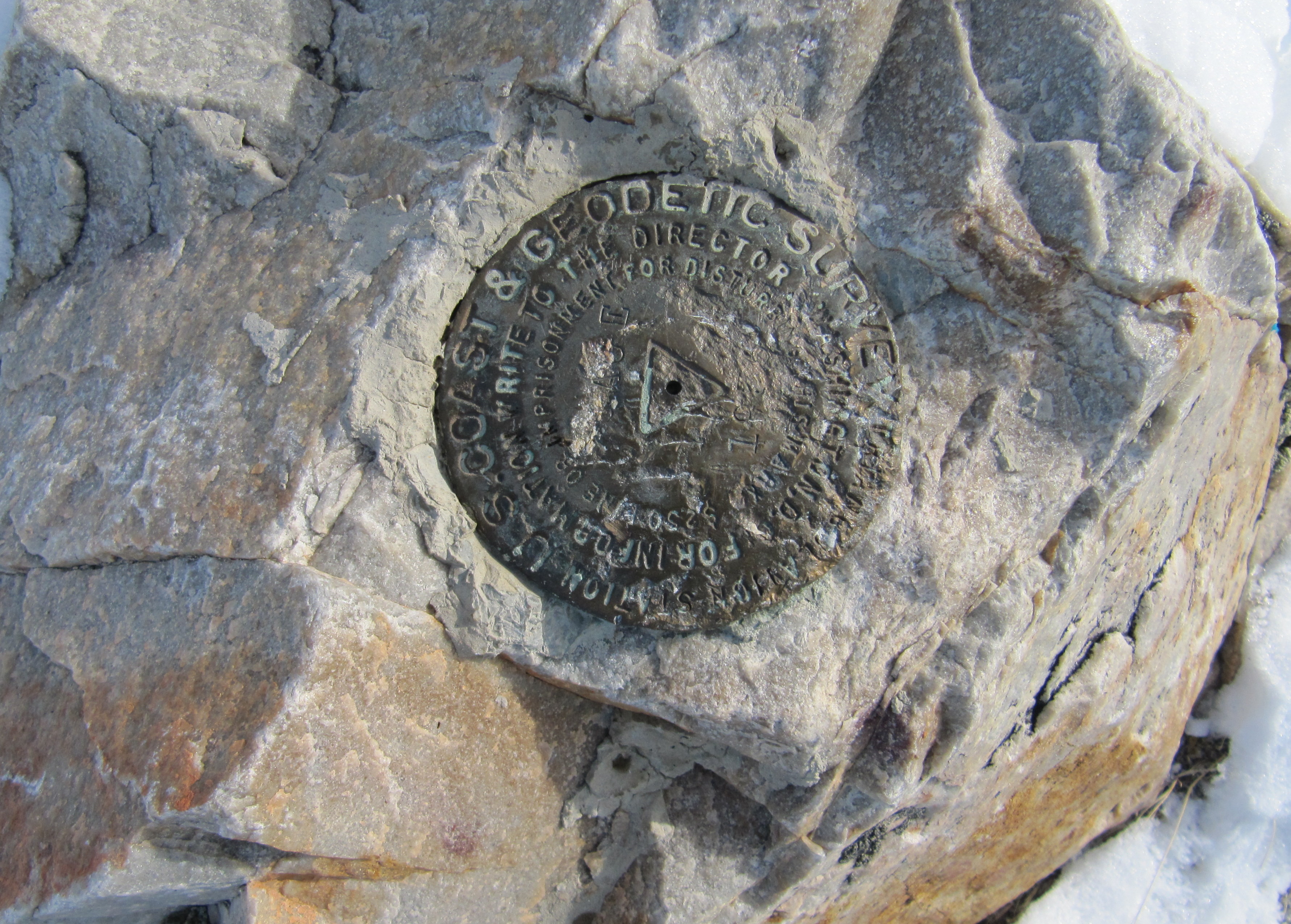
The USGS benchmark atop Camelback Mountain. Margo Mandella Photo
Additional Resources
Regions: Pocatello Range->Portneuf Range->SOUTHERN IDAHO
Mountain Range: Pocatello Range
Longitude: -112.35029 Latitude: 42.88129