Elevation: 9,996 ft
Prominence: 736

Climbing and access information for this peak is on Page 328 of the book. Updated November 2020
Cobble Mountain is a beautiful peak with three magnificent ridges on its south side: the southwest ridge, the south ridge, and the southeast ridge. The east face of the summit ridge is particularly rugged and exposed. The high point is about 0.3 miles south of the Continental Divide. This climb is part of a four-peak odyssey that includes Cobble Mountain (9,996 feet), Knob Mountain (9,762 feet), Red Conglomerate Peaks North (10,106 feet) and Red Conglomerate Peaks South (10,250 feet). USGS Edie Creek
Cobble Mountain (summit is in dead center) and its magnificent south ridge as viewed from the campsite at the base of the south ridge. Livingston Douglas Photo
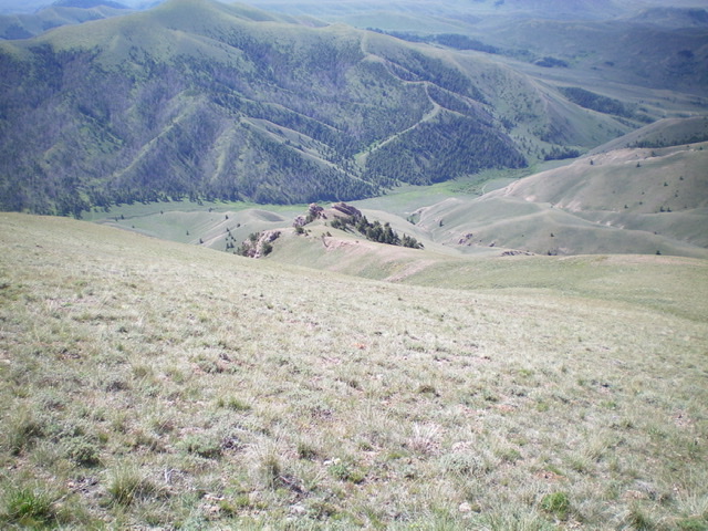
Looking down the south ridge (dead center) of Cobble Mountain, with the green, lush Bull Pen below. Notice the rocky outcrop at 8,800 feet in the center of the photo). Livingston Douglas Photo
Access
From I-15 at Dubois, ID, drive west on ID-22 for 5.9 miles to Medicine Lodge Road (signed). Turn right/north onto Medicine Lodge Road and reset your odometer. At 21.0 miles, the pavement ends. At 25.7 miles, reach a [signed] road junction with Irving Creek Road. Turn right/northeast and reset your odometer. At 2.7 miles, reach an unsigned road junction with a cattle gate for each road. Go straight/north to continue up Irving Creek Road. Go right/east for Bull Pen Road.
Turn right here to reach the Bull Pen. Go through the cattle gate and continue east to reach BLM land. The road gets much rougher here. It is now a badly-rutted, 2-track dirt road and is getting overgrown with grass. But it is drivable if you have decent ground clearance, 4WD, and good tires. At 5.4 miles, reach a dispersed campsite and primitive spur road where you can park (7,450 feet). This campsite is on the right/south side of the road and is 0.6 miles below the National Forest boundary. It sits at the base of the south ridge of Cobble Mountain.
South Ridge, Class 3
The Climb
Only the summit rocks are Class 3. From the campsite, cross to the north side of Bull Pen Road and bushwhack north through sagebrush to quickly reach the left/northwest-leaning toe of the south ridge. Higher up, the sagebrush gives way to short scrub and shale. This is a magnificent ridge scramble and presents no problems. The summit is on the first of a row of ugly, crumbly pinnacles on a narrow ridge crest. It is an easy Class 3 scramble up to the small summit perch.
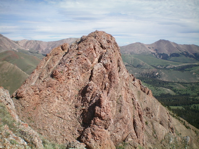
The crumbly summit tower of Cobble Mountain. Livingston Douglas Photo
North Ridge, Class 2
The Descent
From the summit, follow the ridge north then northwest to a 9,540-foot connecting saddle with Knob Mountain. Initially, you must either scramble along the crest of a series of crumbly ridge pinnacles (not a good idea due to sheer faces and crumbly, exposed rock) or drop off the ridge crest to its left/west to the safe scree/gravel base of the pinnacles and return to the ridge crest after passing the pinnacled ridge section. Once past the pinnacles, the ridge is a cruise down to the connecting saddle. This concludes the first leg of today’s four-peak journey.
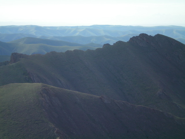
The choppy north ridge of Cobble Mountain. The summit is the highest hump, far right of center. Livingston Douglas Photo
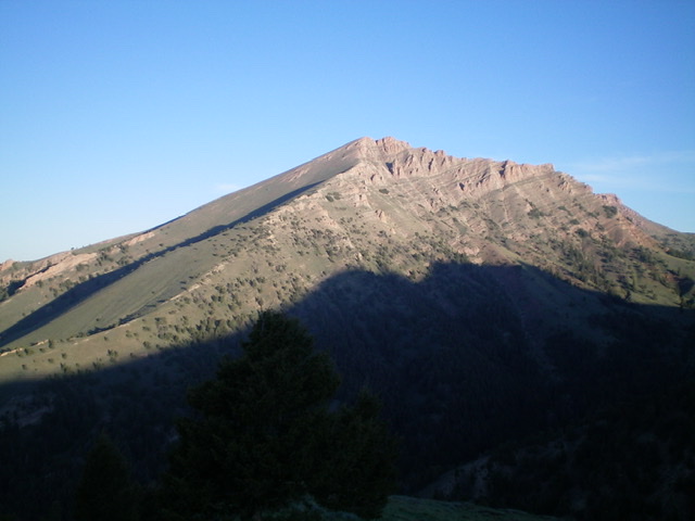
Cobble Mountain and its rugged east face, as viewed from the southeast. Livingston Douglas Photo
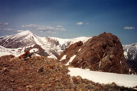
The summit of Cobble Mountain. The rocky summit of Cobble Mountain is on the right of this photo. The peaks in the background are located in Montana’s Tendoy Range. Rick Baugher Photo
Additional Resources
Regions: Beaverhead Range->EASTERN IDAHO
Mountain Range: Beaverhead Range
Longitude: -112.5768 Latitude: 44.4759