Elevation: 9,555 ft
Prominence: 1,855
This peak is not in the book. Livingston Douglas added a new access point, new route, and new photos. Finally, the North Ridge Route is discussed below. Unfortunately, private property now blocks this route. Updated November 2024
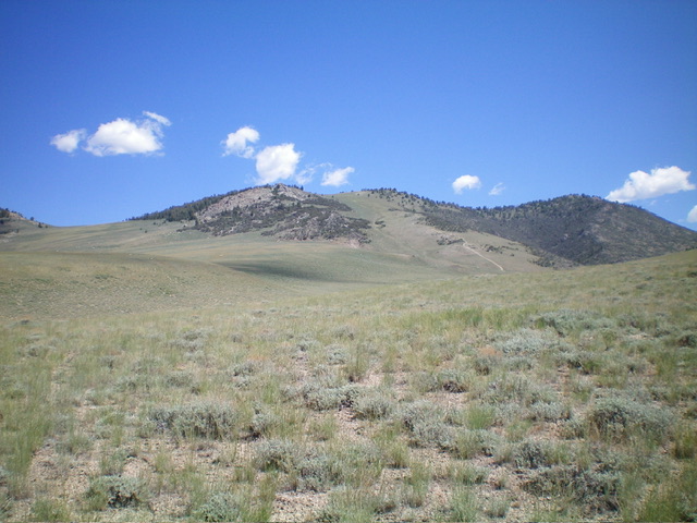
Donkey Benchmark is the highest point in the Donkey Hills. It is located at the northwest end of this Lost River Range subrange. The USGS and the Coast and Geodetic Survey have both surveyed from this summit. The views of the Lost River Range and Lemhi Range from this summit are stunning. USGS Donkey Creek
The summit of Donkey Benchmark as viewed from the west
Access
Primary access is from the Pahsimeroi Highway [(A) on Page 289]. To reach the south end of the Donkey Hills, proceed north from Howe, Idaho up the Pahsimeroi Highway to Wet Creek/Pass Creek Road [(A)(5) on Page 289]. Turn west and follow this road until you can access the Dry Creek Road [(A)(6.1)]. Follow the Dry Creek Road to its unsigned junction with the Long Creek Road. Turn north and follow this road to the junction shown on the map below. Follow the 4WD road for 4.3 miles to the base of the southwest ridge. This is a rocky road with deep ruts in places but it is not steep.
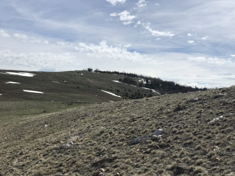
Southwest Ridge, Class 2
The southwest ridge is broad, steep in places, and always scenic. From the end of the 4WD road, angle northeast to the ridge top. Follow the ridge to the summit. This route eventually crosses a minor ATV trail (which comes up from the north) in the last saddle before the summit. The round-trip route covers 3.5 miles with 1,228 feet of elevation gain.
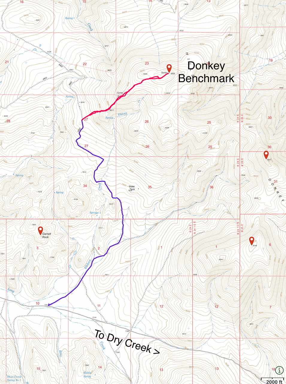
The 4WD road is shown in blue with the hike in red
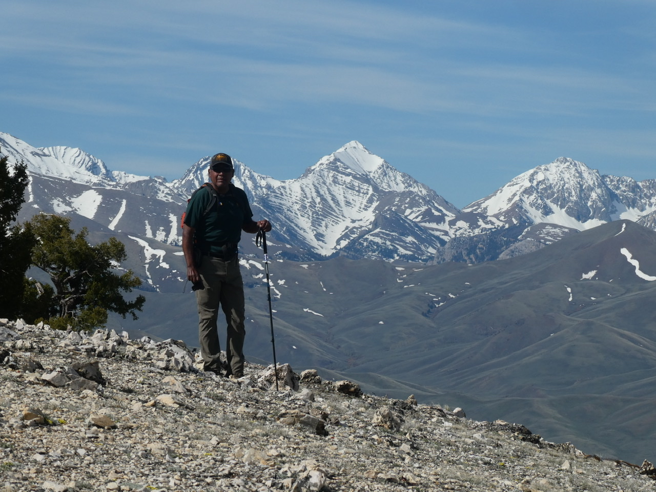
A small sample of the views from Donkey Benchmark. Leatherman Peak is in the distance.
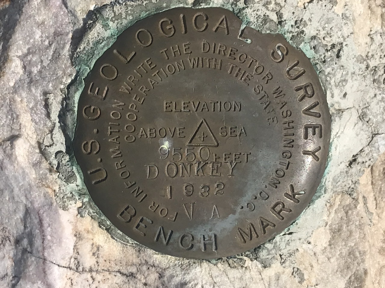
The oldest benchmark on the summit
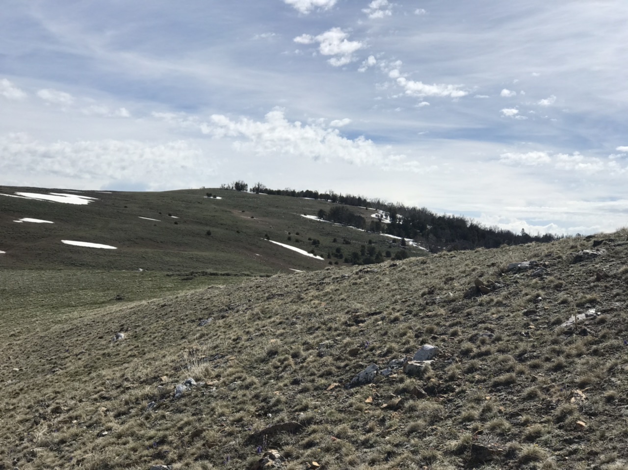
South Ridge by Livingston Douglas
The south aspects of Donkey Benchmark as viewed from very early in the climb. Aim to climb the 2-track road that heads north up to the high saddle in dead center. Livingston Douglas Photo
Access
From the signed junction of Long Creek Road/Donkey Hills Road (BLM-160) and Elkhorn Creek Road (BLM-130), turn right/northeast onto Elkhorn Creek Road and reset your odometer. At 1.0 miles, go right at an unsigned junction. At 1.5 miles, go straight/northeast (not left as the Lopez route goes) at an unsigned junction. The road is now a primitive 2-track that is overgrown, narrow, and bumpy. At 2.1 miles, park at a 4-way unsigned junction (7,585 feet and 44⁰13’49”N, 113⁰33’55”W).Neither of the 2-track roads that emanate from this junction are shown on maps. Elkhorn Creek Road is in poor shape and requires a 4WD vehicle with high clearance.
South Ridge, Class 2
The Climb
From the road junction, follow an unmapped 2-track road on the left side of the road. The 2-track meanders its way over to the south ridge, dropping to cross a dry gully on the way. The 2-track climbs briefly northwest to exit the gully and reaches an unsigned road junction. Go right/northeast here. When the 2-track reaches the south ridge, it turns hard right/northeast to climb the steep, open ridge. The ridge bends left-ish (north-northeast) then left-ish again (north) as it heads up to a prominent saddle just east of rocky Point 9268.
The 2-track fades away as you climb the steep ridge in easy, open grass/scrub. It disappears then reappears (faintly) near its end at the aforementioned saddle. From the saddle, bushwhack north in open grass/scrub then angle left-ish/northwest to skirt the right/east side of the boulders/pines of Point 9268, dropping about 60 vertical feet to remain in reasonably easy, open field grass and reach the broad, forested saddle north of Point 9268. This saddle is a lengthy mess of downed trees in a pine forest.
Bushwhack northwest then north up through a reasonable pine forest and skirt the left/west side of rocky Point 8942. Scramble right-ish/northeast and drop slightly to a minor, forested saddle. From that saddle, head left-ish/northwest then north up through an easy pine forest to reach open terrain (short grass/scrub and ground talus) and the summit ridge. Scramble right/northeast up a final ridge section to reach the open summit. The summit of Donkey Hills HP has three USGS benchmarks, the highest one atop a three-foot tall ground boulder (unusual). A triangulation tripod lays on the ground nearby.
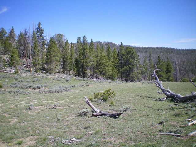
The forested summit hump finally comes into view. This view is from the road saddle to its south. Livingston Douglas Photo
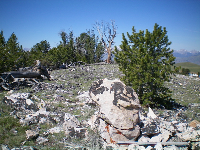
The summit of Donkey Benchmark. The USGS benchmark is embedded atop the large boulder in the foreground. Livingston Douglas Photo
North Slope Route Closed
North Slopes, Class 2
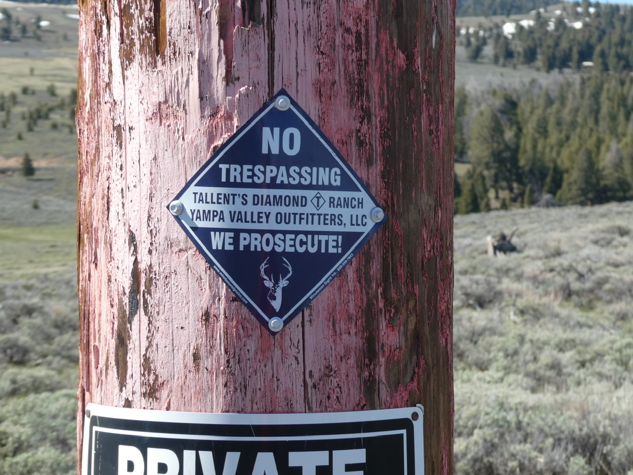
This route was climbed by Rick Baugher. His trip report is linked below. Unfortunately, the route that Rick followed is blocked by private property. It is still possible to climb the peak from the north by skirting the private property on its east side. The maps below shows the access route and the public and private property. Park when you reach the gated private property.
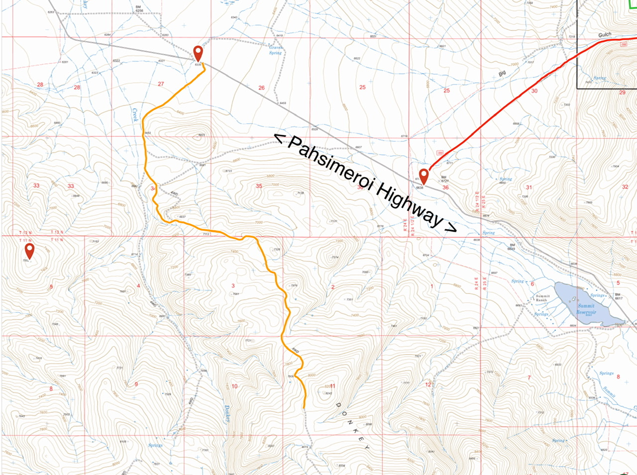
This map shows the entire 4WD approach road from the Pahsimeroi Highway to the closed gate.
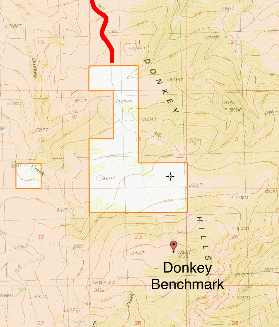
The private property is shown in white. The access road is in red.
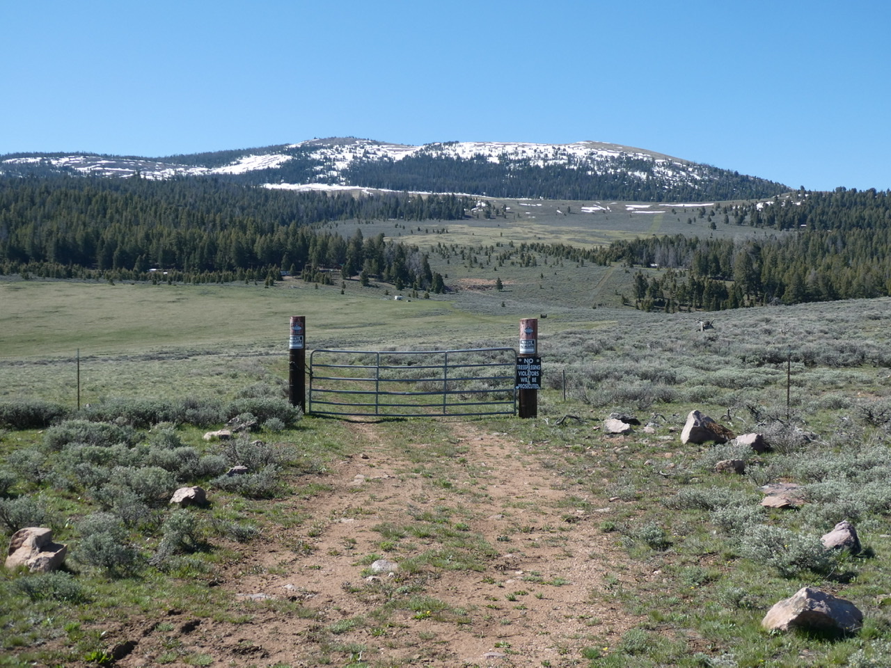
The northern access route to the summit is blocked by private property
Additional Resources
Regions: Donkey Hills->EASTERN IDAHO->Lost River Range
Mountain Range: Lost River Range
Longitude: -113.55949 Latitude: 44.26589