Elevation: 5,040 ft
Prominence: 500
This peak is not in the book. Two routes are set out below. The first is mine. I also climbed the peak using the trails taking the shortest line possible. Livingston Douglas’ report is next. He describes the traverse between Bender Peak and Flat Benchmark in more detail. Finally, you will find the circular route followed is by Erik Pohlmann. Erik approached the peak by following the OHV trails in a counterclockwise manner. Additional Danskin Mountains access information is in the book [(D)(1) on Pages 154-155 and (G)(1) on Page 156. Also see the following website page: Danskin Mountains OHV Trails. Updated October 2023
Flat Benchmark and Bender Peak are located on a ridge that divides Willow Creek and Flat Creek. The highlight of a climb of Flat Benchmark may be the approach. There are multiple scenic trail and loop options and you can easily incorporate bagging Bender Peak which shares the same beautiful rolling trailed ridge which is a highly recommended trek. Unfortunately, due to more recent fires, much of this area is now simply grassland and is devoid of even sagebrush, but is still beautiful to explore during three of the four seasons. I recommend avoiding Summer due to intense heat. USGS Grape Mountain
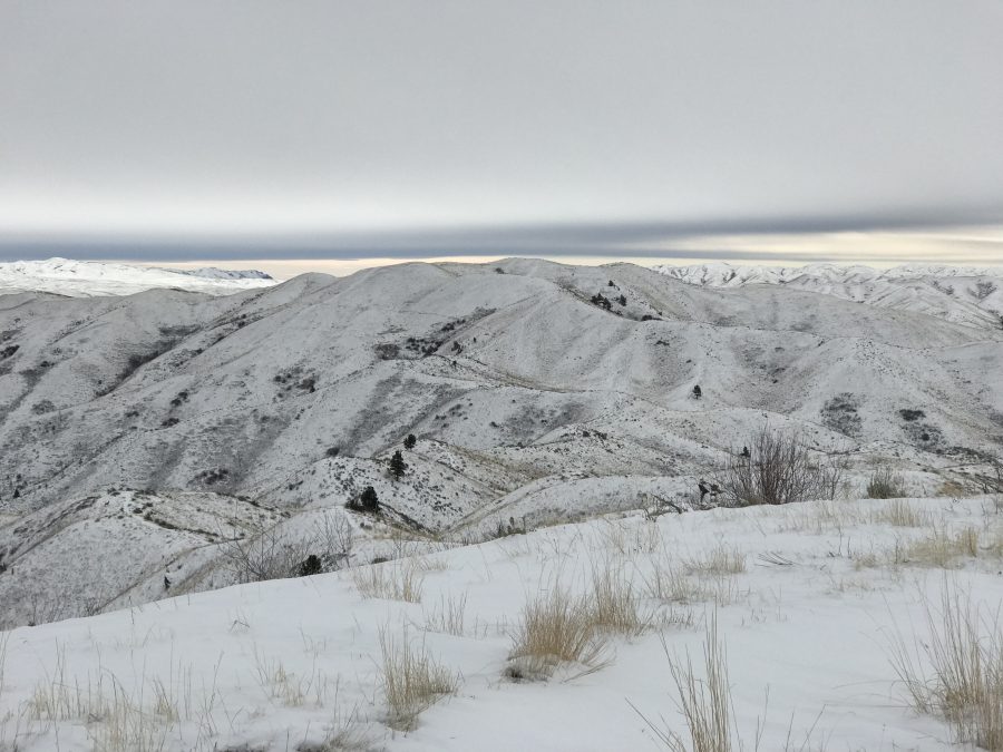
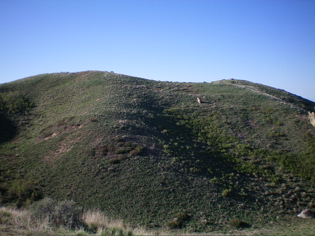
Flat Benchmark as viewed from FST-311
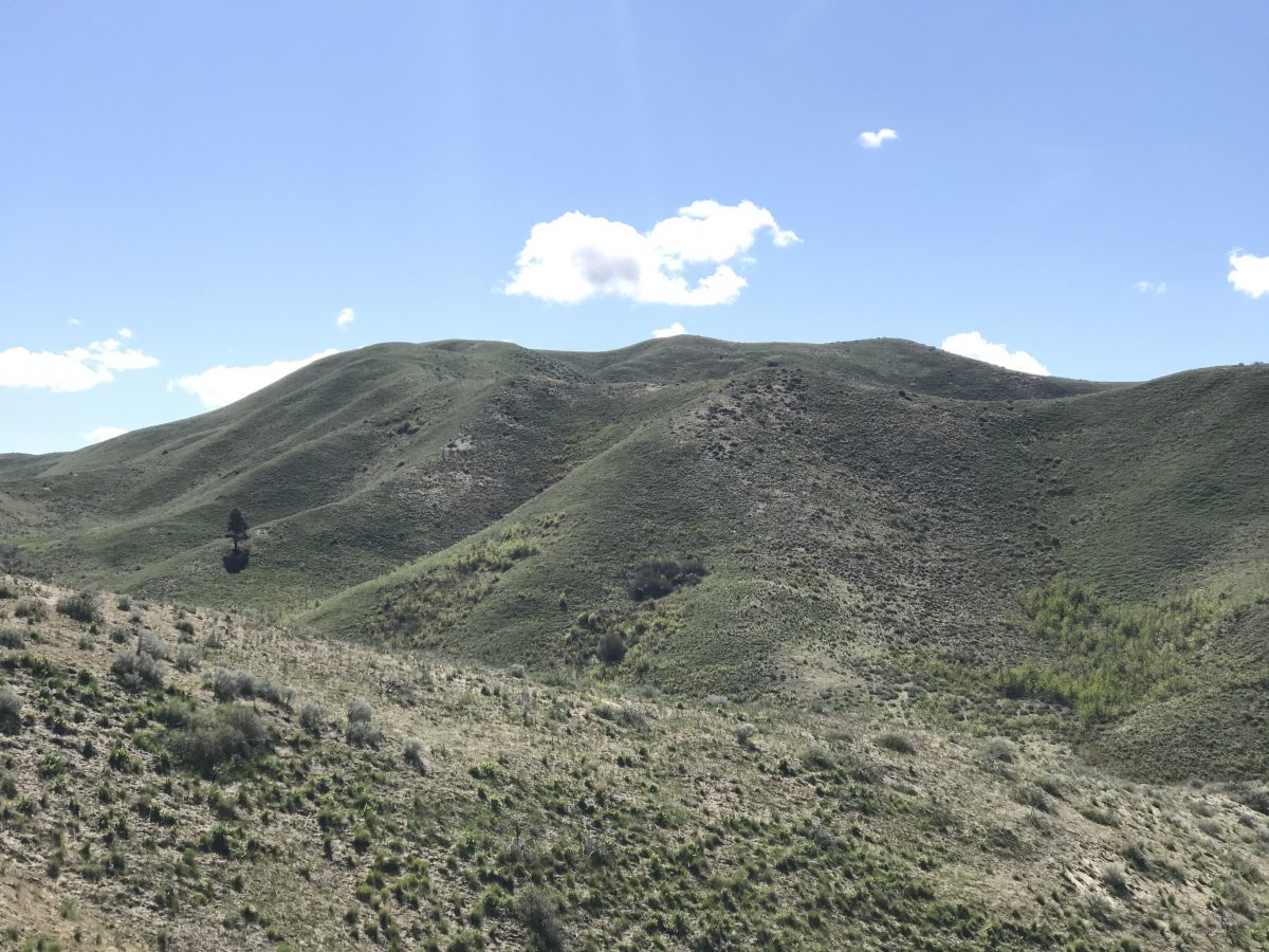
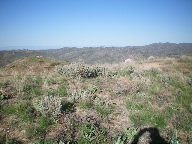
Flat Benchmark as viewed from Bender Peak
North Ridge, Class 2
Access
I parked at the Bender Creek trailhead on Blacks Creek Road. The trail follows FST-300 southeast to FST-311 in 4.3 up-and-down miles. FST-300 is a heavily-used, well-made trail complete with bridges.
From the trailhead, the trail climbs out of Woods Creek, crosses a ridge and drops into Bender Creek. It then climbs out of Bender Creek, crosses another ridge, drops briefly into an unnamed drainage, climbs once again over another ridge and then drops into Jack Creek. The trail then follows Jack Creek down to Flat Creek. The trail turns up Flat Creek. Follow the trail up Flat Creek to the signed junction for FST-311.
FST-311 is a STEEP trail that climbs up to within 150 feet of the summit of Bender Peak where it meets FST-310. Turn east and follow FST-310 south to Flat Benchmark’s North Ridge where an unofficial trail leads quickly to the summit. You can shorten the hike by leaving the trail before the North Ridge and climbing up the steep, grassy slope to the ridge top.
My GPS track. This route covered 14.9 miles round trip with 2576 feet of gain.
Livingston Douglas’ North Ridge Ascent Report
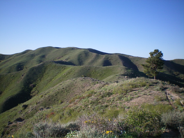
Flat Benchmark as viewed from the north. Livingston Douglas Photo
Access
Same as for Bender Peak. This is the second leg of a 2-peak adventure that includes Bender Peak (4,966 feet) and Flat Benchmark. This journey covers 6.0 miles with 2,550 feet of elevation gain round trip.
North Ridge, Class 2
The Climb
From the 4,620-foot connecting saddle with Bender Peak, follow MC Trail #310 south then southeast up to a flattish area at 4,740 feet where the MC trail bends left/east and an unofficial, steep foot trail head straight south up to the summit ridge of Flat Benchmark. Scramble south up the steep trail to the flatter summit ridge. Bushwhack southeast through easy grass/scrub to reach a high north-south ridge at about 5,000 feet.
Pick up a MC trail on the ridge and follow it right/south to the summit high point of Flat Benchmark. There is no benchmark or summit cairn but the small, open summit is the high point. I continued west to investigate another ridge point just to be sure and it measured 20 feet lower, according to my altimeter. That hump had no benchmark either. My route (via Bender Peak from the northwest) is probably the shortest direct route to the summit of Flat Benchmark.
The final push to the summit of Flat Benchmark. The high point is right of center. Livingston Douglas Photo
The sagebrush summit of Flat Benchmark with a lower hump to its west (left of center). Livingston Douglas Photo
Erik Pohlmann’s Danskin ATV Trail Approach
Access
Trail access can be found on either the West Side Flat Creek drainage via the Bender Creek trailhead, or the East Side Willow Creek drainage via the Willow Creek trailhead. Both drainages are forested but Flat Creek is the best bet during the Spring runoff since it has lower water volume and bridge crossings. The various trails leading from the drainages up to the ridge and summit are steeper on the east Willow Creek side and are more manageable on the west Flat Creek side.
A mountain bike is a great way to explore both Flat Benchmark and Bender Peak and the associated trails. Some of the trails are steep and chewed up, so I recommend biking the trails listed below in sequence which requires very little hike-a-bike and results in 3,500 feet of elevation gain over 24 miles. My favorite trails for biking along this route are FST-311 (which is quite flowy and fast) and FST-400 which is technical and chunky.
Erik’s Recommended Route
Bender Creek trailhead, FST-300, FST-314, FST-310, Flat Benchmark, FST-310, Bender Peak, FST-311, FST-300, FST-317, FST-400, Willow Creek trailhead and finally take the Blacks Creek Road back to the Bender Creek trailhead.
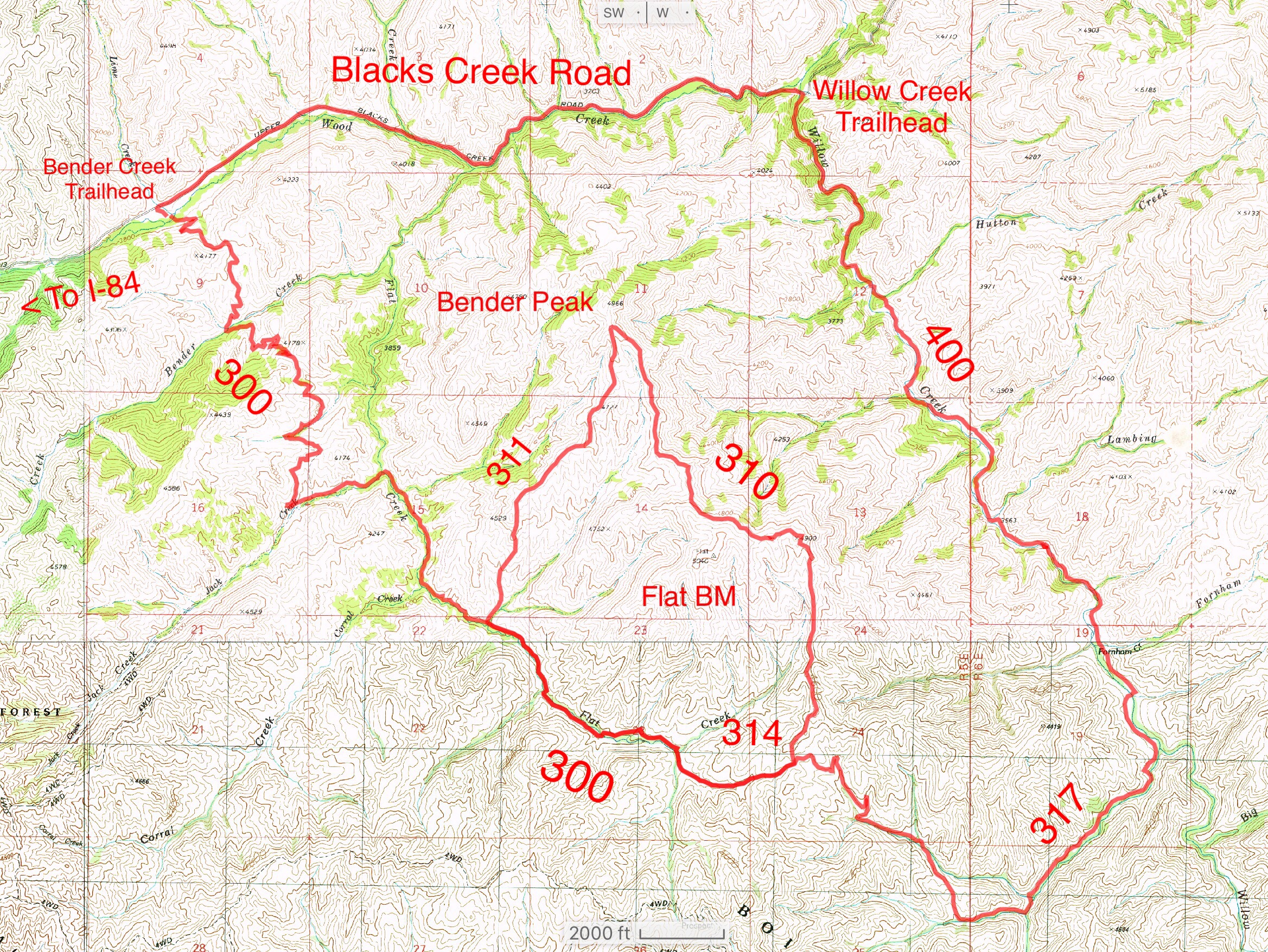
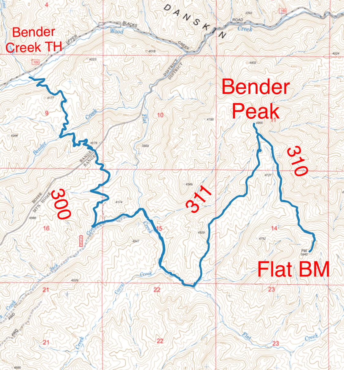
Map with trail options for ascending Flat Benchmark and Bender Peak.
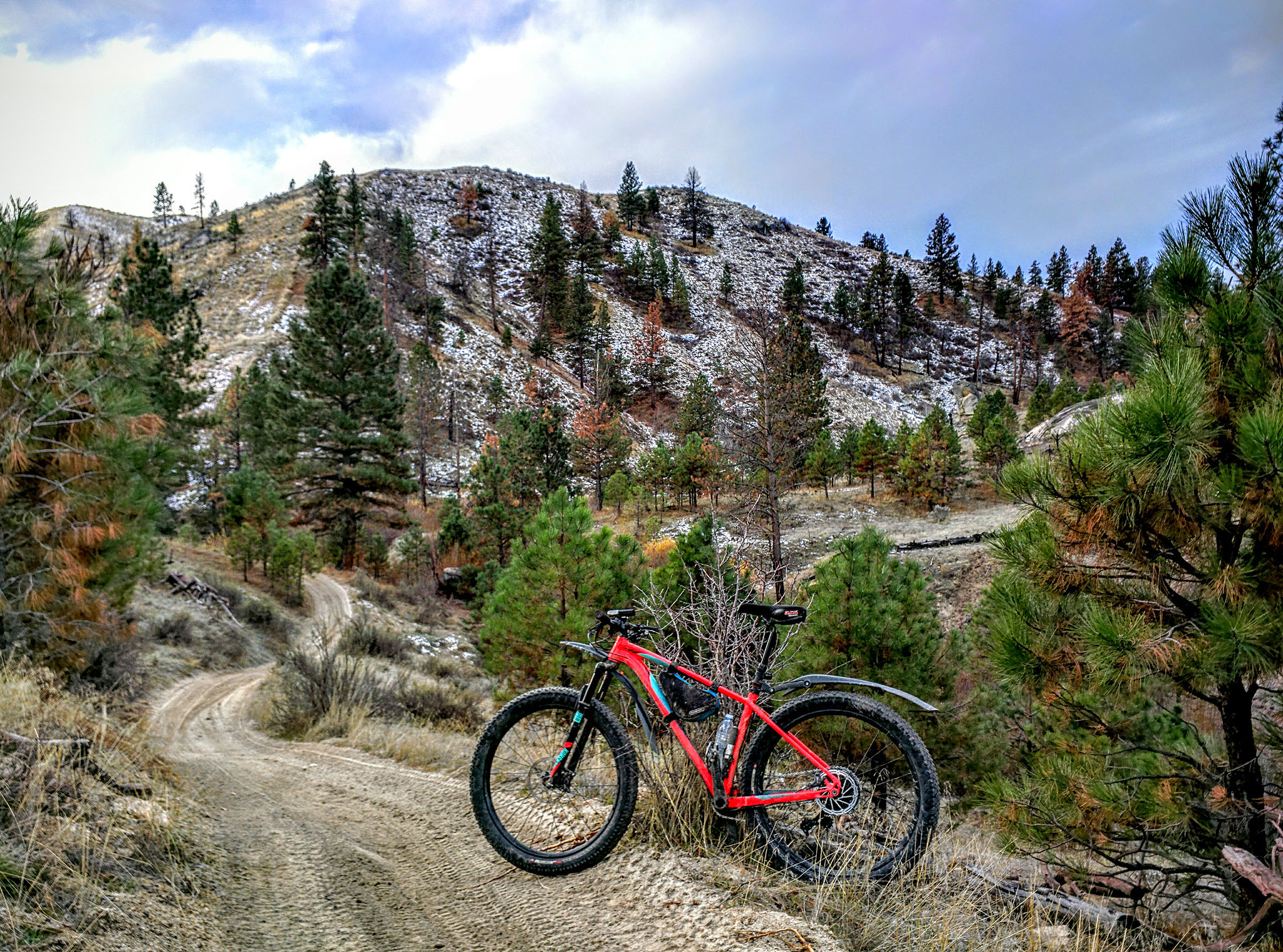
The Flat Creek approach. Erik Pohlmann Photo
Additional Resources
Regions: Boise Mountains->Danskin Mountains->WESTERN IDAHO
Mountain Range: Boise Mountains
Year Climbed: 2019
Longitude: -115.81939 Latitude: 43.50549