Elevation: 4,966 ft
Prominence: 346
This peak is not in the book. Four route descriptions are listed below, two of which are by Livingston Douglas. Additional Danskin Mountains access information is in the book [(D)(1) on Pages 154-155 and (G)(1) on Page 156]. Also see the following website page: Danskin Mountains OHV Trails. Updated October 2023
Peak 4966/Bender Peak is an unofficially-named summit that is located in the north-central portion of the Danskin Mountains. Like many Danskin peaks, Bender Peak is usually accessible in early Spring. USGS Grape Mountain
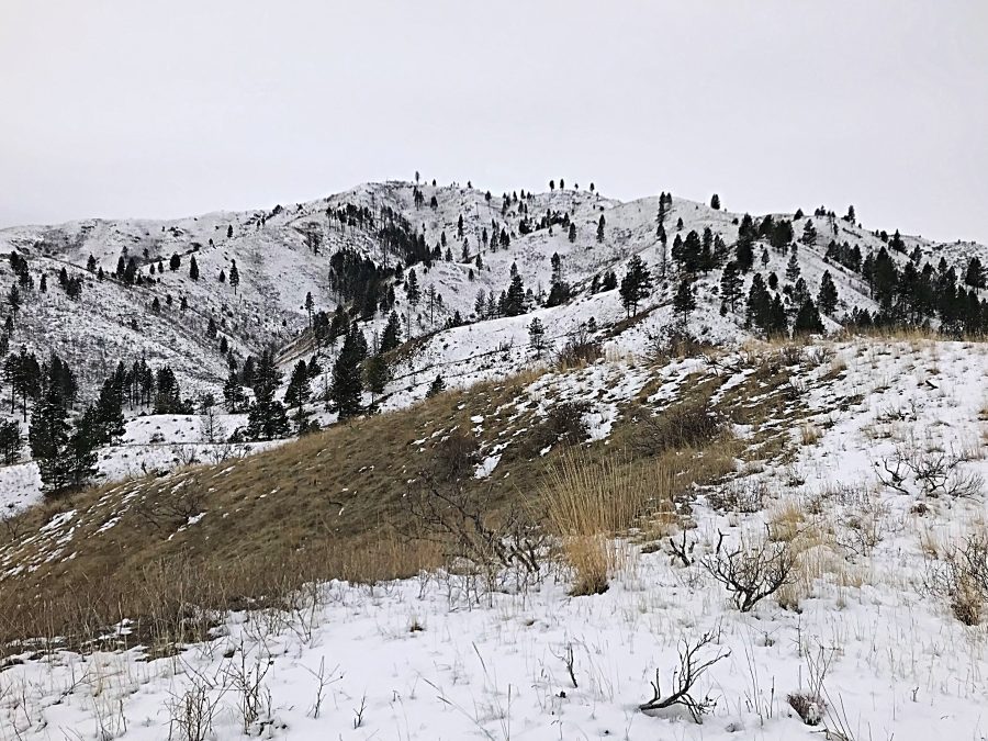
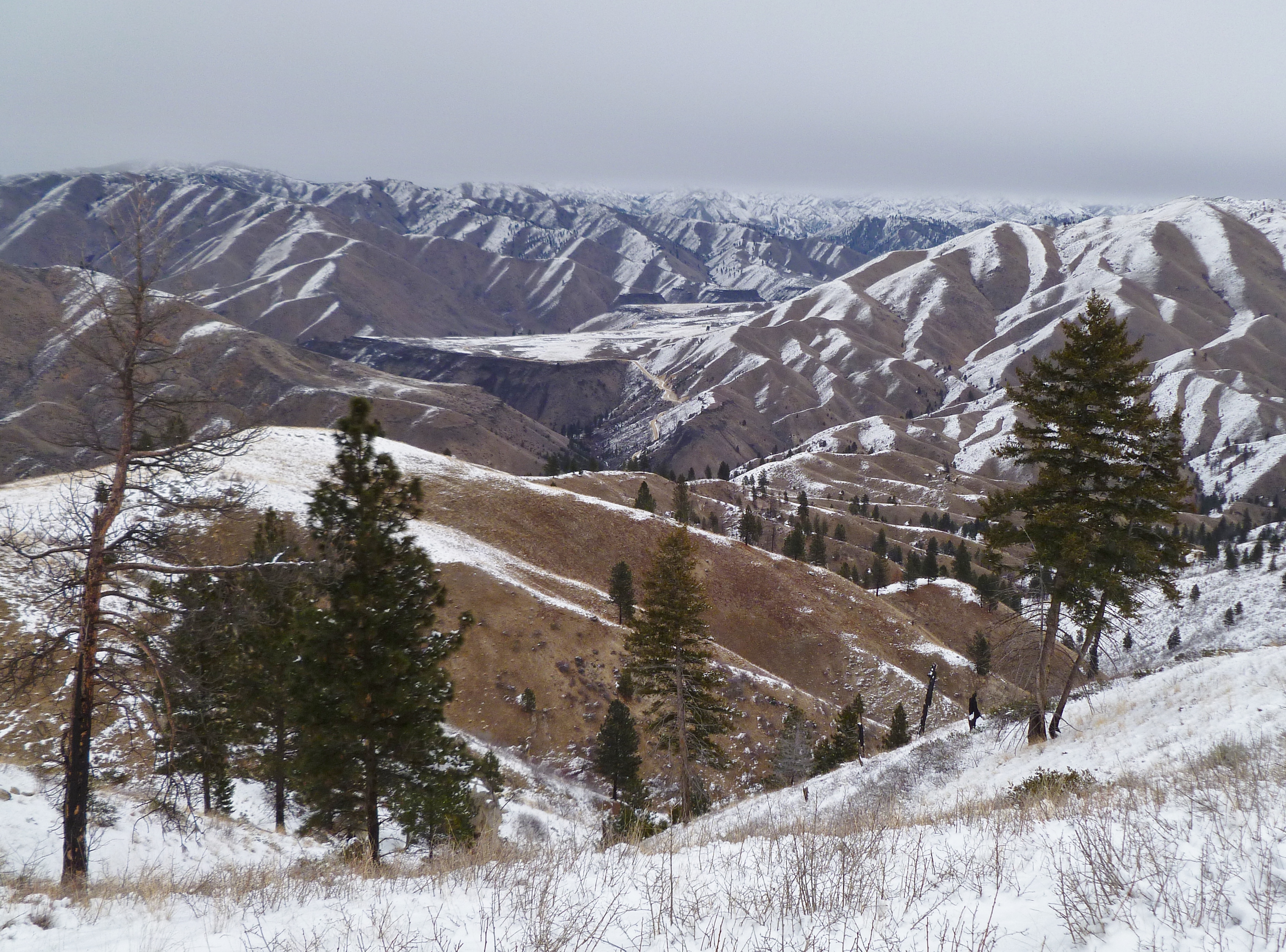
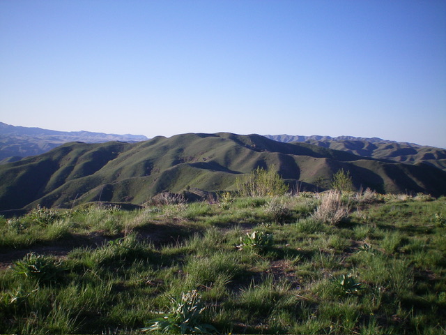
Bender Peak as viewed from midway up the northeast ridge
Access
Access both routes for Bender Peak from Blacks Creek Road [(G)(1) on Page 156] at the Willow Creek trailhead. From I-84, use Exit 64 east of Boise. From the exit, take the well-paved road north through rolling hill country. Keep left at the only paved fork (which has signs for stores in Prairie, Idaho). Continue for 8 miles for the Bender Creek trailhead or 11 miles for the Willow Creek trailhead on this good graded road as it climbs over a pass and then descends to Woods Creek and the trailheads. Here, you will find a vault toilet and a large parking area.
Be aware that a sign at the beginning of the graded road states that it is not maintained during Winter. But based on years of experience, in low snow years the road is often passable most of the winter. Still, it is a narrow, steep road that can be dangerous and impassable in Winter conditions.
Northeast Ridge, Class 2
From the Willow Creek trailhead parking lot, cross the road to the base of the peak’s circuitous Northeast Ridge. A granite rock outcrop marks the base of the ridge on the south side of Willow Creek. Contour around the outcrop and follow a deer trail up the East Side of the ridge for approximately 100 feet. Then climb straight up to the ridge top. From this point, stay on the ridge crest to the summit. The ridge has a series of steps that vary in steepness. When you reach roughly 4,800 feet, cross a motorcycle trail that is part of the Danskin Mountains OHV trail system. This system provides an alternative, but much longer, way to ascend Bender Peak. Follow the trail the final distance to the bald summit.
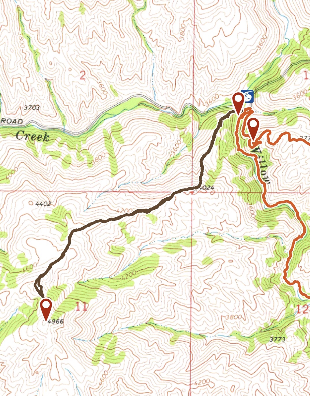
My GPS track up the Bender Peak’s long Northeast Ridge. Round-trip stats: 3.2 miles with 1,550 feet of elevation gain.
For the most part, the Northeast Ridge is broad and devoid of brush or trees.
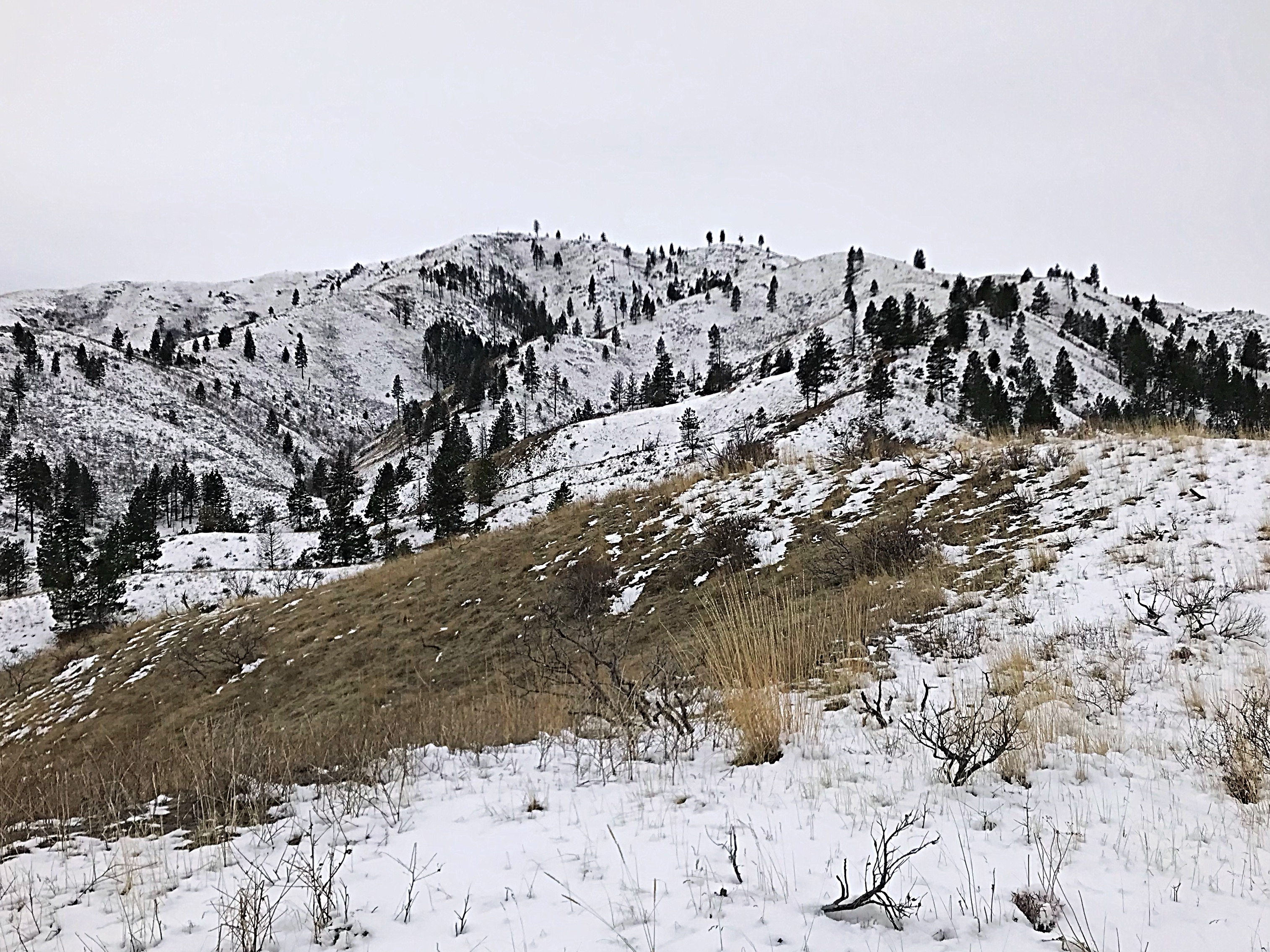
The upper portion of the ridge narrows a bit and has a few trees.
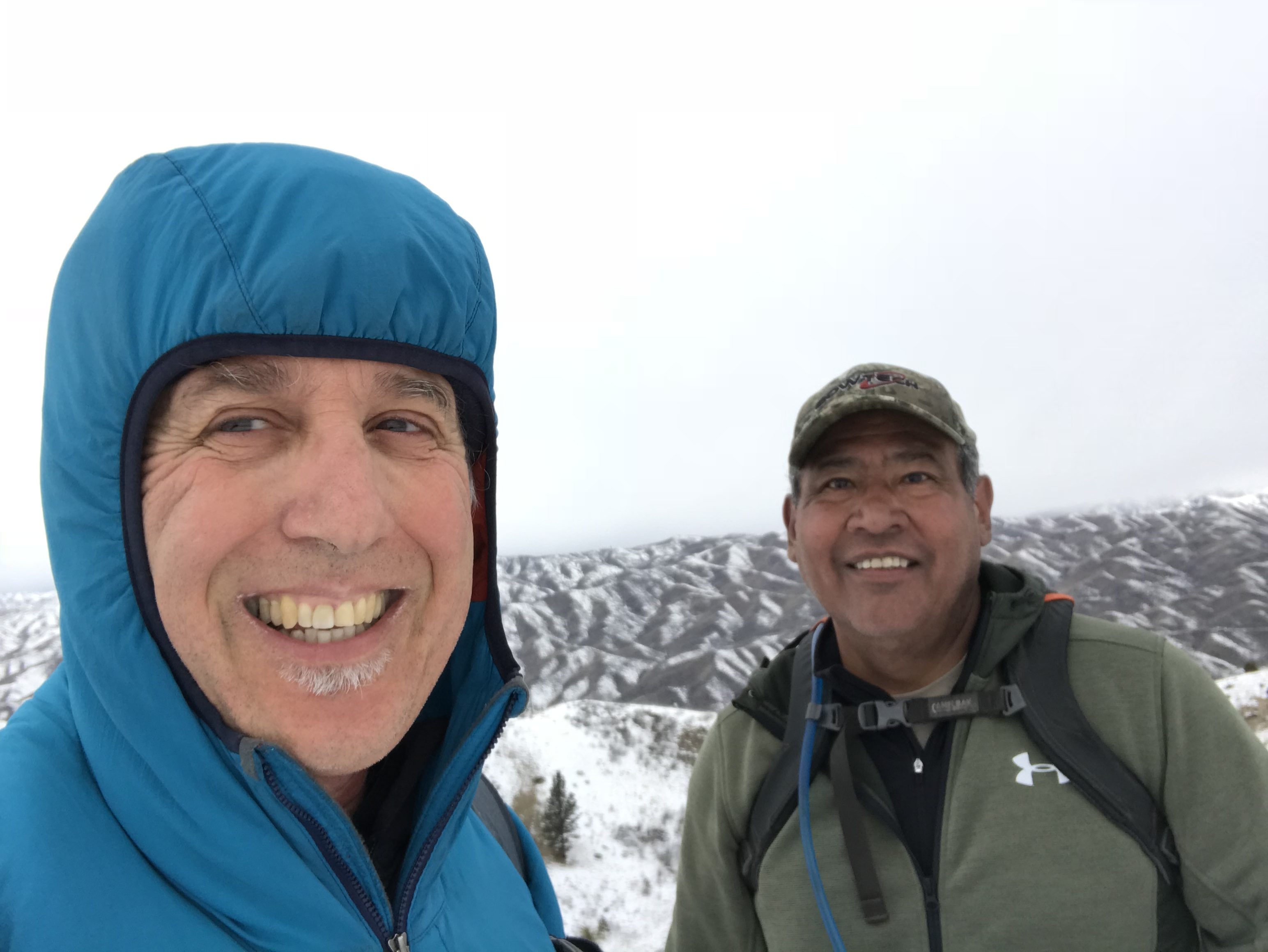
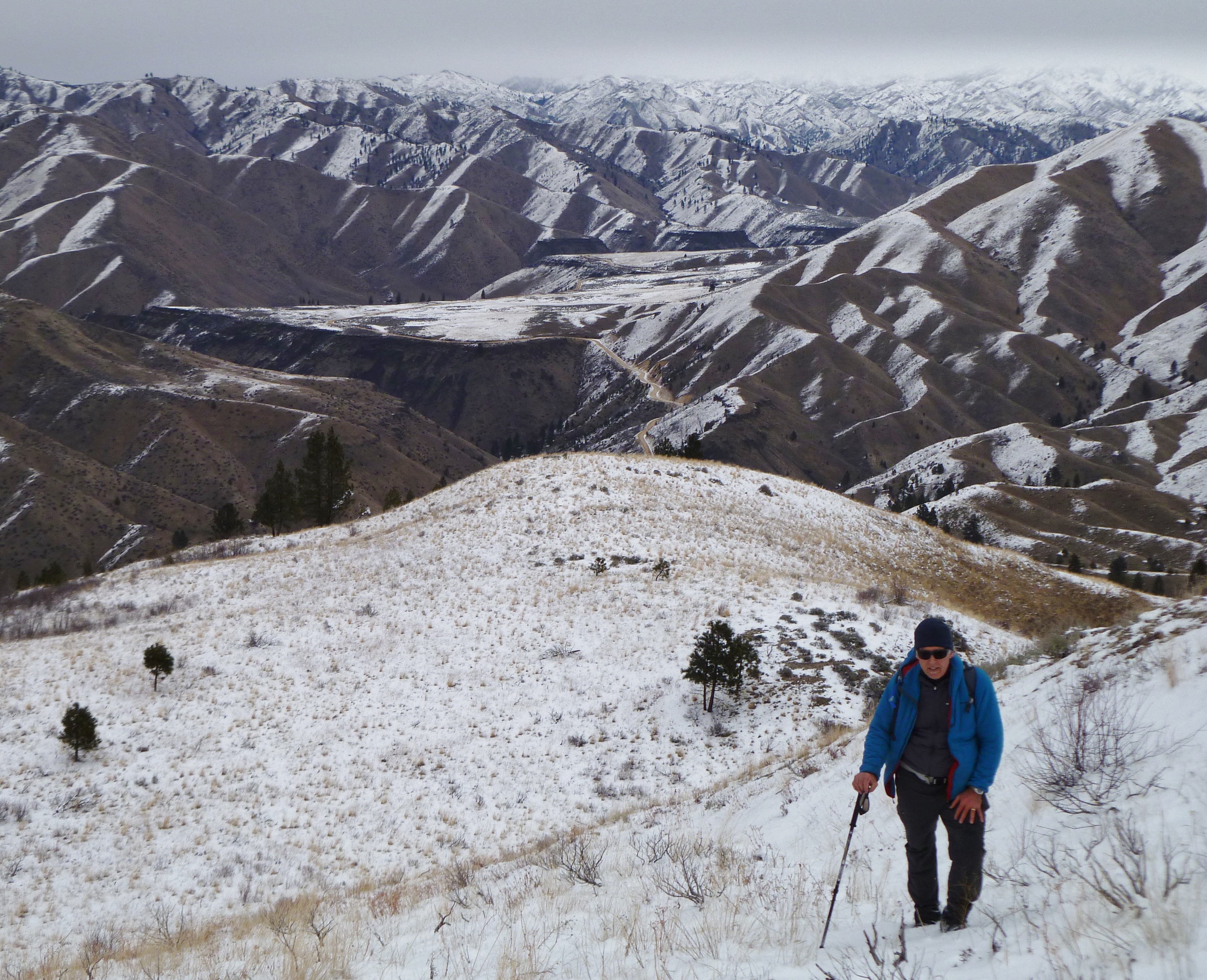
On the summit during a Winter climb. Conditions can vary greatly from winter to winter. We encountered a fresh skiff of snow. A week earlier, the ridge was bare. Some winters you end up in deep snow and avalanche conditions.
Southeast Ridge, Class 1
Park at the Bender Creek trailhead on Blacks Creek Road. The trail follows FST-300 southeast to FST-311 in 4.3 up-and-down miles. FST-300 is a heavily-used trail complete with bridges. From the trailhead, the trail climbs out of Woods Creek, crosses a ridge and drops into Bender Creek. It then climbs out of Bender Creek, crosses another ridge, drops briefly into an unnamed drainage, climbs once again over another ridge and then drops into Jack Creek.
The trail then follows Jack Creek down to Flat Creek. The trail turns up Flat Creek. Follow the trail up Flat Creek to the signed junction for FST-311. FST-311 is a STEEP trail that climbs up to within 150 feet of the summit of Bender Peak where it meets FST-310. Turn left and follow the trail to the summit which is a short distance above.
Northwest Spur/North Ridge and South Ridge by Livingston Douglas
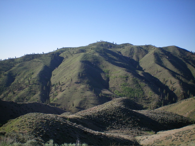
Bender Peak as viewed from the south. Livingston Douglas Photo
Access
From Blacks Creek Pass (on Blacks Creek Road): At 3.5 miles, reach the Bender Creek trailhead (right). At 4.7 miles, reach the Deadman Creek trailhead/campsite (left). At 5.3 miles, reach the pullout (left) for this climb of Bender Peak. This pullout is the only feasible parking option in this somewhat narrow, winding section of Blacks Creek Road near Wood Creek. This pullout is at 3,545 feet and 43⁰32’00”N, 115⁰50’15”W. This pullout sits at the toe of the northwest spur of the north ridge of Bender Peak.
Northwest Spur/North Ridge, Class 2
The Ascent (then Descent)
From the pullout, cross to the south side of Blacks Creek Road and descent 10 feet to cross Wood Creek on a fallen tree. Once across the creek, you face a drainage with a small stream. This drainage goes uphill and to the south then southeast. You can either climb the ridge to the left/east or the ridge to the right/west. I chose the former option but both ridges lead up to the high east-west lateral ridge that precedes the final southward push up the north ridge to the summit.
From the small drainage, scramble left/east up steep grass to reach the crest of the northwest spur. Once on the ridge crest, scramble southeast up the steep, grass-and-scrub, open ridge to the juncture with the north ridge just south of Point 4402. Continue south up the ridge to a flat, grassy area. Cross southeast across the head of a gully (the same gully that the climb initiated from) and drop 15 vertical feet to regain a better-defined ridge that heads hard right/southwest.
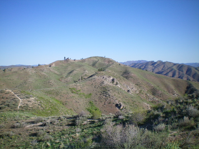
Scramble up the open, grassy ridge to reach the high summit ridge and MC Trail #310. Follow Trail #310 southwest up over a minor ridge hump then continue south-southeast on the trail to drop 40 feet to a final saddle. Continue south up the trail to the summit of Bender Peak. The small, open summit has grass, gravel, and some scattered sagebrush. There is no summit cairn.
The summit hump of Bender Peak as viewed from the ridge hump to its north. Livingston Douglas Photo
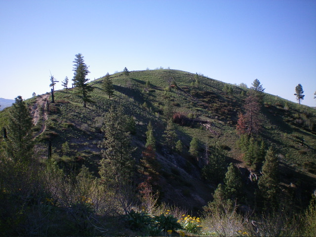
The gentle summit of Bender Peak with Flat Benchmark in the distance. Livingston Douglas Photo
South Ridge, Class 1
The Descent (then Ascent)
From the summit, follow Trail #310 southeast then south along the undulating ridge crest to reach the 4,620-foot connecting saddle with Flat Benchmark (5,040 feet). This concludes the first leg of today’s 2-peak adventure. Flat Benchmark is up next.
Bender Peak (dead center) as viewed from the north. The summit hump is not quite visible. My ascent ridge is just left of center. Livingston Douglas Photo
Additional Resources
Regions: Boise Mountains->Danskin Mountains->WESTERN IDAHO
Mountain Range: Boise Mountains
Year Climbed: 2018, 2019
Longitude: -115.82909 Latitude: 43.52209