Elevation: 8,345 ft
Prominence: 365
Climbing and access information for this peak is on Page 69 of the book. This peak is one of five peaks that make up the Gospel Crags Group. Contributor Mike Hays has provided us a more detailed and updated access and route information report, which is set out below. I have added a GPS track, photos and additional information in [*]s to Mike’s narrative. The origin of the name Gospel Peak is set out at the following link: Where Do Mountain Names Come From. Updated July 2022
Gospel Peak Update by Mike Hays
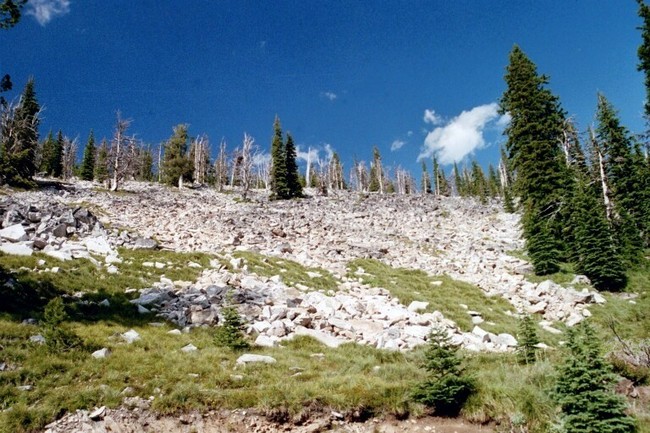
Gospel Peak is one of the highest points along the Salmon/Clearwater Divide. Along with Pyramid Peak, Gospel Peak anchors the western portion of the Gospel-Hump Wilderness of the Nez Perce National Forest. This primitive area is approximately 206,000 acres and forms part of a 4.3 million-acre wilderness block with the Frank Church River of No Return Wilderness and the Selway-Bitterroot Wilderness. Subalpine glacial lakes abound in this area and many of them support great trout fishing. The area is an easy day trip from Grangeville, ID and provides excellent backcountry hiking and camping. A climb of Gospel Peak can be combined with nearby Pyramid Peak for an easy double-peak day.
You can see three ranges and four states (including Idaho) from Gospel Peak’s summit, including the Wallowa Mountains in Oregon, Bitterroots of Montana, and the Blue Mountains and prairies of southeast Washington. On a clear day, you can see deep into the Payette Mountains to the south and the mountains of the St. Joe River basin to the north. USGS Hanover Mountain
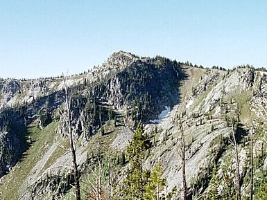
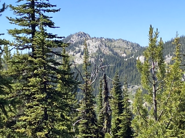
Gospel Peak as viewed from Pyramid Peak. Mike Hays Photo
Access
From US-95, turn east into Grangeville, ID and continue a long mile on Main Street (ID-13) to the east edge of town. The town ends abruptly at the old Forest Service office on the northeast corner of the intersection of ID-13 and the Mount Idaho Grade Road. The Forest Service office is a good place to have a break or obtain maps. From this intersection, travel south (right from downtown) on the Mount Idaho Grade Road. After 0.7 miles, keep to the right (straight) where the main road curves left at the drive-in theater. The road now becomes the Grangeville-Salmon Road. After about 2 miles, the road begins to climb the mountains south of town after crossing the National Forest Boundary.
The road becomes FSR-221 at Fish Creek Campground. Continue on the paved road to the well-marked FSR-444 and turn left onto the gravel road. This turn is just before Mile Marker 30 and is approximately 31 miles south of Grangeville. Go approximately 8 miles on FSR-444 to the Upper Gospel Lake pull-out. Park here or continue up the road for approximately 1/8th mile where there is a pronounced curve to the right and room for 2 or 3 cars to park. You can also drive as far as the ridge (mentioned below) and park there.
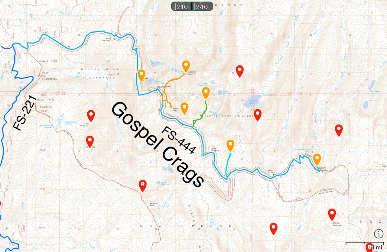
The Gospel Crags comprise five ragged peaks along FS-444. This map provides an overview of the five peaks and the routes to the summits.
[FSR-221 is a major, well maintained road which runs between the main Salmon River and Grangeville. It’s southern end is accessed from the Salmon River Road east of Riggins, Idaho. The southern end is gravel but wide and suitable for passenger vehicles.]
North Ridge, Class 2
From the Upper Gospel Lake pull-out, hike on gentle terrain through an open subalpine forest until you reach the ridge. Once at the ridge, turn south for an easy 0.5-mile walk to the peak. The walk to the summit is gentle from the north, west, and south. [Alternativley, you can approach the peak from numerous spots along FS-444. The map below shows my route. At some point in the distant pass a well constructed trail led to the summit. The trail can still be followed as it switchbacks up north side of the peak’s summit block.]
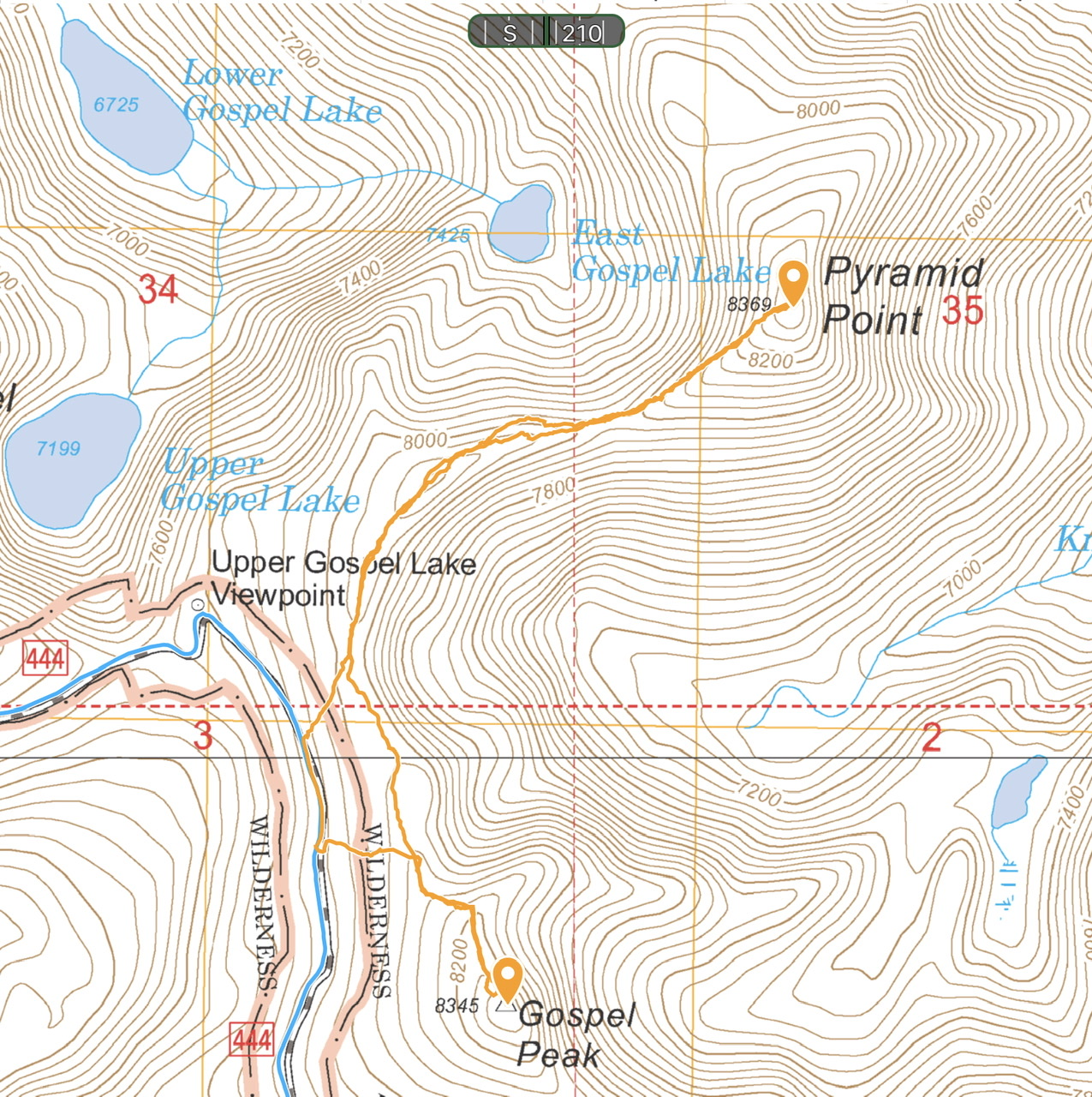
My route up Gospel Peak and Pyramid Peak. This route totaled 2.8 miles. The climb from FS-444 to Gospel Peak was just over 0.6 miles and just over 300 of elevation gain.
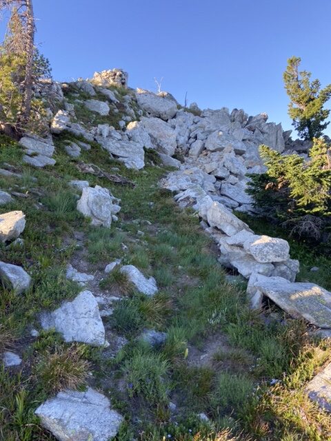
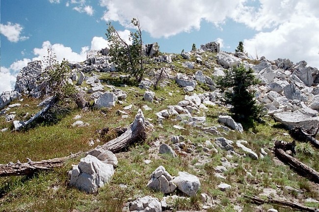
Remnants of the trail near the summit.
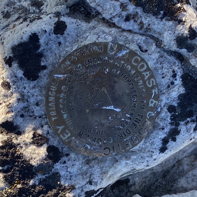
The benchmark on the summit.
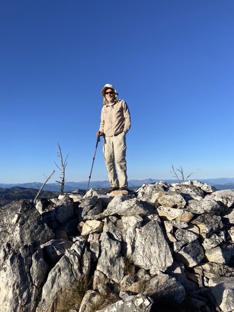
Steve Grantham on the summit.
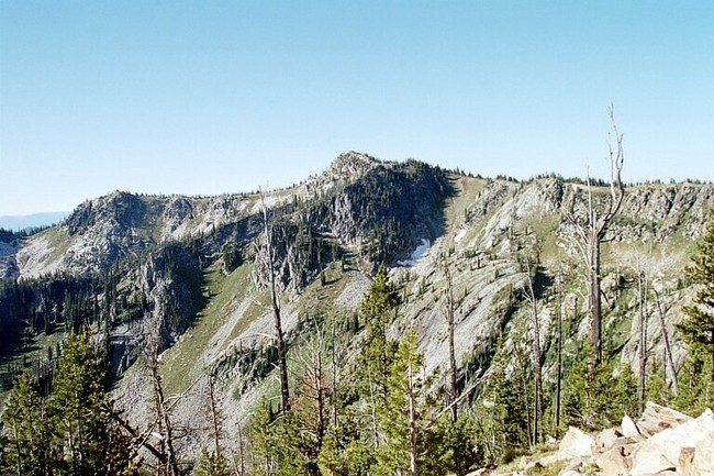
The East Ridge of Gospel Peak. Mike Hays Photo
The summit. Mike Hays Photo
Gospel Peak viewed from the south.
Additional Resources
Mountain Range: Southern Clearwater Peaks
Year Climbed: 2022
Longitude: -115.94019 Latitude: 45.62039