Elevation: 9,857 ft
Prominence: 1,037
Climbing and access information for this peak is on Page 131 of the book. Livingston Douglas added 2024 updates. Updated December 2024
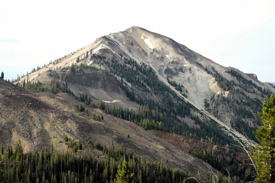
Mount Greylock is just 43 feet shy of 10,000 feet. As I noted in the book, it served as a fire lookout from 1934-1942. As you will see from the accompanying photos, the lookout is no longer habitable. From the summit, there are exceptional views of the Salmon River Mountains, the White Clouds and the Sawtooth Range.
Undoubtedly a trail once led to the summit of this peak, but you would be hard pressed to find much left of it today. The ridgeline east of the Yankee Fork drainage has many unnamed peaks that are worthy hiking goals. You will find wild country interspersed with old and new mining works. You may spot wildlife including elk, deer, mountain goats, and wolves. USGS Custer
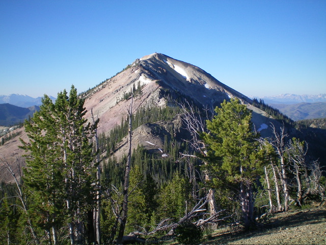
Mount Greylock as viewed from the north
I climbed the peak in 2014 with Gilbert Gallegos and Andrew Chiles following the route suggested in the book, which traverses the ridge between Estes Mountain and Greylock. We started at the saddle south of Estes Peak and followed the ridge south to the summit, crossing 2 unnamed peaks on the way.
The following access information updates the entry in the book which is Loon Creek Summit Road [(F)(3.2) on Page 141]. You can access the ridge between Estes Mountain and Mount Greylock via a road that, as far as I know, does not have a Forest Service number designation. I will designate it as the Estes Mining Road. This road leaves Loon Creek Summit Road 5.1 miles north of the beginning of that road.
The Forest Service map and the USGS quad show this road as a jeep trail but it is a well-maintained (albeit steep) road that leads up and over the ridge to the east. Turn right onto this road and drive 2.4 miles to the ridge top where you will find parking and a spot to make a pleasant, dry car camp. From the end of the road to the summit of Greylock, it is roughly 2.2 miles depending upon the line you chose. There are three unnamed peaks (Peak 9366, Peak 9381 and Peak 9403) that you can easily add to your itinerary. I have added website entries for each of these peaks.
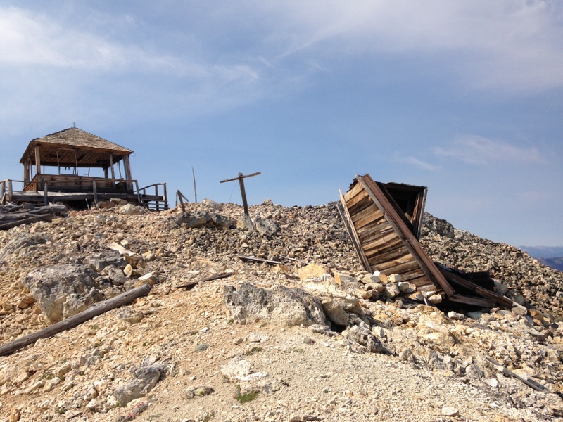
The ruins of the Greylock Fire Lookout.
We skirted the two9 intervening peaks on the walk over and then climbed over them on the way back. Here is our GPS track:
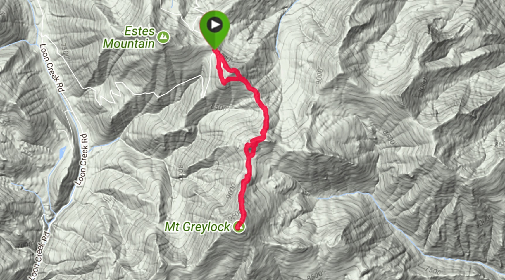
My GPS track
And the roundtrip profile: 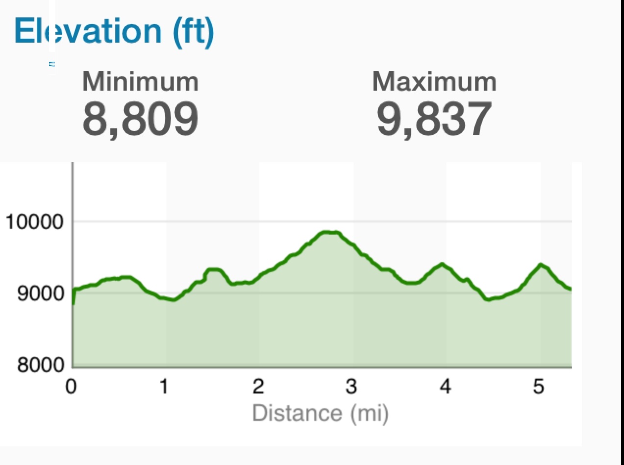
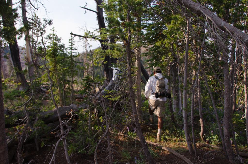
The hike starts out through a thick forest. Andrew Chiles Photo
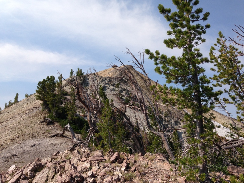
The view of the summit from the last saddle to the north
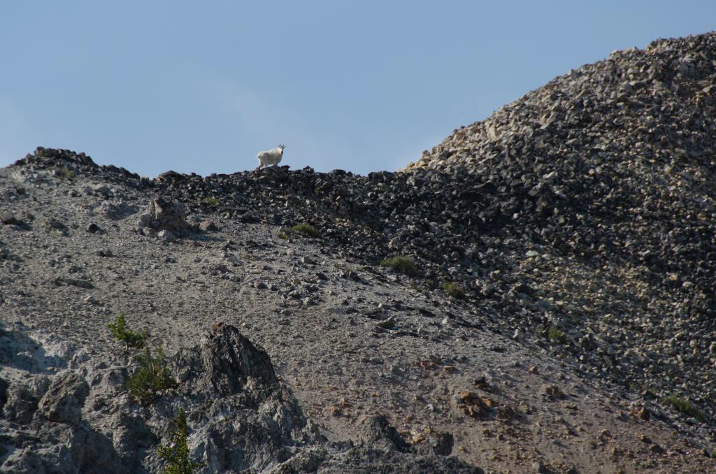
We saw one goat on the climb. Andrew Chiles Photo
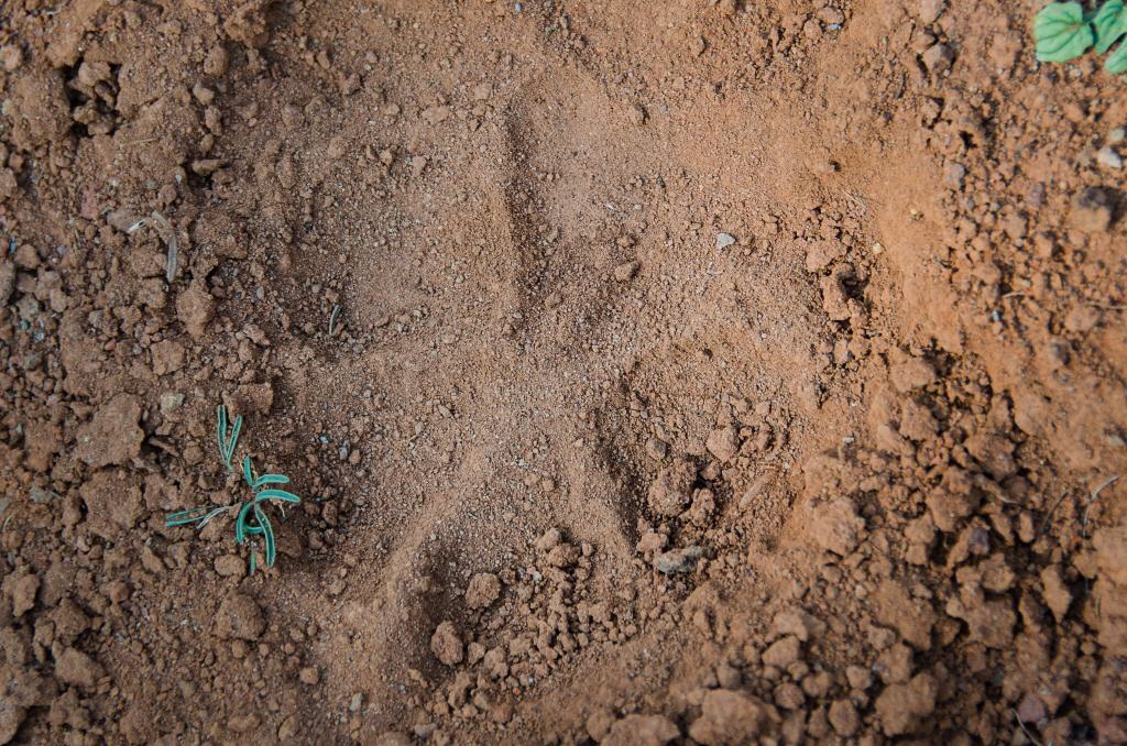
This may be the reason we only saw one goat. This wolf track was found nearby. Andrew Chiles Photo
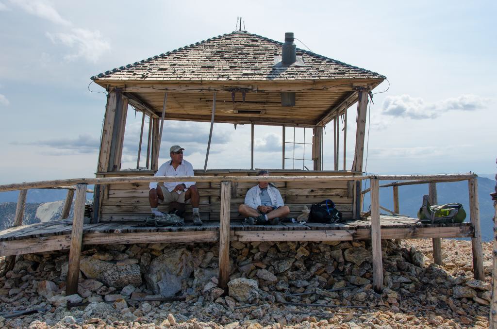
The old lookout may not be habitable but it’s still a good place to take a shady break and enjoy the view. Andrew Chiles Photo
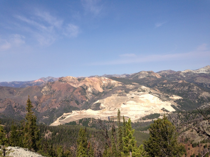
There is a large open pit nine just to the west of the peak. It is a huge scar.
2024 Updates by Livingston Douglas

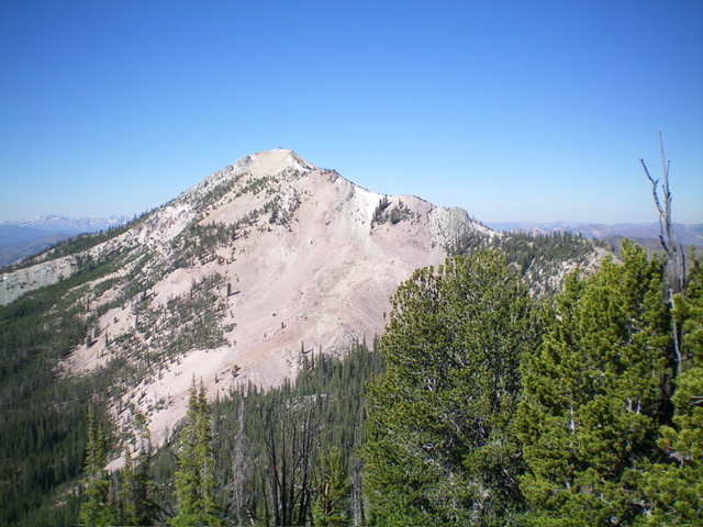
Mount Greylock as viewed from Peak 9461 to its northeast. Livingston Douglas Photo
Mount Greylock is a magnificent peak in the Eastern Salmon River Mountains with over 1,000 feet of prominence. Its lengthy north ridge includes unranked Peak 9380 and ranked Peak 9366. Mount Greylock is most easily climbed via its north ridge from a saddle near Estes Mountain.
Access
Same as for Peak 9366. This is the third leg of a 4-peak adventure that includes Peak 9366, Peak 9380, Mount Greylock (9,857 feet), and Peak 9403. It covers 7.0 miles with 3,150 feet of elevation gain round trip.
North Ridge, Class 3
The Climb
From the forested connecting saddle at 9,060 feet, bushwhack through a thick pine forest in the saddle area with a minor hump to climb over. Reach the base of the ominous, open rock/scree/gravel of the bumpy north ridge of Mount Greylockat about 9,120 feet. Scramble up a very steep, loose ridge outcrop early on (Class 3) on very fragile face rock and steep scree/gravel. Once past this difficult section, continue south up the steep-ish ridge crest to reach a massive ridge block at 9,350 feet.
Skirt the right/west side of this ridge obstruction on a weak game trail in angled, loose gravel/sand then climb like a dog (on all fours) to regain the ridge at just above 9,400 feet (Class 2+). Once back on the ridge crest, scramble up the remaining 450 vertical feet to the summit on reasonable ridge rock. Finish off the peak with a climb up steep-ish boulders/talus with the help of a foot trail in part of this rocky patch. The summit of Mount Greylock has a summit cairn with a post in it. The fire tower is a collapsing structure, with broken glass, sagging floors, and a destroyed outhouse nearby.
Mount Greylock and its meandering, rocky north ridge (in dead center) as viewed from Peak 9380 to its north. The north ridge was my ascent route. Livingston Douglas Photo
Mount Greylock as viewed from Peak 9403 to its northeast. Greylock’s north ridge is the skyline in center and right of center. Livingston Douglas Photo
Ridge Traverse to Peak 9403, Class 3
Return north to the 9,060-foot connecting saddle just underneath the cliff bands on the south ridge of Peak 9380. Descend about 20 vertical feet below the saddle to a meadow (of sorts) to begin the ascending face traverse to the 9,100-foot connecting saddle between Peak 9380 and Peak 9403. This side-hilling adventure (Class 2+) is punishing due to steep, loose gravel when crossing two large gullies. Once across these dry, gravelly gullies, scramble quickly up to the west ridge of Peak 9403 on, or just above, the connecting saddle. This concludes the third leg of today’s 4-peak journey. Peak 9403 is up next.
Additional Resources
Regions: Eastern Salmon River Mountains->Salmon River Mountains->Southeast Corner Peaks->WESTERN IDAHO
Mountain Range: Salmon River Mountains
Year Climbed: 2014
First Ascent Information:
- First Ascent Year: 1800
- Season: Spring
- Route: Unknown
- Party: No doubt by Yankee Fork miners.
Longitude: -114.69749 Latitude: 44.419732