Elevation: 9,403 ft
Prominence: 343
This peak is not found in the book. Livingston Douglas added the 2024 Update which includes more detail than my 2014 entry. Updated December 2024
Peak 9403 sits between Estes Mountain and Mount Greylock north of the Yankee Fork Town Site. It is 1.4 miles SSE of Estes Mountain, 0.8 miles NNE of Mount Greylock, and 0.6 miles east of Peak 9380. Climb this peak in conjunction with a climb of Mount Greylock.
Climb this peak from the saddle south of Estes Mountain. The summit is a 1.6 mile walk from the parking spot described below with an elevation gain that will vary depending on whether you cross over or skirt Peak 9366. Access to the ridge is set out below. Class 2. USGS Custer
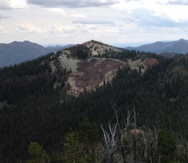
Peak 9403 as viewed from Peak 9366.
The following access information expands on the access information in the book. Start on Loon Creek Summit Road [(F)(3.2) on Page 141], which begins just north of the Yankee Fork Dredge. From this road, you can access the ridge between Estes Mountain and Mount Greylock via a road that, as far as I know, does not have a Forest Service number designation. I will designate it as FS-3.2.2, Estes Mining Road. This road leaves Loon Creek Summit Road 5.1 miles north of the beginning of that road. The Forest Service map and the USGS quad show this road as a jeep trail but it is a well-maintained (albeit steep) road that leads up and over the ridge to the east. Turn right onto this road and drive 3.4 miles to the ridge top, where you will find parking and a spot to make a pleasant, dry car camp.
2024 Updates by Livingston Douglas
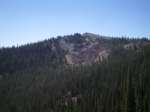
Peak 9403 as viewed from the east. Livingston Douglas Photo
Peak 9403 is an attractive, pyramidal-shaped summit that sits east of the lengthy north ridge of Mount Greylock (9,857 feet). It is most easily climbed in combination with Mount Greylock and Peak 9380 to its west.
Access
Same as for Peak 9366. This is the fourth leg of a 4-peak adventure that includes Peak 9366, Peak 9380, Mount Greylock (9,857 feet), and Peak 9403. It covers 7.0 miles with 3,150 feet of elevation gain round trip.
West Ridge, Class 2
The Climb
From the 9,100-foot connecting saddle with Peak 9380,bushwhack southeast through a section of thick pine forest with ample blowdown. Continue east up the ridge in semi-open, forested terrain with a stable gravel base. Finish off the peak with a move right/southeast on easy gravel/sand to reach the small, rocky summit area. A gray rocky outcrop seems to be the high point. However, I built a small cairn atop a nearby hump of open gravel/scree that may also be the high point. There were no signs of previous ascent. Stand atop both potential high points just to be sure.
From the summit, return to the 9,100-foot connecting saddle with Peak 9380. Climb the east ridge of Peak 9380 then descend its north ridge to the 8,820-foot connecting saddle with Peak 9366. Climb the southeast ridge of Peak 9366 then descend its northwest ridge to return to the 8,980-foot saddle at which today’s 4-peak adventure began.
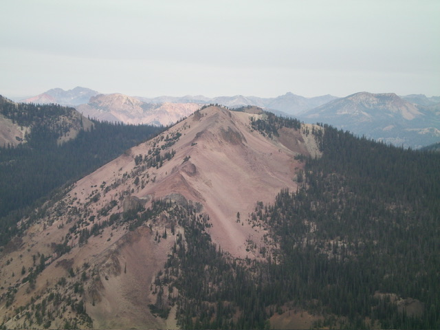
Peak 9403 (dead center) as viewed from Peak 9477 to its north. Livingston Douglas Photo
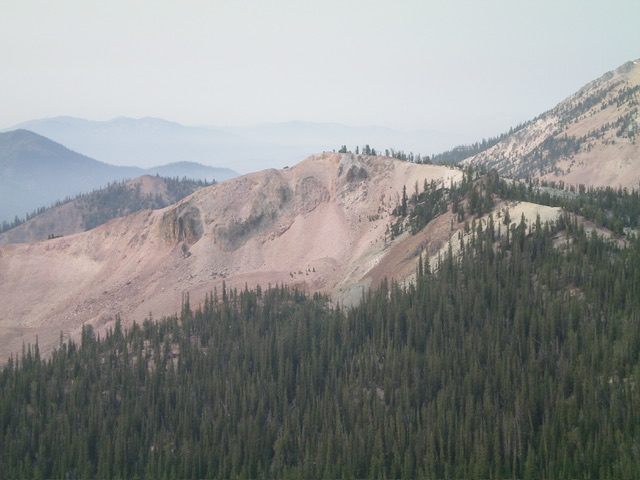
Peak 9403 as viewed from the northwest. Livingston Douglas Photo
Additional Resources
Regions: Eastern Salmon River Mountains->Salmon River Mountains->Southeast Corner Peaks->WESTERN IDAHO
Mountain Range: Salmon River Mountains
Longitude: -114.68389 Latitude: 44.43011