Elevation: 8,464 ft
Prominence: 904
Climbing and access information for this peak is on Page 70 of the book. Three routes, all still viable, are listed in the book. The shortest route is described in more detail below. The trails in this area are infrequently maintained and expert trail-finding abilities may be required. Published July 2020
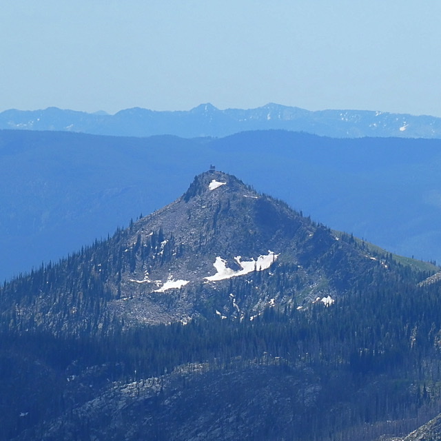
Oregon Butte is a shark tooth-shaped summit located 24 miles SSW of Elk City, Idaho and south of Buffalo Hump in the Gospel Hump Wilderness. The peak has been used as a fire lookout since 1929. USGS Buffalo Hump
Oregon Butte as viewed from Buffalo Hump
Access and Route, Class 1
FS-233/Crooked River Orogrande Road [(F)(1.2) on Page 79]. The shortest hiking approach to the peak begins at the road that leads to the Stump Lake north of Oregon Butte. Leave Grangeville, driving east on ID-13. Almost immediately, turn right onto Mount Idaho Grade Road. This road drops into the deep South Fork Clearwater River Canyon and reaches a junction with ID-14. Follow ID-14 toward Elk City for 34.0 slow miles to FS-233/Crooked River Road.
Follow this graded gravel road south to the town of Orogrande. From Orogrande, the road deteriorates as it continues southwest to Orogrande Summit in a total of 18.6 miles from ID-14. There is a confusing junction with intersections on the summit. A sign warns that the continuation of FS-233 is not suitable for 2WD vehicles. At this junction, FS-233 veers left, drops down into Lake Creek and then climbs up to Hump Lake exactly 6.0 miles from Orogrande Summit. The road then continues south to its terminus near Jump Camp where FST-202 begins. Follow FST-202 southeast to FST-203. Take FST-203 to FST-225 which leads to the summit.
Be warned: The road down from Orogrande summit to Lake Creek is a difficult 4WD road and better suited for ATVs. Victor Zhou states the road “is good for maybe the first half-mile, but as of Fall 2014, it deteriorates VERY quickly after that point. If you pass up a small parking spot on the left, you’ve essentially committed yourself to rolling down the steep and rocky road all the way down to Lake Creek. I managed to drive my 4Runner down and back up and, while I made it, I hated and despised every nail-biting minute of it.”
Additional Resources
Mountain Range: Southern Clearwater Peaks
Longitude: -115.66869 Latitude: 45.52169