Elevation: 5,096 ft
Prominence: 316
This peak is not in the book. Additional Danskin Mountains access information is in the book [(D)(1) on Pages 154-155 and (G)(1) on Page 156]. Livingston Douglas revised this page. Also see the following website page: Danskin Mountains OHV Trails. Updated October 2023
Peak 5096 is located on a long North-South ridge between Grouse Creek and Blacks Creek. Access the peak from Blacks Creek Road [(G)(1) on Page 156]. Peak 5096 and Peak 5100 can be combined into a great 9.0-mile round trip ridge walk with great views. If you have hiked Kepros Mountain and enjoyed the walk, you will find this walk its equal. USGS Arrowrock Dam
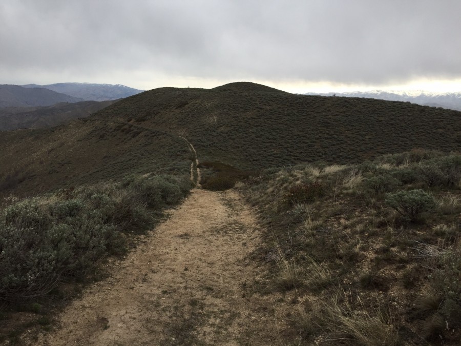
Peak 5096 as viewed from the south. The old road that follows the ridge line to this peak and Peak 5100 is closed to motor vehicles.
Access
FST-291/Woodtick Creek Trail is located 0.4 miles north of Blacks Creek Pass on Blacks Creek Road. The trailhead is signed. Blacks Creek Pass is 10.8 miles northeast of I-84. There is parking for 1-2 vehicles at the trailhead.
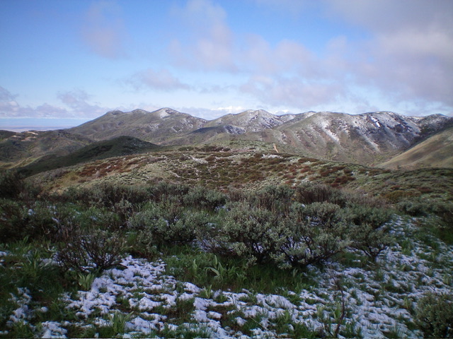
View from the summit of Station Peak. Livingston Douglas Photo
Southeast Ridge, Class 2
FST-291 works up the creek for a short ways and crosses the creek. The trail quickly climbs up to a pass at the head of Grouse Creek and a junction. The left fork descends into the drainage. Follow the old road northeast along the ridge crest to reach a fence row just past Station Peak. Leave the road here and bushwhack right/southwest through sagebrush along the fence row to reach the small summit area. There was no summit cairn or summit register on top. Given the sagebrush bushwhack required to reach the summit, I rate this climb at Class 2 even though much of the hike is Class 1.
Please note that there is a large section of private land in this area and access could be closed in the future. As of 2023, the old road/trail is still open to the public but requires 240 feet of extra uphills (round trip) when climbing Station Peak from the Woodtick Creek trailhead. 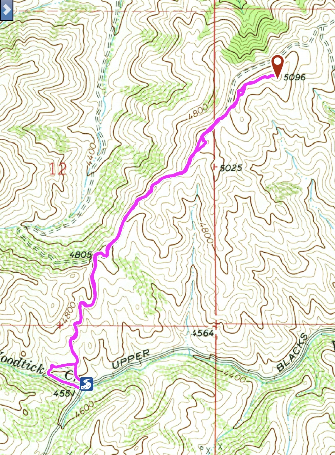
My GPS track from 2018. 3.0 miles round-trip with 651 feet of elevation gain.
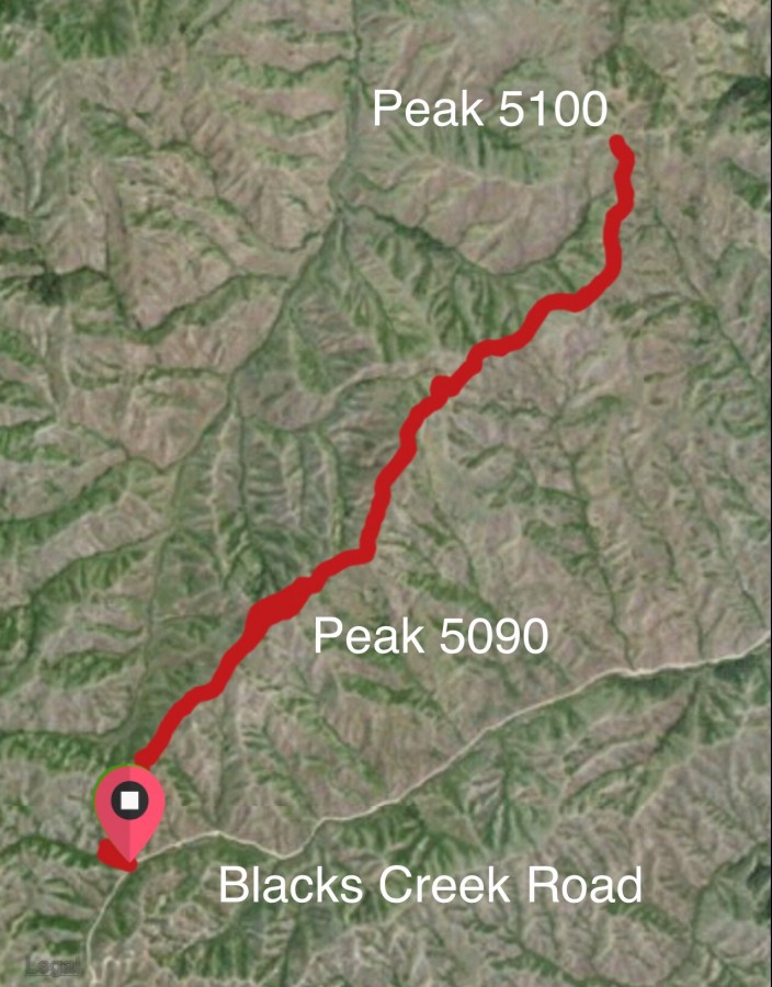
Peak 5096 and Peak 5100. My GPS track from 2015. Note that Peak 5096 is incorrectly identified on this map as 5090 (my error).
Additional Resources
Regions: Boise Mountains->Danskin Mountains->WESTERN IDAHO
Mountain Range: Boise Mountains
Year Climbed: 2015, 2018, 2019, 2020
Longitude: -115.91129 Latitude: 43.52769