Elevation: 5,331 ft
Prominence: 391
This peak is not in the book. Livingston Douglas significantly revised and updated this page. Updated October 2023
This Danskin Peak offers a good early-season ascent and has been climbed in Winter. You can follow a ridge over to Fiddler Benchmark and make it a 2-peak day. The central portion of the range is accessed via the Danskin Mountains OHV Trail System. The preceding link covers the trails that lead to the summit of Hutton Peak. The trails of this system are closed to motorized travel in Spring. USGS Grape Mountain
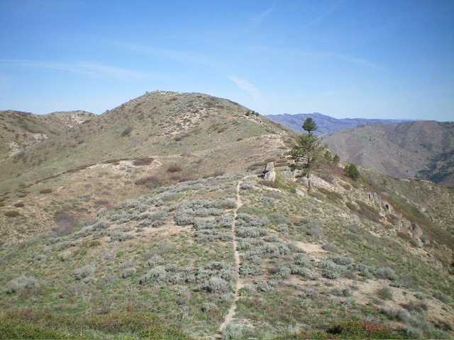
The summit hump of Hutton Peak as viewed from high on the northwest ridge. Livingston Douglas Photo
Access
The north side of Hutton Peak is a mix of private land and BLM land, so be careful. The northwest ridge route can be done entirely on BLM land. My route cuts across three corners of private land relatively early in this climb but there is no fencing or signage prohibiting crossing these small sections. This makes the route cleaner and, given the lack of signage/fencing, it’s difficult to pinpoint exactly where the private/public land boundaries are.
Park along Blacks Creek Road just above the South Fork Boise River on the northwest side of Hutton Peak. There are multiple gullies here and it is a bit confusing. I parked at the first sharp bend in the road just east of posted land. This bend/gully is at 3,720 feet and 43⁰32’49”N, 115⁰47’02”W. The ideal launch point, however, is one gully east of my selection. That gully allows you to more easily avoid any private land crossings for the entire climb.
The mileage figures from Blacks Creek Pass (on Blacks Creek Road) are as follows. At 3.5 miles, reach the Bender Creek trailhead. At 6.7 miles, reach the Willow Creek trailhead. At 9.2 miles, reach my bend/gully for the Hutton Peak climb. At 9.3 miles, reach the ideal bend/gully for the Hutton Peak climb.
Northwest Ridge, Class 2
The Ascent (then Descent)
From the road bend, briefly scramble steeply southeast up the dry gully then climb steeply left/east up onto the ridge. At about 4,400 feet, angle diagonally left/southeast to cross a dry gully and reach the ridge on the east side of another gully. Scramble steeply up the ridge southeast then south then southeast to reach another ridge, which turns into a steep face. Head south up the face to reach a minor ridge saddle. Follow an unofficial ridge trail east over a minor hump then drop to a final saddle. Continue southeast up the ridge crest on the trail to the summit of Hutton Peak. The high point is a large boulder. There is no summit cairn. The terrain on this climb is entirely open scrub and is not cumbersome.
Southeast Ridge, Class 1
The Descent (then Ascent)
From the summit, follow an unofficial ridge trail southeast to Point 5220 and an unsigned “T” junction. From this junction, follow a MC trail along the ridge crest as it heads east then southeast then south (with many ups and downs) to reach the connecting saddle with Fiddler Benchmark. This saddle is at 4,940 feet and concludes the first leg of today’s 2-peak adventure. Fiddler Benchmark is up next.
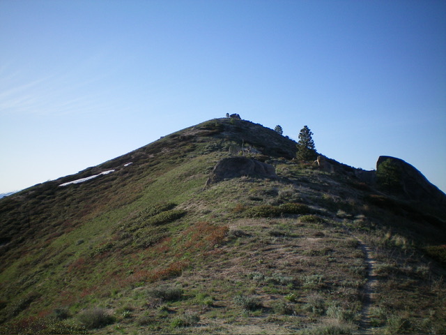
Hutton Peak (left of center) as viewed from the southeast. Livingston Douglas Photo
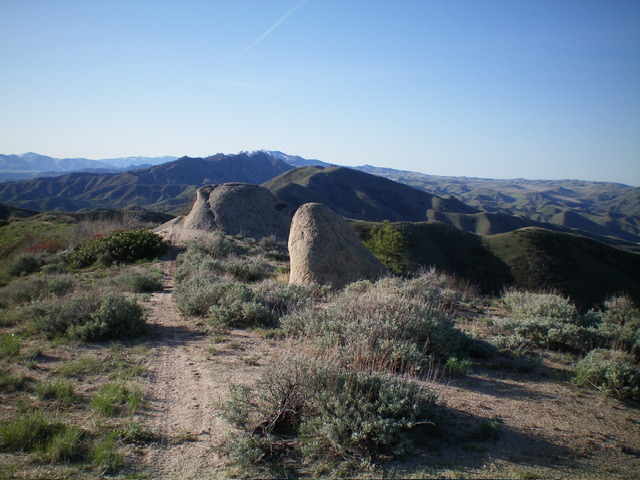
The summit area of Hutton Peak with Fiddler Benchmark in the distance. Livingston Douglas Photo
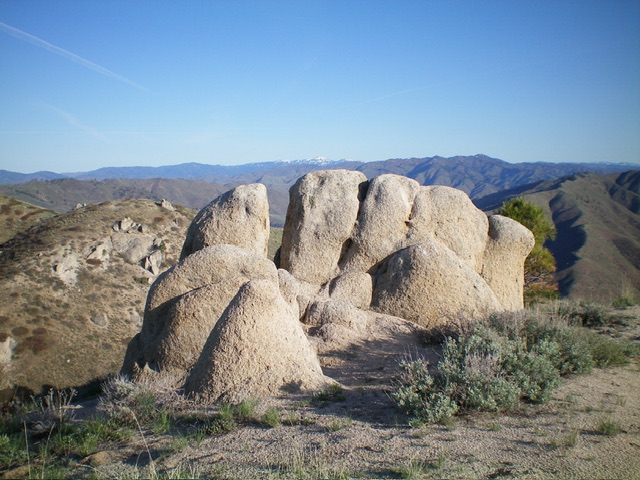
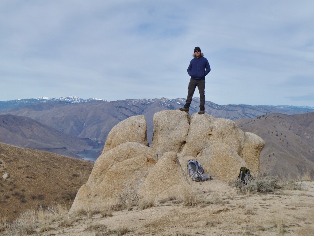
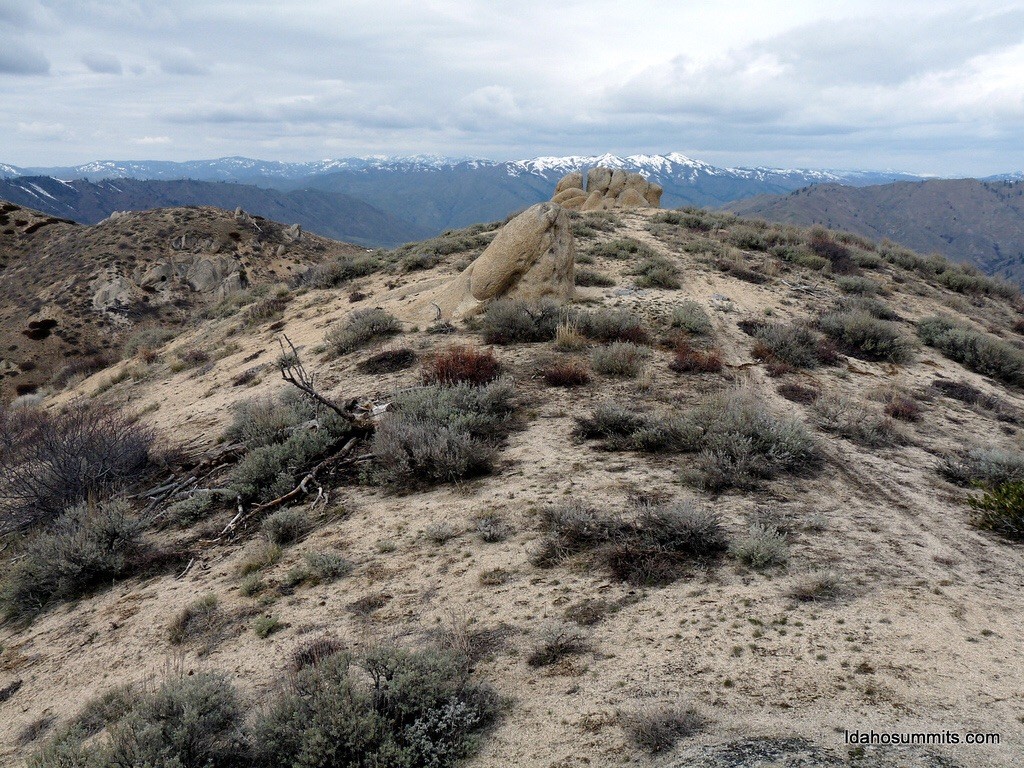
The summit boulders atop Hutton Peak. Livingston Douglas Photo
Ascending the peak’s west ridge, which can be reached from the Willow Creek Trailhead. From the trailhead, take the trail on the left that immediately climbs up out of the stream bottom. Follow the trail east until reaching the first ridge that climbs up to the peak’s west ridge.
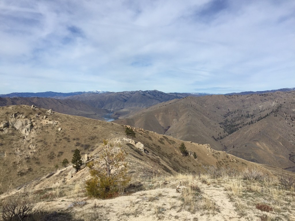
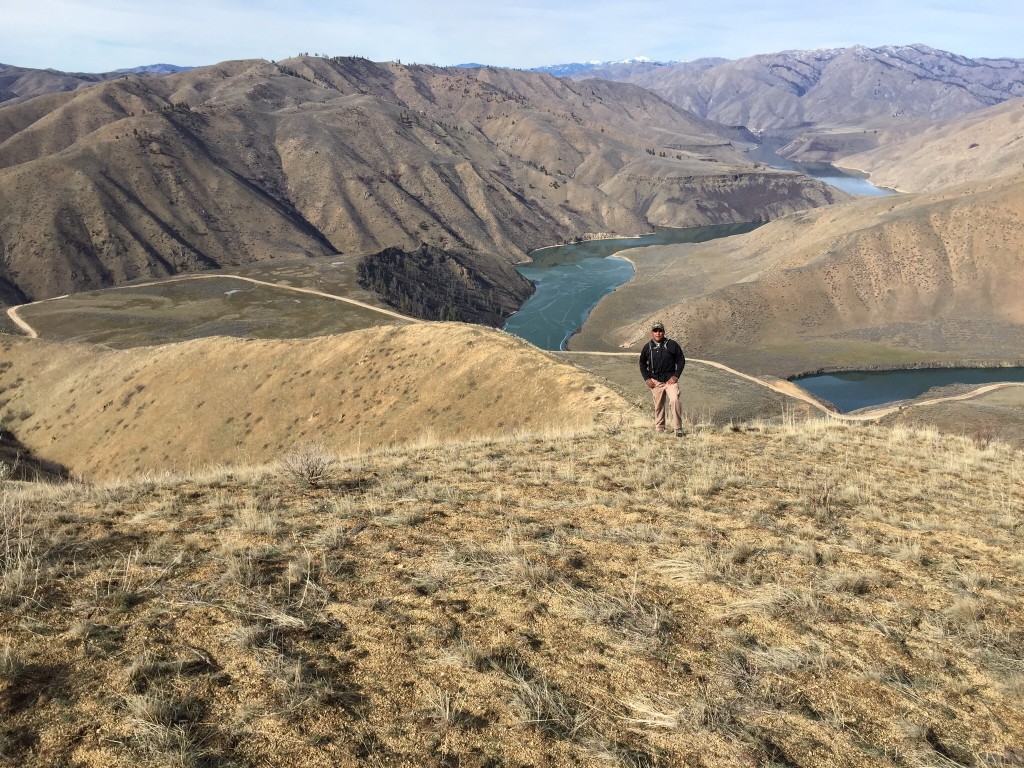
The west ridge is a bit of a roller-coaster walk but the views of the South Fork Canyon and the surrounding mountains are exceptional.
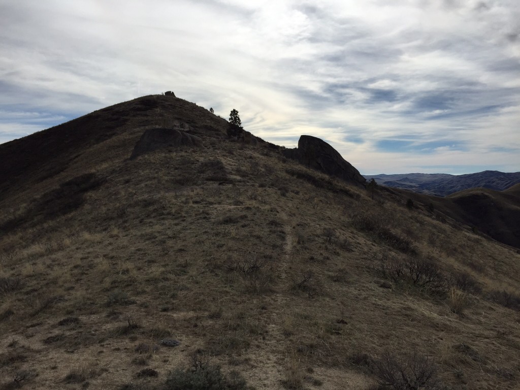
The final push to the summit
The high point of Hutton Peak (2/11/15). Gilbert Gallegos Photo
The summit of Hutton Peak. Dan Robbins Photo
Additional Resources
Regions: Boise Mountains->Danskin Mountains->WESTERN IDAHO
Mountain Range: Boise Mountains
Year Climbed: 2015
Longitude: -115.76893 Latitude: 43.53701