Elevation: 5,602 ft
Prominence: 502
This peak is not in the book. Published November 2023
Peak 5602 is a scrub hump that is located on a high ridgeline that separates Wagonhammer Creek from Little Fourth of July Creek in the Beaverhead Mountains. Due to private land, Peak 5602 is only publicly accessible via its west side from Wagonhammer Creek Trail. USGS North Fork
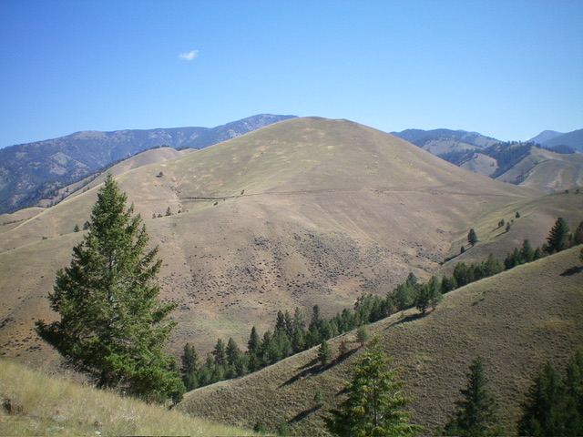
Peak 5602 as viewed from the southwest. Livingston Douglas Photo
Access
Same as for Peak 5362. This is the second leg of a 3-peak adventure that includes Peak 5362, Peak 5602, and Peak 5186. It covers 8.5 miles with 3,500 feet of elevation gain round trip.
Map Errors
FST-130 (on the east side of Wagonhammer Creek) is not at the mouth of a narrow, forested gully (as maps indicate) though it does exist at the head of the gully. FSR-072/Wagonhammer Creek Road ends after 0.2 miles up from US-93. The USGS topo map incorrectly shows FSR-072 continuing up Wagonhammer Creek but it is now only a foot trail (FST-137).No maps show the ridge road that covers much of the ridge traverse from Peak 5602 to Peak 5186.
West Ridge, Class 2
The Climb
From the signed trail junction of FST-130 and FST-137 at Wagonhammer Creek, hike briefly northeast up FST-137. Leave the trail to bushwhack across Wagonhammer Creek (a small stream) and enter a narrow, forested gully. Contrary to the USGS topo map, there is no trail in the gully. From the mouth of the gully, climb steeply south to reach the crest of the semi-open west ridge. This is a short but STEEP bushwhack (Class 3) up loose rock and thick brush/grass with a few pines mixed in.
Once on the crest of the west ridge, scramble southeast then east up the steep, narrow ridge in decent grass/scrub (with nearby pines) to reach open field grass higher up. Join FST-130 in a flat area just below 4,800 feet (the trail is mispositioned on the USGS topo map) and follow it east-southeast up the ridge to a departure point where the trail crests and leaves the ridge. Scramble east then northeast then north in easy field grass to reach the bare summit of Peak 5602. I built a summit cairn on the scree/gravel high point.
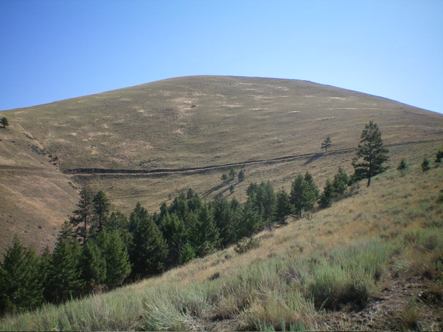
Peak 5602 as viewed from midway up the west ridge (my ascent route). Livingston Douglas Photo
South Ridge/West Spur, Class 2
The Descent
From the summit, descend south in steep field grass to a saddle with a fence row along it. Follow an old road bed (with a foot trail in it) all the way to the saddle at the base of the northeast ridge of Peak 5186. The road bed (mostly grass now) is handy because it skirts the right/north side of a series of ridge humps and stays level before descending to the critical saddle, where the road heads left/south down a gulch to the valley floor. The 4,900-foot saddle is the low point between Peak 5602 and Peak 5186. It concludes the second leg of today’s 3-peak adventure. Peak 5186 is up next.
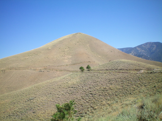
Peak 5602 as viewed from the south. Livingston Douglas Photo
Additional Resources
Regions: Beaverhead Range->EASTERN IDAHO
Mountain Range: Beaverhead Range
Longitude: -113.9220 Latitude: 45.4002