Elevation: 6,188 ft
Prominence: 368
This peak is not in the book. This peak is part of a multi-peak ridge traverse known as the Monument Gulch Triple Play. This traverse includes Peak 6188/Boyer Gulch Peak, Peak 6130/Middleman Peak, and Peak 6291/Monument Gulch Peak. I added a GPS track and photo. A 2-track road not shown on the USGS quadrangle leads nearly to the summit. Updated September 2020
Peak 6188 sits at the head of Boyer Gulch. It is one of three ranked summits that are mixed in with a plethora of other lower hills nearby. All three of these peaks are on the west side of Monument Gulch and are at the north end of the Bennett Hills. Be careful to avoid the [signed] private land on the left/southwest side of the ATV road as you hike up the final gulch in your approach to the southeast ridge of Peak 6188. USGS Dempsey Meadows
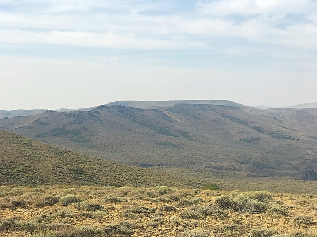
Boyer Gulch Peak as viewed from Middleman Peak.
Southeast Ridge, Class 2
Access—Monument Gulch/Bliss Road
This road is accessed from US-20 at Hill City. Like all roads in the Mount Bennett Hills, this road may be rough or muddy at times. From Hill City on US-20, drive south at the intersection signed for Camas Prairie Centennial Marsh (Swamp Road/1300W) for 3.1 miles to a road junction. Turn left/east onto Stokes Road/600S and drive 0.7 miles to an [unsigned] road junction at the base of Monument Gulch. This is Monument Gulch Road. Turn right/south drive 2.9 miles south up Monument Gulch Road to a cattle guard at a pass. Park in a large parking area just past the cattle guard on the right/east side of the road. You can even make this area work as a dispersed campsite.
The Climb
Please note that the Mountain Home BLM Map fails to show many of the roads that exist in the area of this climb. The USGS Dempsey Meadows quadrangle DOES show the roads/trails so the USGS topo map is a MUST for this climb. It even shows the main road (used for hiking much of the road mileage) in RED so it is particularly useful!
From the parking area at the pass, hike south down Monument Gulch Road for 1.2 miles to an unsigned road junction [While you can certainly drive this section of road because Monument Gulch Road in this area is quite smooth, this long hike/climb is a loop route that begins and ends at the pass where I was camped].
Go right/northwest on an ATV road/trail and remain on it as it gradually climbs a gulch then flattens out and turns west then southwest, dropping into a second gulch. The old road/trail then turns right/northwest and climbs the second gulch to reach a saddle just east of Peak 6188. After hiking about 3-3/4 miles on this ATV road/trail, leave the road before reaching the pass and hike up a weak 2-track jeep road (not shown on any maps) up a side gully of field grass and scrub to reach the southeast ridge.
Once on the southeast ridge, bushwhack north up through thick scrub and sagebrush to reach rocky Point 6113 (cairn here). Continue northwest along the torturous ridge for almost ½ mile. The mix of scrub and boulders is tedious and a series of false summits will unnerve you. The summit of Peak 6188 is at the very north end of the summit ridge. There is a modest cairn near the high point. This summit is clearly higher than most of the other hills in this area.
Northeast Face, Class 2
Access
Same as for the southeast ridge
The Descent
From the summit, descend directly northeast down the face to reach the ATV road/trail. While this descent is short, it is certainly not sweet. The thick sagebrush here is rather annoying. Hike south down the ATV road and, after it doglegs left/east and returns to a meadow with an unsigned [critical] road junction at the base of a broad gulch heading northeast, stop here. The next leg of this journey begins here—the climb of the south ridge of Peak 6130.
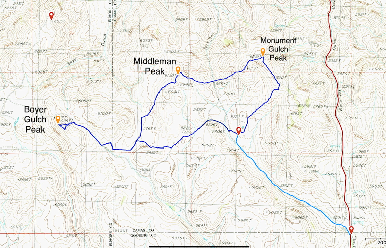
This GPS track documents my shorter version of Livingston Douglas’ Monument Gulch Triple Play. The dark blue loop is 8.0 miles with 1,325 feet of elevation gain. The light blue line covers 2.0 miles with 200 feet of elevation gain.
Additional Resources
Regions: Bennett Mountain Hills->WESTERN IDAHO
Mountain Range: Bennett Mountain Hills
Year Climbed: 2020
Longitude: -115.09969 Latitude: 43.21749