Elevation: 6,291 ft
Prominence: 528
This peak is not in the book. This peak is part of a multi-peak ridge traverse known as the Monument Gulch Triple Play. This traverse includes Peak 6188/Boyer Gulch Peak, Peak 6130/Middleman Peak, and Peak 6291/Monument Gulch Peak. I added a GPS track and photo. A 2-track road not shown on the USGS quadrangle leads nearly to the summit. Updated September 2020
Peak 6291 is the final, and highest, of three ranked summits at the north end of the Bennett Hills on the west side of Monument Gulch. It offers beautiful views of the ranch land to the north and, in many places, has sharp drops eastward to Monument Gulch. USGS Dempsey Meadows
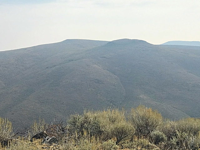
Monument Gulch Peak as viewed from Middleman Peak
Southwest Ridge, Class 2
Access—Monument Gulch/Bliss Road
This road is accessed from US-20 at Hill City. Like all roads in the Mount Bennett Hills, this road may be rough or muddy at times. From Hill City on US-20, drive south at the intersection signed for Camas Prairie Centennial Marsh (Swamp Road/1300W) for 3.1 miles to a road junction. Turn left/east onto Stokes Road/600S and drive 0.7 miles to an [unsigned] road junction at the base of Monument Gulch. This is Monument Gulch Road. Turn right/south drive 2.9 miles south up Monument Gulch Road to a cattle guard at a pass. Park in a large parking area just past the cattle guard on the right/east side of the road. You can even make this area work as a dispersed campsite.
The Climb
This climb is the final leg of a three-peak adventure involving Peak 6188, Peak 6130, and Peak 6291. From the narrow gap/pass at the base of the southwest ridge of Peak 6291, follow the south side of the fence row east up through sagebrush. Move to the north side of the fence row after a short distance in order to have easier scrub to maneuver through. The cattle fence eventually disappears in a gully. Continue scrambling up the wide open, rounded ridge to reach Point 6253. You may have thought that this is the summit but you were wrong. This is a false summit.
The true summit is another ¼ mile away to the northeast and you must drop a sizable 100 feet to a scrub-filled saddle and then climb a final ridge section east to reach the true summit. This summit is a gentle hump with short scrub and somewhat annoying ground talus. There are two cairns on the summit. A large cairn with a post in it at the north end of the summit cap and a smaller cairn at the high point in the center of the summit cap.
Southeast Ridge/East Shoulder, Class 2
Same as for the southwest ridge
The Descent
From the summit, follow the tedious, “chunky” (ground talus and clumpy scrub) terrain on the ridge southeast to a scrub-clogged saddle. From the unpleasant saddle, climb southeast up easier scrub to reach the six-foot cairn atop Point 6269. From here, descend south and cross the upper reaches of a gully. Cross the gully and follow a cattle/game trail to contour onto the east shoulder. Follow the right/south side of the shoulder in a gully of tall, thick sagebrush (with gaps and some minor cattle trails), aiming for the pass at the head of Monument Gulch and your parking/camping spot. Cross a final cattle fence to reach Monument Gulch Road and the parking/camping area.
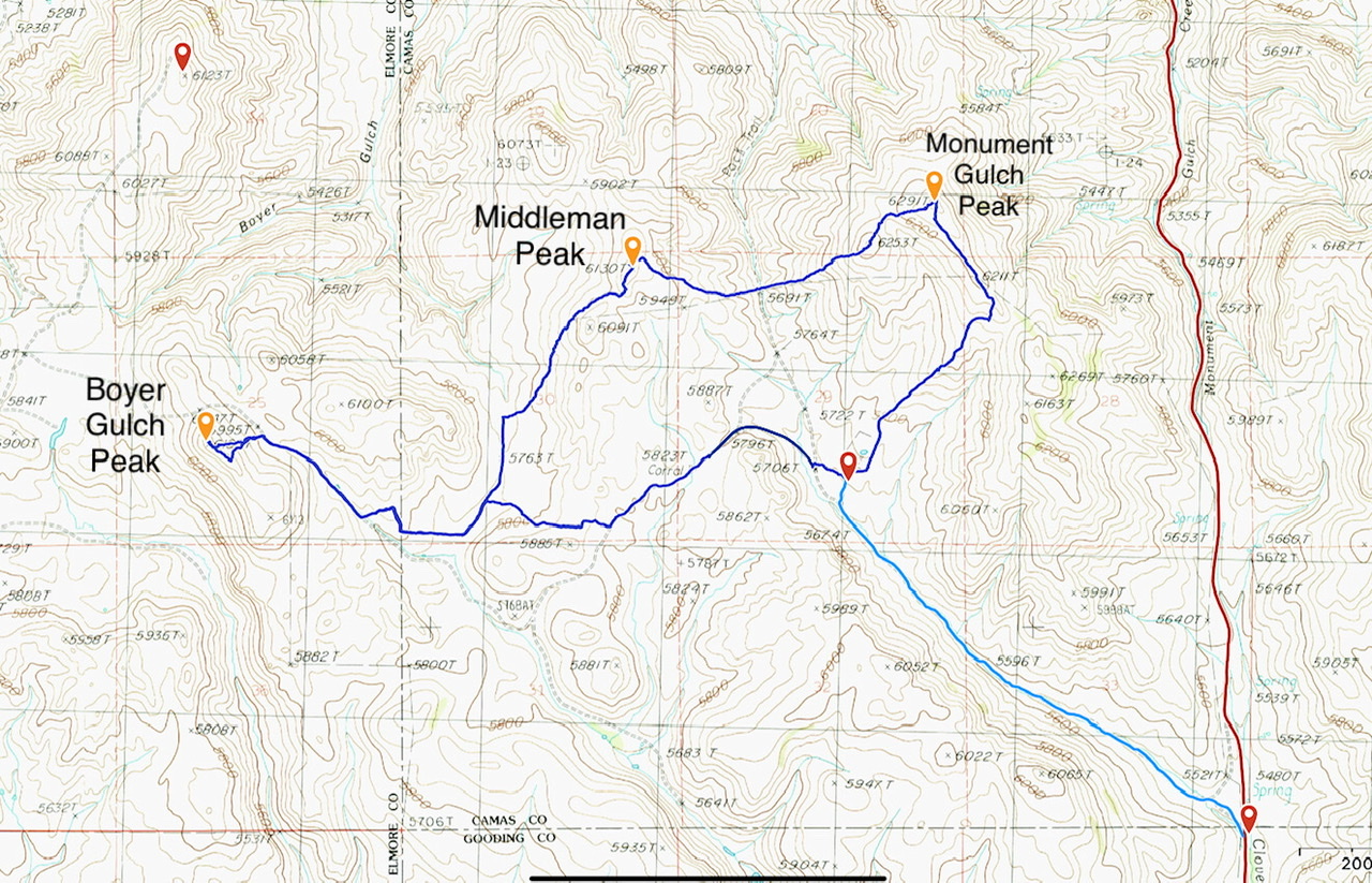
This GPS track documents my shorter version of Livingston Douglas’ Monument Gulch Triple Play. The dark blue loop is 8.0 miles with 1,325 feet of elevation gain. The light blue line covers 2.0 miles with 200 feet of elevation gain.
Additional Resources
Regions: Bennett Mountain Hills->WESTERN IDAHO
Mountain Range: Bennett Mountain Hills
Year Climbed: 2020
Longitude: -115.04939 Latitude: 43.22959