Elevation: 6,218 ft
Prominence: 318
This peak is not in the book. Livingston Douglas climbed this peak from Peak 6850. His Southwest Shoulder Route is set out below. Updated November 2022
Peak 6218 is on a long north/south trending ridgeline that separates Maxfield Creek from Thompson Creek. USGS Deer Mountain
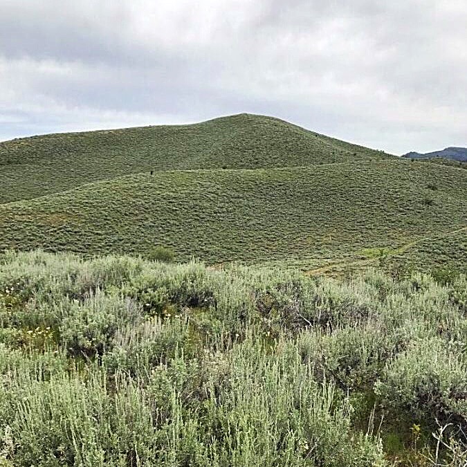
Peak 6218. Margo Mandella Photo
Access
FS-069 climbs up Hawks Gulch and then drops into Maxfield Creek. The road fords Maxfield Creek at a point where it forms a broad puddle. While the bottom of the puddle is rocky, a 4WD and caution are recommended. After the creek crossing, the road quickly passes by Peak 6394 on the right and then reaches the top of the Peak 6218’s south ridge. At this point, FS-069 meets an unnumbered road that follows the peak’s south ridge to the summit. See the Southern Soldier Mountains Access page for details on reaching FS-069.
South Ridge, Class 1
The unnumbered road leads to the summit in 1.7 miles with just over 300 feet of elevation gain. While it is passable to 4WDs, it is not clear whether the road is open for private vehicle use because the road does not show up on either the Forest Service Topo Map or the Motor Vehicle Use Map. The road ends about 0.4 miles from the top. From that point, the only obstacle between you and the summit is the thick sagebrush. In any event, it is a short walk to the summit from either FS-069 or the end of the unnumbered road.
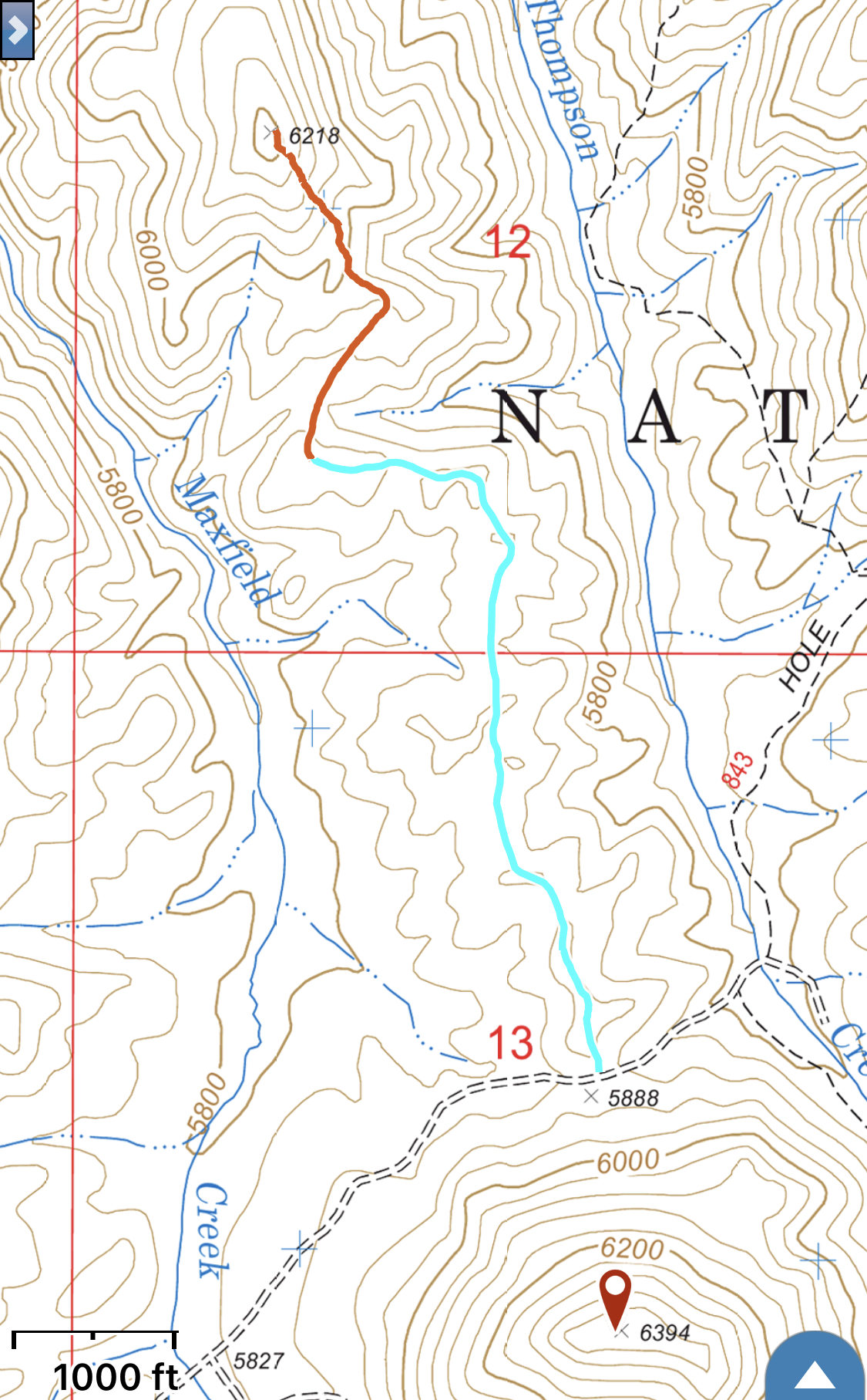
My GPS track. We drove the blue section which was 1.0 mile and walked the remaining distance of 0.7 miles.
Southwest Shoulder, Class 2 by Livingston Douglas
The Ascent
From Maxfield Creek at the base of the southwest shoulder, climb up the obvious shoulder/ridge that heads left-ish/northeast to the summit of Peak 6218. The shoulder is a mess of thick, steep sagebrush early on but becomes easier higher up as the sagebrush is more gapped. The summit of Peak 6218 is a rocky outcrop with a torn-down cairn.
Additional Resources
Regions: Soldier Mountains->WESTERN IDAHO
Mountain Range: Soldier Mountains
Year Climbed: 2019
Longitude: -115.09849 Latitude: 43.43719