Elevation: 6,260 ft
Prominence: 280
This peak is not in the book. Published November 2021
Peak 6260 is a minor hill that is located just above Jeffs Creek and due north of the more rugged Peak 6643. It is a short climb from Jeffs Flats Road/FSR-079. USGS Pats Creek
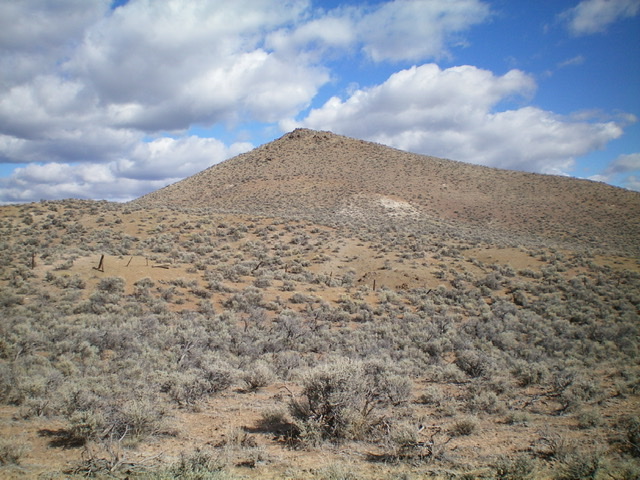
Peak 6260 (hump in mid-ground) as viewed from the east.
Access
Same as for Peak 6340. This is the second leg of a 3-peak adventure that includes Peak 6340, Peak 6260, and Peak 6643. It covers 5.5 miles with 2,350 feet of elevation gain round trip.
East Face, Class 2
The Climb
From the 5,820-foot connecting saddle with Peak 6340, bushwhack west up an easy sagebrush slope, staying just right/north of a gully. Reach the elongated north-south summit ridge crest and head right/north to reach the high point area. The high point is the tallest of three large boulders/outcrops that protrude from the ground. I built a summit cairn on one of the outcrops.
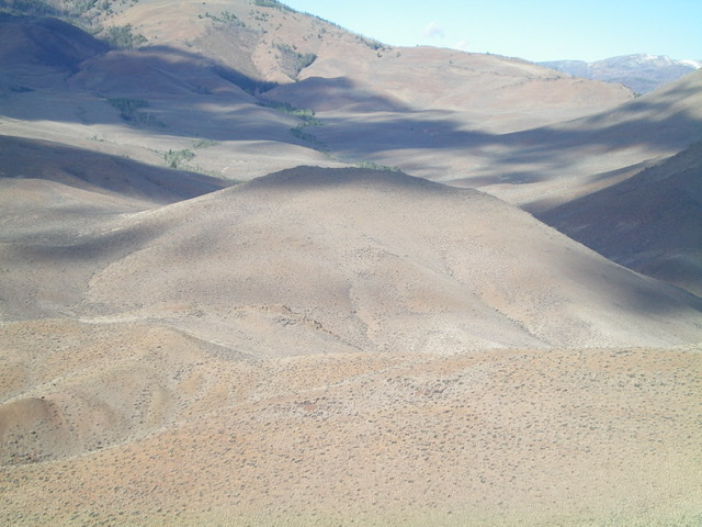
Looking up the east face of Peak 6260 (just left of center). Livingston Douglas Photo
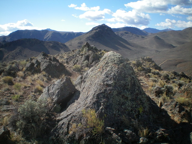
The summit of Peak 6260 with Peak 6643 in the distance. Livingston Douglas Photo
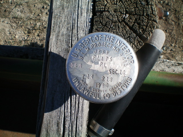
The Jeffs Flats benchmark in a cattle cistern at the base of the east face. First time I’ve ever found a benchmark in a cistern! Livingston Douglas Photo
South Face, Class 2
The Descent
From the summit, follow a rock-and-sagebrush ridge crest south. The ridge morphs into a face. Descend south down the face on a sagebrush slope and cross two dry gullies to reach the base of a dry, easy sagebrush gully that leads southeast up onto the north ridge of nearby Peak 6643. You will cross Jeffs Flats Road just before reaching the base of this gully. This concludes the second leg of today’s 3-peak journey. Rocky Peak 6643 is up next.
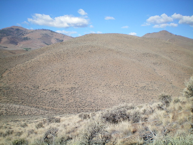
The south face of Peak 6260. The summit is not yet in view. Livingston Douglas Photo
Additional Resources
Regions: Eastern Salmon River Mountains->Salmon River Mountains->Southeast Corner Peaks->WESTERN IDAHO
Mountain Range: Eastern Salmon River Mountains
Longitude: -114.31709 Latitude: 44.55429