Elevation: 6,340 ft
Prominence: 520
This peak is not in the book. Published November 2021
Peak 6340 is a hill that sits above the confluence of Mill Creek and Challis Creek, northwest of Challis. It is a short climb from either Mill Creek Road or Jeffs Flats Road. USGS Pats Creek
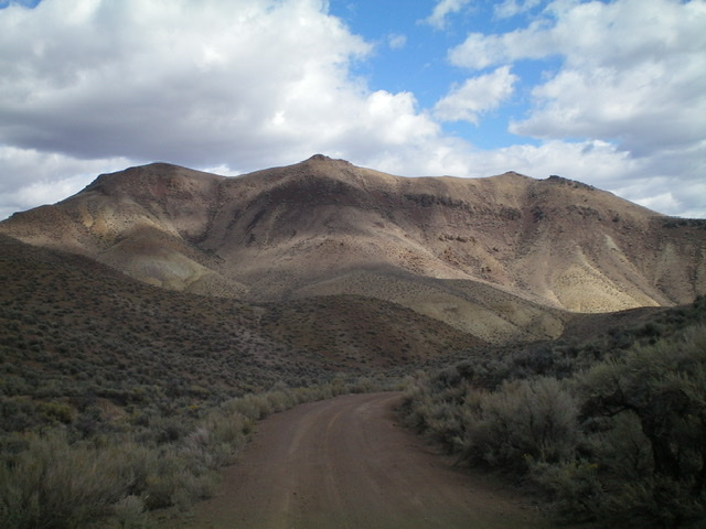
Peak 6340 as viewed from Jeffs Flats Road to its southwest. The summit is in dead center. Livingston Douglas Photo
Access
This is the first leg of a 3-peak adventure that includes Peak 6340, Peak 6260, and Peak 6643. It covers 5.5 miles with 2,350 feet of elevation gain round trip.
From US-93 at the north end of Challis, turn left/west onto [signed] Clinic Avenue. Follow Clinic Avenue as it goes west briefly, then jogs north briefly, then heads west to a “T” junction with [unsigned] Challis Creek Road. This junction is 0.4 miles from US-93. Turn right/north onto Challis Creek Road and drive 5.2 miles to a poorly-signed junction with Mill Creek Road/FSR-079. Turn left/south onto well-graded Mill Creek Road and drive 1.2 miles to a signed junction with Jeffs Flats Road/FSR-079. Park at this junction (5,450 feet). Yes, Mill Creek Road becomes Jeffs Flats Road here. The road that continues up Mill Creek is a private road to a ranch and is gated/posted.
South Ridge, Class 2
The Climb
The road junction sits at the toe of the [obvious] south ridge of Peak 6340. From the junction, follow a fence row north up the crest of the ridge. The fence row ends quickly. Continue up the steep, loose, gravel/dirt and scree patches of the south ridge. Use any embedded rock or tall scrub to improve your traction. Higher up, the ridge steepens and is loose gravel. This is the crux of the climb. Once atop this steep section, you reach a rocky ridge outcrop and much flatter, easier terrain. The ridge bends left-ish/northwest here. Drop 30 vertical feet to a minor saddle then scramble up easy, short scrub to reach the summit. The summit of Peak 6340 is a combination of rock and scrub and has two summit cairns.
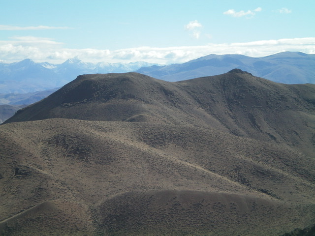
Peak 6340 as viewed from the west. The summit is right of center. Livingston Douglas Photo
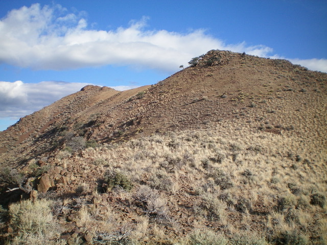
The upper section of the south ridge. The summit is left of center. Livingston Douglas Photo
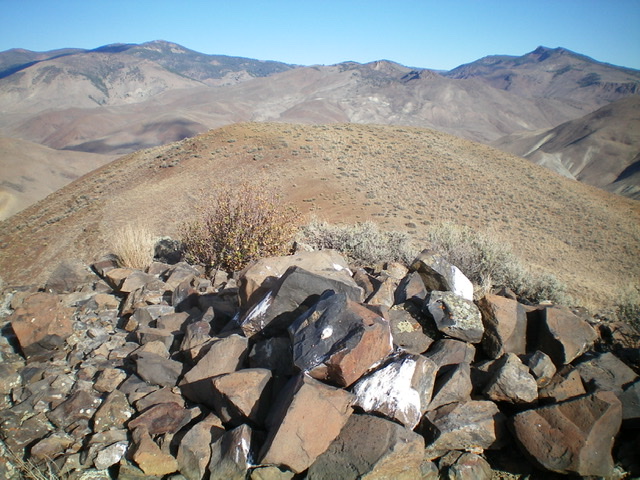
Looking northwest from the summit of Peak 6340. Livingston Douglas Photo
Southwest Ridge, Class 2
The Descent
From the summit, descend northwest to a minor saddle then up easy scrub to the top of Point 6323, which IS lower than the true/southeast summit, according to my altimeter. From Point 6323, descend west-southwest down steep, loose scree/gravel (initially) then sagebrush to a saddle. From this saddle, scramble west up over a sagebrush hump. From that hump, head left/south to a minor saddle. From there, go southwest up over a minor hump and continue southwest down to a final saddle with a cattle cistern in it (and a USGS benchmark!). An old 2-track road crosses this saddle and connects two gullies. This 5,820-foot saddle is the connecting saddle between Peak 6340 and Peak 6260. It concludes the first leg of today’s 3-peak journey. Peak 6260 is up next.
Additional Resources
Regions: Eastern Salmon River Mountains->Salmon River Mountains->Southeast Corner Peaks->WESTERN IDAHO
Mountain Range: Eastern Salmon River Mountains
Longitude: -114.29659 Latitude: 44.55701