Elevation: 6,643 ft
Prominence: 383

This peak is not in the book. Published November 2021
Peak 6643 is a rugged, rocky outcrop amongst a sea of sagebrush hills that separate Jeffs Creek from Mill Creek in the Eastern Salmon River Mountains. It is a short climb from Jeffs Flats Road/FSR-079. USGS Pats Creek
Peak 6643 as viewed from the north. The rocky summit is just right of center. Livingston Douglas Photo
Access
Same as for Peak 6340. This is the third leg of a 3-peak adventure that includes Peak 6340, Peak 6260, and Peak 6643. It covers 5.5 miles with 2,350 feet of elevation gain round trip.
North Ridge, Class 3
The Climb
From the base of the lowest gully that separates Peak 6260 from Peak 6643, scramble up a prominent gully on the northwest side of Peak 6643. The gully climb is through easy, gapped sagebrush and leads southeast up onto the north ridge at a saddle (6,220 feet). Follow the ridge southwest then south up steep-ish scrub and embedded boulders/talus with some rocky ridge outcrops along the way. Cross to the left/east side of the ridge higher up then climb back up onto the rocky, very steep ridge crest (Class 3). Continue climbing up the ridge, cross over a rocky ridge point, and drop 25 vertical feet to a minor notch. From there scramble south up to the small, rocky summit perch. The summit has a small cairn atop the highest boulder.
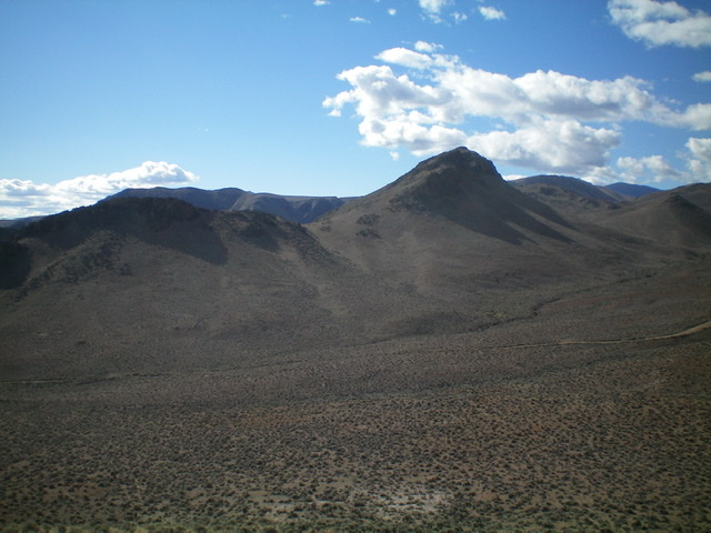
The ascent gully to the north ridge is in dead center and rises to the obvious saddle on the ridge. Livingston Douglas Photo
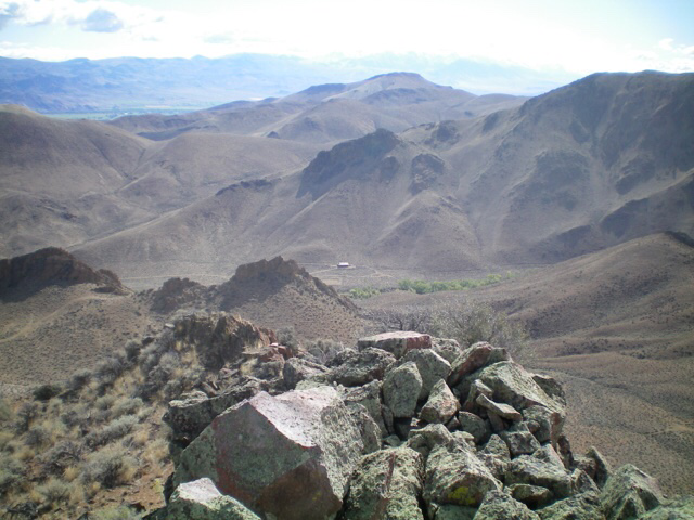
Looking east from the summit down into the Mill Creek Valley. Livingston Douglas Photo
East Ridge/East Face, Class 3
The Descent
From the summit, descend the rocky east ridge (then east face) to a 2-track road. The east ridge requires a Class 3 downclimb of a headwall high up. After descending a section of steep talus/scree, you will be relieved to reach the gentler sagebrush slopes below. Bushwhack through the sagebrush to reach the 2-track road at a junction in a saddle. Follow the 2-track road left/north until it intersects Jeffs Flats Road. Go right/east onto Jeffs Flats Road and follow it back to its junction with Mill Creek Road and your parked vehicle.
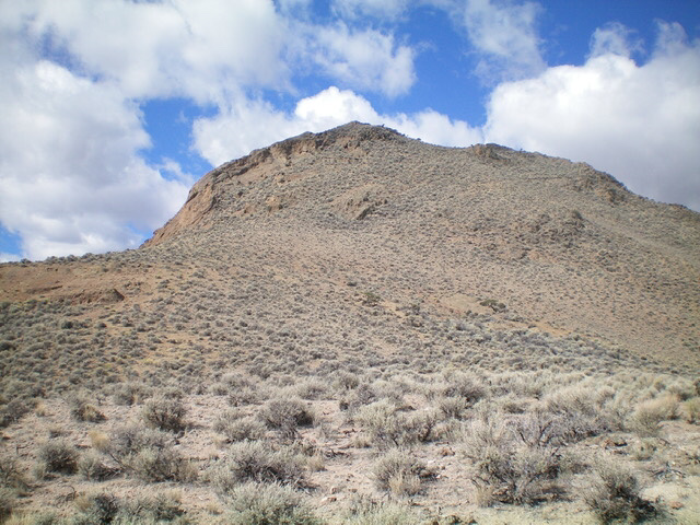
The steep east ridge/face of Peak 6643 as viewed from its base. This was my descent route. Livingston Douglas Photo
Additional Resources
Regions: Eastern Salmon River Mountains->Salmon River Mountains->Southeast Corner Peaks->WESTERN IDAHO
Mountain Range: Eastern Salmon River Mountains
Longitude: -114.31589 Latitude: 44.54159