Elevation: 6,775 ft
Prominence: 315
This peak is not in the book. Published November 2020
Peak 6775 is one of four ranked summits on a ridgeline that separates Fall Creek from Pritchard Creek in the Caribou Range northwest of Palisades Reservoir. This climb is part of a four-peak adventure that includes Peak 6958, Peak 7100, Peak 7034, and Peak 6775. This is mostly open country but has patches of aspen forests to navigate. USGS Conant Valley
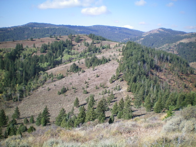
Peak 6775 and its northeast ridge as viewed from the east. The ridge is more tedious than it appears in this photo. Livingston Douglas Photo
Access
Same as for Peak 6958. This is the final leg of a four-peak journey that begins along Fall Creek Road.
Northeast Ridge, Class 2
The Climb
From the 6,420-foot connecting saddle with Peak 7034, follow the left/south side of a fence row to reach the summit of Peak 6775. There is an occasional foot path alongside the fence. The terrain is open but is somewhat thick with brush and sagebrush. It is not a whole lot of fun. The summit had a minimal cairn so I built a much nicer summit cairn.
Southeast Ridge, Class 2
The Descent
From the summit, descend southeast on the brushy ridge. Find a good cattle trail pretty high up and descend it most of the way down to FSR-077/Fall Creek Road. The lower section of the ridge is easy, open scrub and the final drop to the road has a cattle trail through the thick brush/sagebrush. When you reach Fall Creek Road, follow it northeast for 2.3 miles to the old mining road and your parked vehicle.
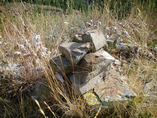
The newly-built summit cairn atop Peak 6775. Livingston Douglas Photo
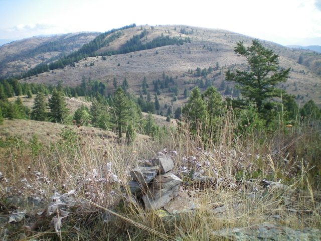
Looking northeast from the summit of Peak 6775. Livingston Douglas Photo
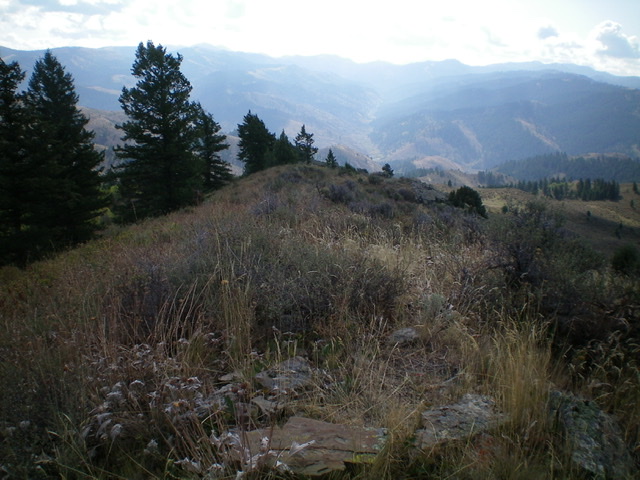
Looking down the southeast ridge (descent route) from the summit of Peak 6775. It is a brushy mess but a good cattle trail will soon “make your day.” Livingston Douglas Photo
Additional Resources
Regions: Caribou Range->SOUTHERN IDAHO
Mountain Range: Caribou Range
Longitude: -111.47819 Latitude: 43.41429