Elevation: 7,100 ft
Prominence: 680
This peak is not in the book. Published November 2020
Peak 7100 is one of four ranked summits on a ridgeline that separates Fall Creek from Pritchard Creek in the Caribou Range northwest of Palisades Reservoir. This climb is part of a four-peak adventure that includes Peak 6958, Peak 7100, Peaks 7034, and Peak 6775. This is mostly open country but has patches of aspen forests to navigate. USGS Conant Valley
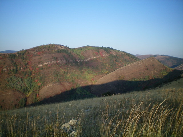
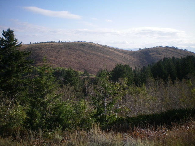
Peak 7100 as viewed from the northeast. The summit is the right hump in dead-center. Livingston Douglas Photo
Access
Same as for Peak 6958. This is the second leg of a four-peak journey that begins along Fall Creek Road.
Northeast Ridge, Class 2
The Climb
From the 6,580-foot connecting saddle with Peak 6958, bash southwest up through a dense patch of aspens to reach open terrain on the left/southeast side of the ridge. Skirt just left/southeast of a ridge hump then drop to a small saddle. Bushwhack southeast then south up through a mix of aspens and maples to reach the final push to the summit ridge. A very thick patch of aspens and willows blocks access. Push through it to reach the open, easy right/southwest side of the summit ridge of Peak 7100. A short walk left/southeast brings you to the cairned high point.
Peak 7100 and its aspen-clogged northeast ridge, as viewed from Peak 6958 to the northeast. Livingston Douglas Photo
The summit area of Peak 7100, looking northwest. Note the contrast between the open terrain (left side) and the thick aspens/brush (right side). Livingston Douglas Photo
Southwest Ridge, Class 2
The Descent
The ridge traverse from Peak 7100 to Peak 7034 is a weaving, up-and-down, contorted mess. Navigation is important in this stretch so be alert and have your compass ready. There are patches of forest that completely block your visibility. From the summit of Peak 7100, descend west then southwest through thick sagebrush to reach an aspen-clogged, narrow saddle at 6,820 feet. From this saddle, head south up through more aspens then some open terrain then more thick aspens to reach a nice open ridge crest just below, and east of, Point 6986.
Scramble west up the easy, open ridge crest to Point 6986. From there, descend southwest then west over a small hump. Head west then southwest then south in open terrain (more sagebrush) to reach a small saddle (6,500 feet) below the north ridge of Peak 7034. This concludes the second leg of today’s four-peak journey. Peak 7034 is up next.
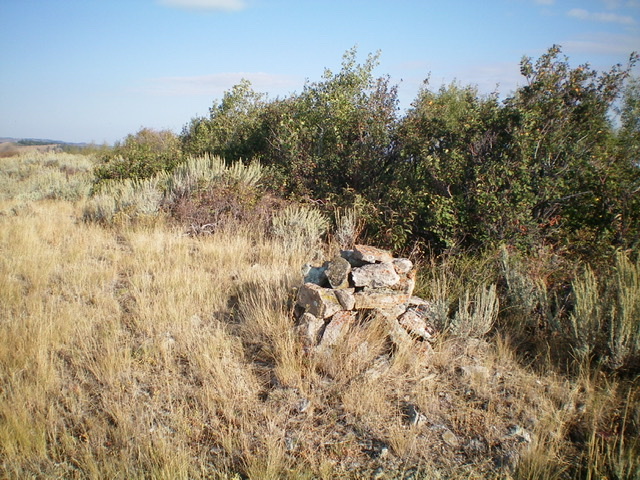
The nice summit cairn atop Peak 7100, looking southeast at Point 7040+. Livingston Douglas Photo
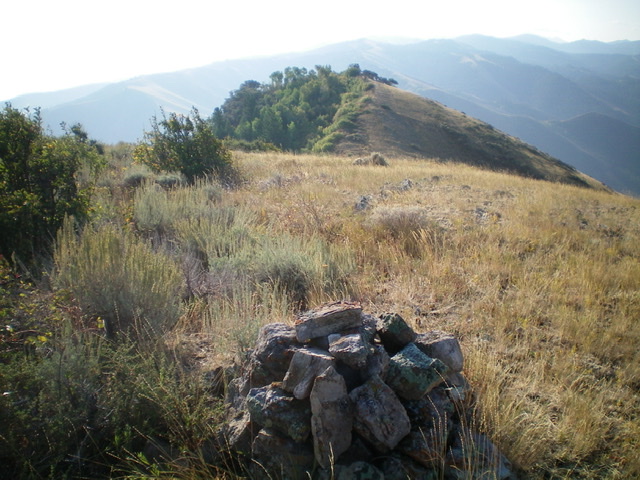
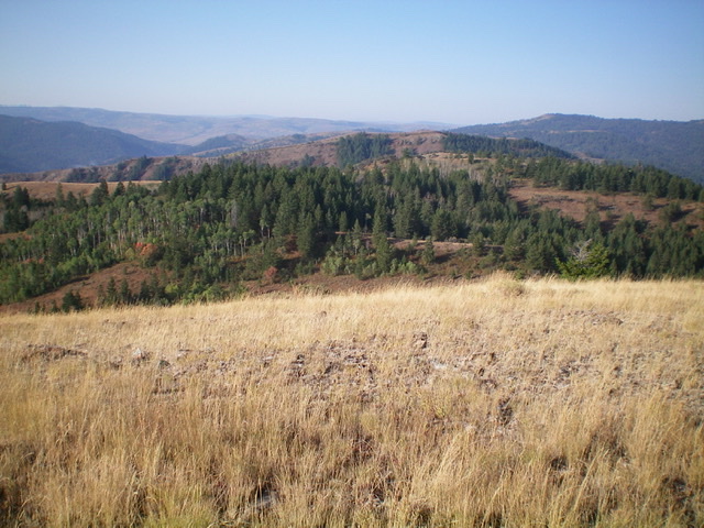
Peak 7100 as viewed from the southwest (summit is left of center). Notice how the southwest face is open scrub/brush, quite a contrast to its heavily-forested northeast face. Livingston Douglas Photo
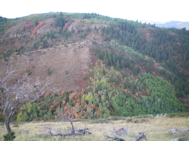
Looking southwest at the up-and-down ridgeline to Peak 7034. It is a mix of forest and open areas. Livingston Douglas Photo
Additional Resources
Regions: Caribou Range->SOUTHERN IDAHO
Mountain Range: Caribou Range
Longitude: -111.44169 Latitude: 43.42979