Elevation: 6,860 ft
Prominence: 322
This peak is not in the book. Livingston Douglas added the Northwest Ridge Route to this entry. Updated November 2022
Peak 6860 is located northwest of Sheep Point. This peak has a rocky summit outcrop that requires a short scramble. While the peak is a quick hike from the Featherville Highway (FS-484) which follows its northern slopes, the easiest route is actually from the southeast. USGS Deer Mountain
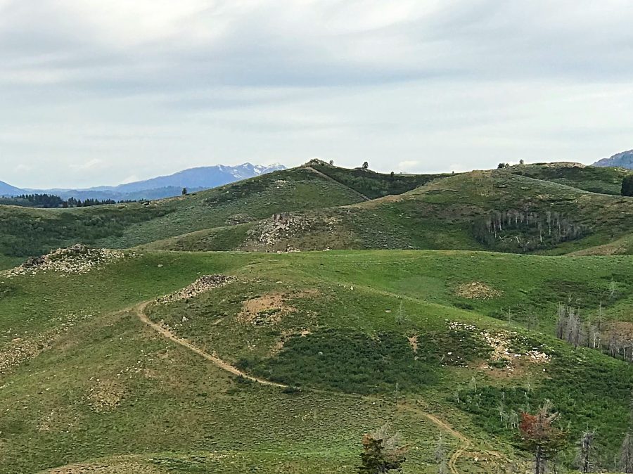
Peak 6860 as viewed from the southeast. The cut running toward the summit is a bulldozer track made to install a range fence.
Access
To access Peak 6860, see the Southern Soldier Mountains Access page. See also the Sheep Point page, which includes a GPS track for ascending the peak. Follow FS-484 and the unnumbered road around to the peak’s southeast side and park.
Bulldozer Scar, Class 3
From your parking spot, the fence line running up toward the summit cannot be missed. Follow the bulldozer scar uphill until its end just below the summit rocks. Turn right and hike up to the east side of the rocks. Scramble up the easy Class 3 rocks to the top and enjoy the view from the summit!
Northwest Ridge Route by Livingston Douglas
Access
From its well-signed “trailhead,” drive up Chimney Creek Road for 4.0 miles to a “T” junction. Turn right/east onto [signed] FSR-484 and drive 1.4 miles to a road junction at a shoulder crossing. Park here (6,580 feet). GPS coordinates: 43⁰26’15”N, 115⁰00’25”W.
Northwest Ridge, Class 3
The Climb
From the shoulder crossing, bushwhack southeast up through sagebrush onto a hump. Drop 30 vertical feet southeast to a minor saddle then contour southeast to a saddle to skirt Point 6839. This contouring is in somewhat-thick sagebrush. Once on the ridge, scramble south to the beautiful, rocky summit. The summit boulders are Class 3 and have sagebrush mixed in.
Additional Resources
Regions: Soldier Mountains->WESTERN IDAHO
Mountain Range: Soldier Mountains
Year Climbed: 2019
Longitude: -115.00529 Latitude: 43.43119