Elevation: 7,112 ft
Prominence: 332
This peak is not in the book. Published November 2023
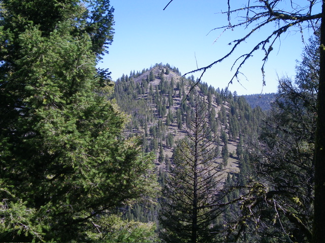
Peak 7112 is the middle of three ranked summits that sit on the southeast section of Porphry Ridge in the Yellowjacket Mountains. It can be climbed directly from FSR-112 to its southwest or in combination with nearby Peak 7112 and Peak 7220. USGS Blackbird Mountain
Peak 7112 as viewed from the southwest. Livingston Douglas Photo
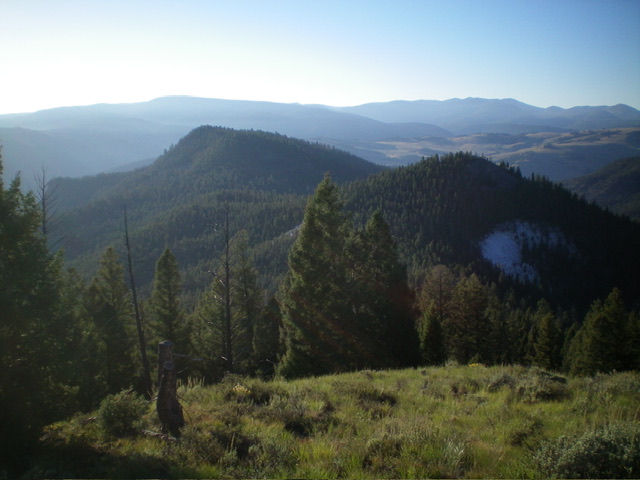
Peak 7220 (left) and Peak 7112 (right) as viewed from Peak 7248 to the northwest. Livingston Douglas Photo
Access
Same as for Peak 7248. This is the second leg of a 3-peak adventure that includes Peak 7248, Peak 7112, and Peak 7220. It covers 5.0 miles with 2,225 feet of elevation gain round trip.
Map Errors
The USGS topo map shows a 4WD road that crosses PorphryRidge between Peak 7112 and Peak 7220. That road no longer exists, though some of the old road bed remains in a few spots near the saddle.
Northwest Ridge, Class 2
The Climb
Bushwhack across the elongated, 6,780-foot connecting saddle through copious deadfall to reach the base of the northwest ridge. Climb southeast up the forested, rounded ridge to reach the edge of a rocky talus slope on the right/west side of the ridge crest. Scramble briefly up the firm talus to reach the small, open summit. The summit had a torn-down cairn on the rocky summit outcrop so I rebuilt it and stuck a tree branch in it.
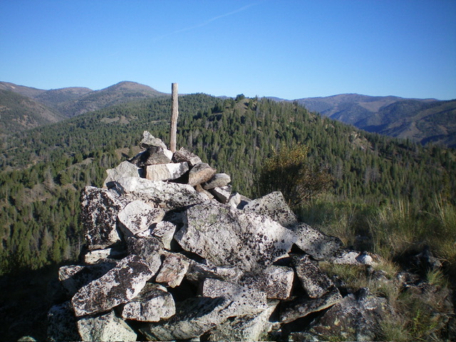
The summit cairn atop Peak 7112 with Peak 7248 in the distance (mid-ground). Livingston Douglas Photo
East Ridge, Class 2
The Descent
From the summit, descend northeast then east through a semi-open pine forest. Skirt the right/south side of a ridge hump on a decent elk trail that leads down to a ridge saddle at 6,700 feet. There is no 4WD road passing through the saddle as the USGS topo map indicates. This is the connecting saddle with Peak 7220. It concludes the second leg of today’s 3-peak adventure. Peak 7220 is up next.
Additional Resources
Regions: Eastern Salmon River Mountains->Salmon River Mountains->WESTERN IDAHO->Yellowjacket Mountains
Mountain Range: Eastern Salmon River Mountains
Longitude: -114.3612 Latitude: 45.0271