Elevation: 7,741 ft
Prominence: 441
This peak is not in the book. Published July 2022
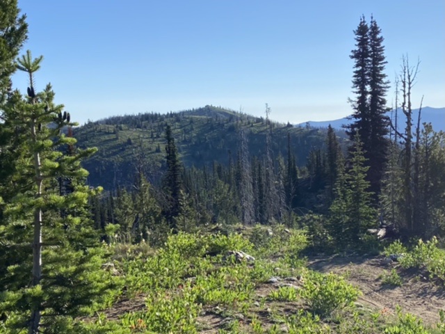
Nut Basin Lookout is the northwesternmost peak on a the ridge system that includes Southwest Butte. The peak was used as a fire lookout as early as 1915. A structure was constructed on the summit in 1927. The structure was destroyed in 1957. As you would expect, the view is massive, especially to the north, east, and south. USGS John Day Mountain
Nut Basin Lookout as viewed from the east slopes of Southwest Butte
Access and Route, Class 1
A 4WD road leads to the summit via the peak’s west ridge. This short road begins just north of the Southwest Butte trailhead. There are two options for reaching this road. Primary access is via US-95.
Western Approach. From the US-95 Slate Creek junction (19 miles north of Riggins), turn onto Slate Creek Road. This road is on the north end of the developed area that includes the Slate Creek Ranger Station and a couple dozen private homes at the mouth of Slate Creek. Follow the road for 0.3 miles where the actual Slate Creek Road merges to the left. Stay on the pavement (to the right) and continue for 0.3 mile to the Nut Basin Road/FSR-441. Turn east on Nut Basin Road and climb out of the canyon. Continue for approximately 17 miles on Nut Basin Road to the point just before the road reaches the top of the peak’s west ridge. Turn left and follow the road to the summit.
Southern Approach. From Riggins, go east on Salmon River Road for 9.5 miles to the mouth of Allison Creek. Turn left onto Allison Creek Road/FSR-221 and follow it for 16.2 miles to the trailhead. There are a couple of intersections to be aware of. About 3.0 miles after the road leaves the bottom of Allison Creek, turn left onto FSR-535. After nearly 4.0 miles, merge left (continue straight) onto FSR-441 and continue to the Southwest Butte trailhead. This will be about 0.1 mile before the turnoff to the Nut Basin high point. Also see Southwest Clearwater Mountains Access Points.
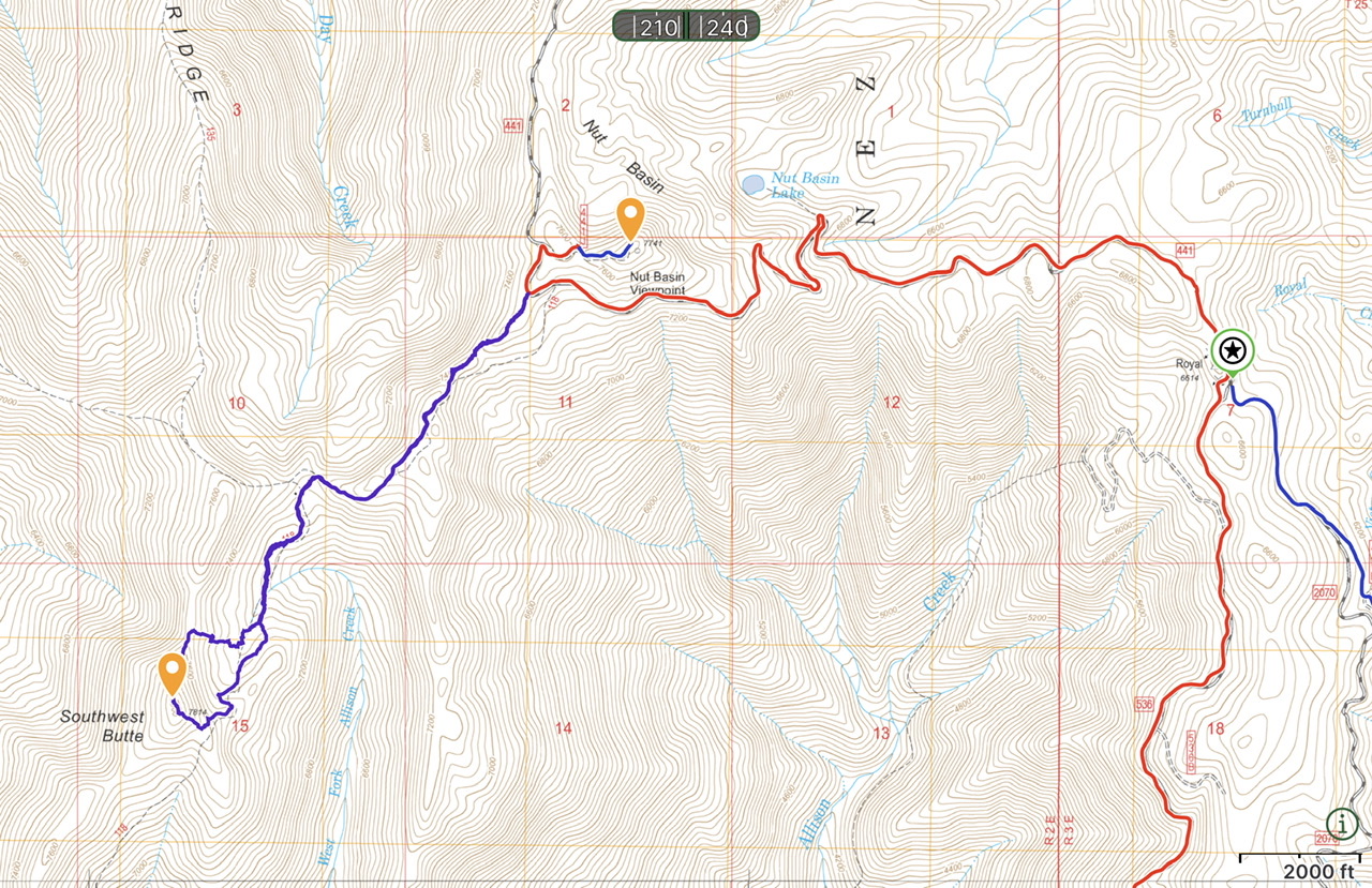
My GPS tracks for Southwest Butte and Nut Basin Lookout. My route was 4.4 miles with 1,305 feet of elevation gain round trip.
Additional Resources
Mountain Range: Southern Clearwater Peaks
Year Climbed: 2022
Longitude: -116.17409 Latitude: 45.52819