Elevation: 7,161 ft
Prominence: 381
This peak is not in the book. Published January 2023
Peak 7161 is a ranked ridge hump on the long northwest ridge of the Pleasantview Hills HP (7,420 feet). It sits above West Elkhorn Canyon to its north. Peak 7161 is most easily climbed from BLM-657 and its southeast ridge. USGS Sheep Creek Spring
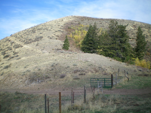
Peak 7161 and its southeast ridge (coming at the camera), my descent route. Livingston Douglas Photo
Access
Same as for Peak 7092. This is the second leg of a 3-peak adventure that includes Peak 7092, Peak 7161, and the Pleasantview Hills HP (John Evans Mountain).
Map Errors
There is no National Forest map for this area. The USGS topo map fails to show many of the old 2-track roads on the ridges in this area, two of which were very helpful in this 3-peak journey.
Southwest Ridge, Class 2
The Climb
From the 6,524-foot connecting saddle with Peak 7092, follow an old, dilapidated fence row (shown on the USGS topo map) northeast up the southwest ridge to Point 7024 in reasonable sagebrush with a cattle trail (of sorts) near the fence row early on. To reach the top of Point 7024, cross under the stiff, high cattle fence (yes, the fence is maintained well higher up) just right/southeast of the summit and walk a short distance to the bare summit.
From Point 7024, follow a foot path eastward alongside the left side of the fence row down to a saddle, up over a ridge hump, then down to another saddle. At this second saddle, the fence row leaves the ridge and heads east to another saddle. Leave the fence row here and bushwhack northeast up easy scrub to reach the bare summit of Peak 7161. The summit had a large, torn-down cairn which I rebuilt.
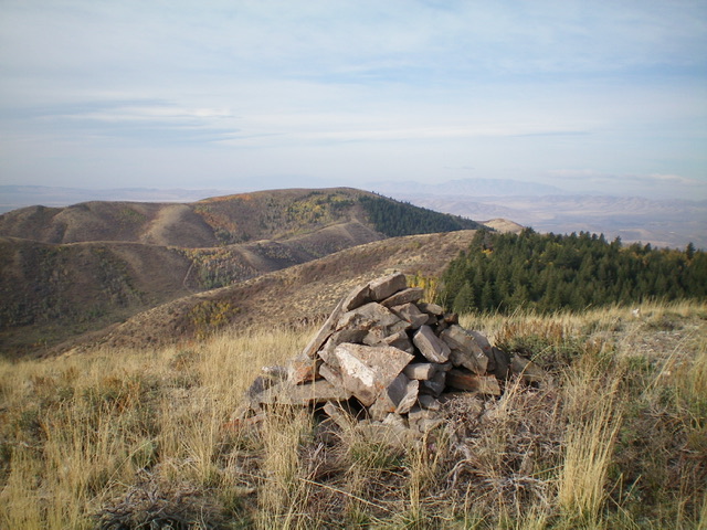
The summit cairn atop Peak 7161 with Peak 7092 in the distance (dead center). Livingston Douglas Photo
Southeast Ridge, Class 2
The Descent
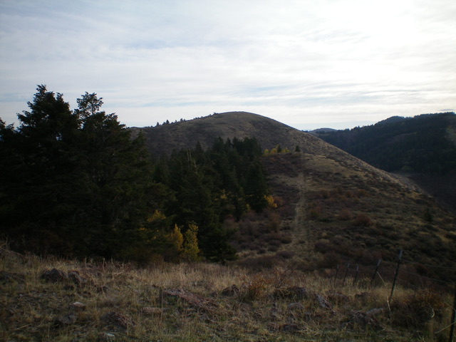
Peak 7161 as viewed from Point 7024 to its west. Livingston Douglas Photo
From the summit, descend southeast down a ridge/face of easy open field grass/scrub and quickly reach a ridge saddle with BLM-657 crossing it. This saddle has a fence row and a cattle gate there. This is the 6,780-foot connecting saddle with Pleasantview Hills HP. It concludes the second leg of today’s 3-peak journey. Pleasantview Hills HP (John Evans Mountain) is up next.
Additional Resources
Regions: Pleasantview Hills->SOUTHERN IDAHO
Mountain Range: Pleasantview Hills
Longitude: -112.5102 Latitude: 42.2329