Elevation: 7,374 ft
Prominence: 514
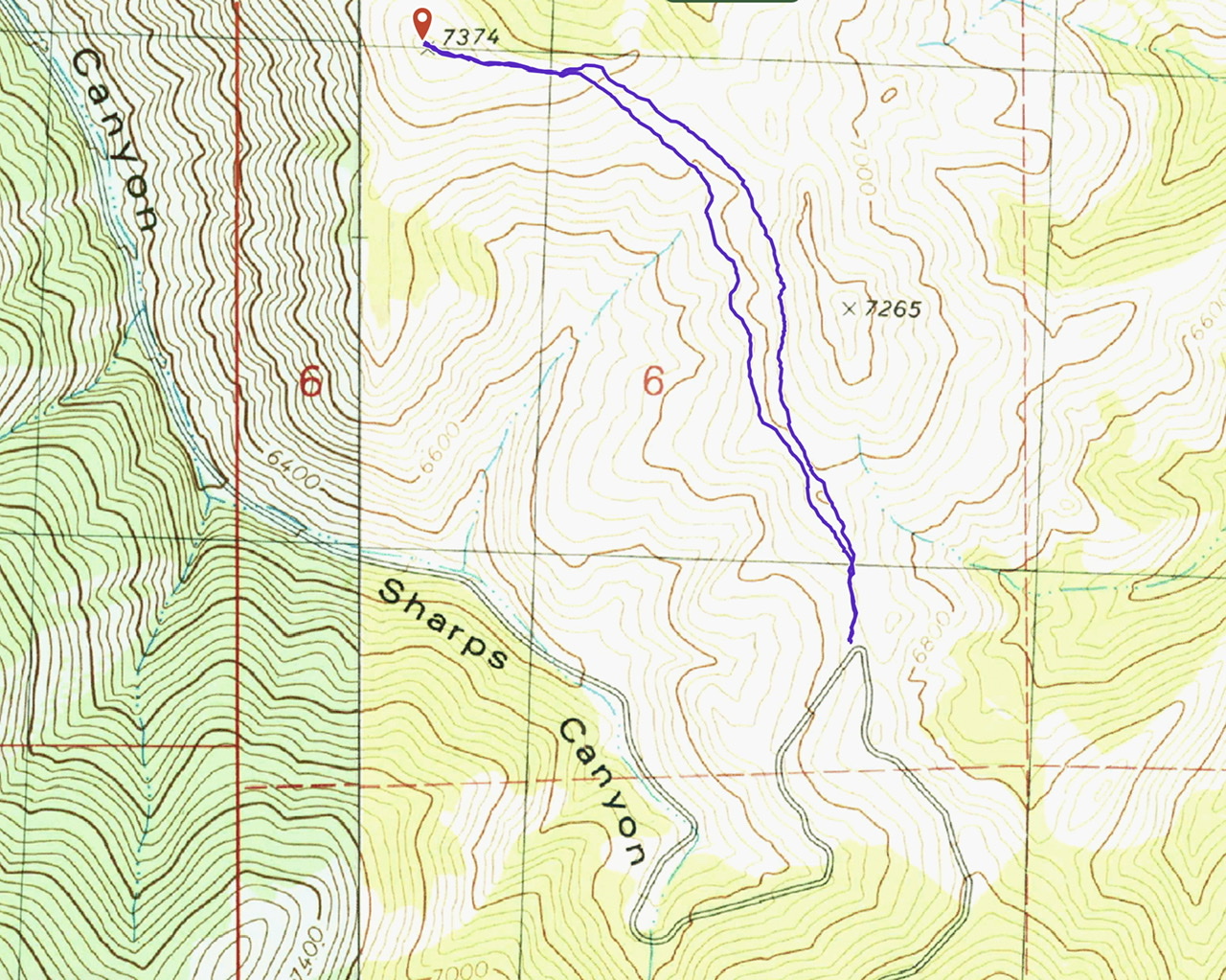
This peak is not in the book. Livingston Douglas climbed this peak as part of a grand traverse. He started at the beginning of Sharps Canyon, climbed Peak 7921, traversed to Bell Mountain and the finally ended with an ascent of this peak via its southeast ridge. You can reach the start of the southeast ridge by 4WD via the road to Bell Mountain. I added a GPS track for the shorter route below. Updated September 2020
Peak 7374 sits at the head of Crooked Creek Canyon, a side canyon that comes up from Muldoon Canyon. It is the high point on a ridge that separates Crooked Canyon from Sharps Canyon. The easiest ascent route is via Sharps Canyon Road and the southeast ridge. This area is a patchwork of BLM land, State of Idaho land, and private land. Consult the BLM Fairfield map to stay out of trouble. USGS Little Wood River Reservoir
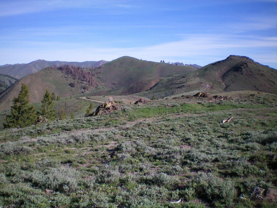
Peak 7374 (center) as viewed from the base of the north ridge of Bell Mountain. The ridge hump on the right side of the photo is Point 7265. You can see sections of the southeast ridge of Peak 7374 from here. Livingston Douglas Photo
Southeast Ridge, Class 2
Access
From the junction of ID-75 and Pine Street in Bellevue, drive east on Pine Street (which becomes Muldoon Canyon Road) for 5.9 miles to an unsigned junction with Sharps Canyon Road, a BLM road. Park near this junction in a pullout area (5,800 feet).
The Climb
This climb is the final leg of a ridge traverse from Bell Mountain to Peak 7374. From the 6,860-foot connecting saddle with Bell Mountain, leave the road and scramble north along a fence row up to Point 7265. The terrain here is open and is not too bad. Descend north-northwest from Point 7265 to reach a very narrow section of ridge. Side-hilling here is brutal, so stay on the ridge crest and work your way through the rocky outcrops/towers on the ridge (Class 2+).
The rocky terrain soon ends at a critical ridge juncture. Skirt the left/west side of a ridge hump here to reach a final saddle (7,100 feet). Scramble west up a final section of ridge on easy, open scrub to reach the bare summit of Peak 7374. The summit has a modest cairn.
The round trip distance from the road is 2.3 miles with 490 feet of elevation gain. I take issue with Livingston on one point in his description. In my opinion, the side hill past the intervening high point is not too difficult.
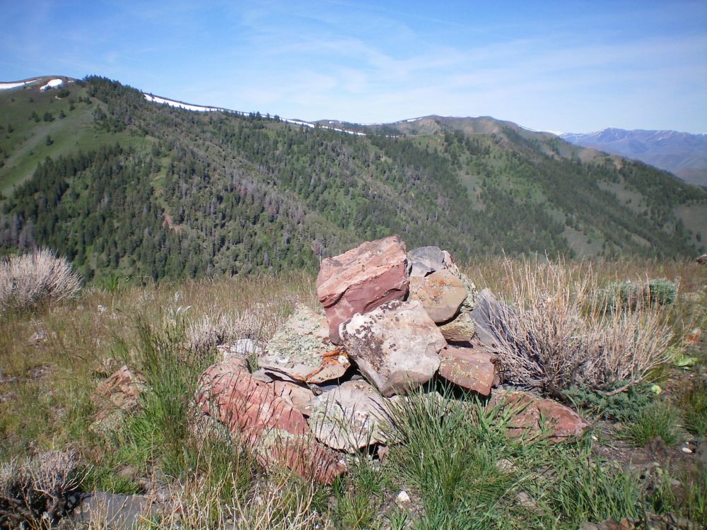
The summit cairn atop Peak 7374 with the long northeast ridge of Peak 7921 in the background. The summit of Peak 7921 is at the upper left corner of the photo. Livingston Douglas Photo
Northwest Ridge, Class 2
Access
Same as for the southeast ridge. This is the final leg of a loop route that begins and ends at the base of the Sharps Canyon BLM Road.
The Descent
From the summit, descend the loose scree of the narrow ridge northwest, staying just to the left/southwest of a lengthy burn area. At about 6,750 feet, the ridge forks. Go left/northwest here to continue down the correct ridge. The ridge finally bends right-ish/north at 6,600 feet and drops to Seamens Creek alongside Muldoon Canyon Road. Jump the small creek to reach the road. Follow Muldoon Canyon Road downstream to reach the intersection with Sharps Canyon Road and the parking area.
Additional Resources
Regions: EASTERN IDAHO->Pioneer Mountains
Mountain Range: Pioneer Mountains
Year Climbed: 2020
Longitude: -114.12429 Latitude: 43.45359