Elevation: 7,800 ft
Prominence: 240
This peak is not in the book. Livingston Douglas added a new route and photos to this page. Updated January 2023
Peak 7800 is located north of Pine Creek Pass and ID-31. It is the first peak north of the pass on the ridge that divides Teton and Bonneville counties. The summit offers excellent views of the Big Hole and Snake River Range peaks as well as the Tetons. Reach the summit via a well-used trail. In stable snow conditions, this peak offers good back-country skiing on moderate slopes. USGS Fourth of July Peak
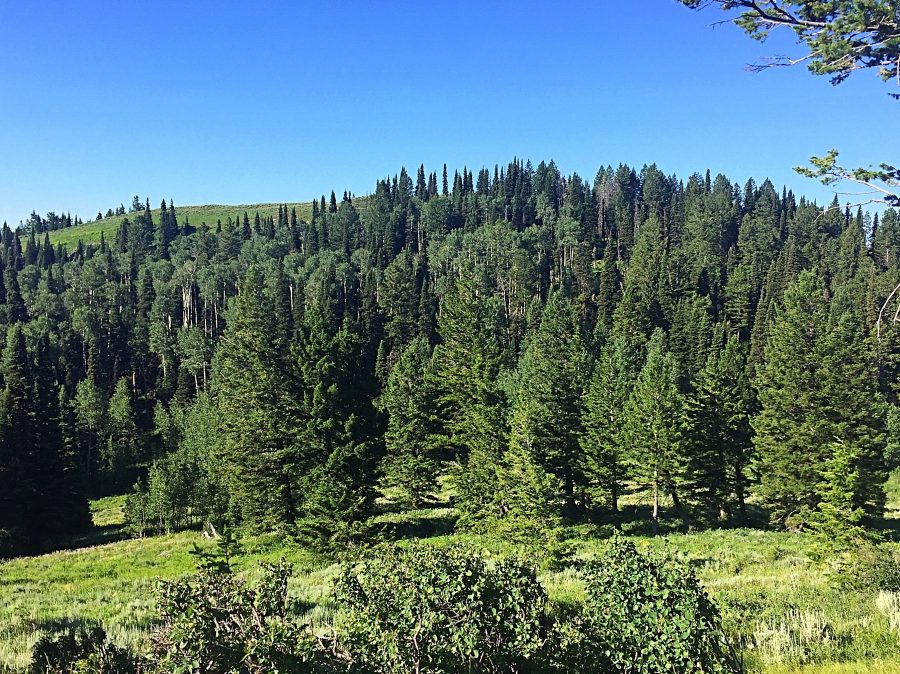
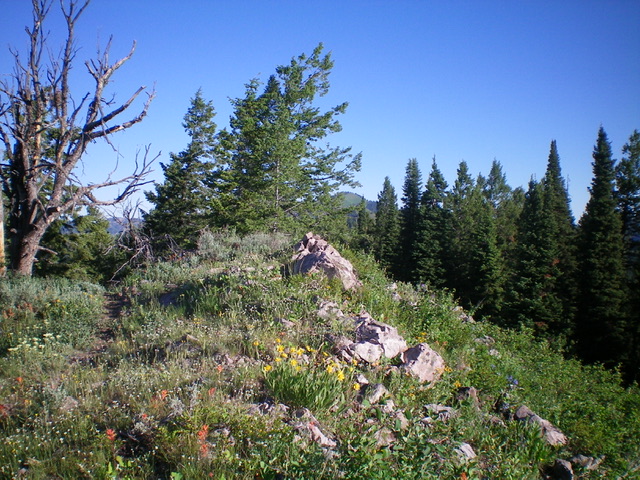
Peak 7800 as viewed from the slopes of Peak 7834.
Pine Creek Pass Route, Class 1+
Access this route from ID-31 at Pine Creek Pass. There is a large parking lot on the East Side of the highway. A good but unsigned trail leaves the pass on the West Side of the highway. This trail takes you nearly to the summit and connects with other trails that continue on to Peak 7834 and Squirrel Mountain.
The actual summit of Peak 7800 lies just north of the point where the main trail drops off the ridge. A use trail leads from this point and leads the last hundred feet or so to a small rock pile that is the high point. There was no summit register. The trail was in good shape for the entire distance (July 2017). I climbed Peak 7800, Peak 7834 and Squirrel Mountain together. The segment to Peak 7800 from Pine Creek Pass covers 1.7 miles (one-way) and entails 1,040 feet of elevation gain.
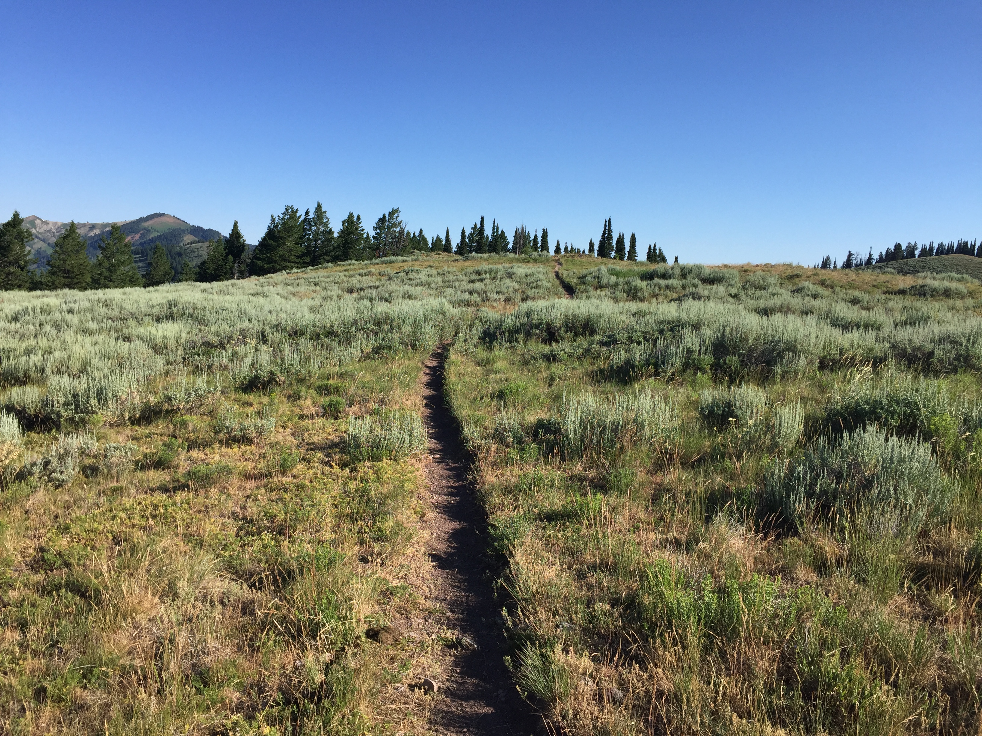
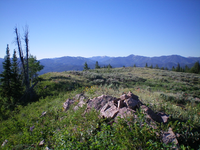
Approaching Peak 7800 from Pine Creek Pass.
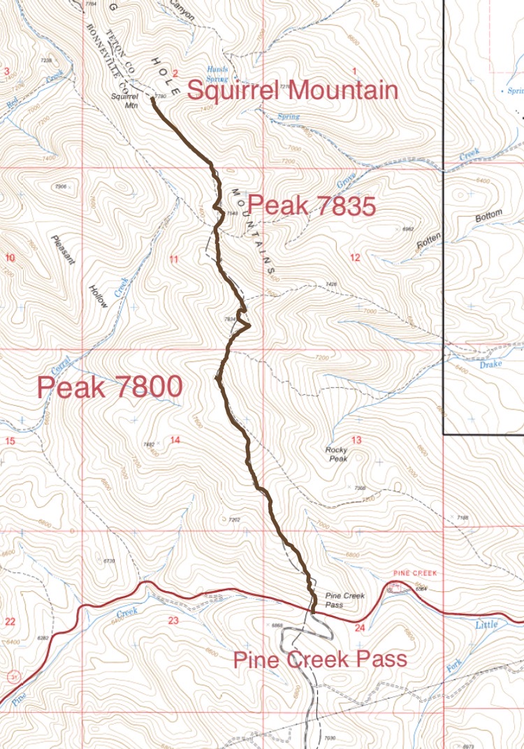
My GPS track to Peak 7800, Peak 7834, and Squirrel Mountain.
![The Pine Creek Summit area [(B)(2)] offers an excellent jumping off for backcountry skiing in both ranges when safe snow conditions exist. This shot shows the approach to Peak 7834.](https://www.idahoaclimbingguide.com/wp-content/uploads/PICT000229.jpg)
The Pine Creek Summit area [(B)(2)] offers an excellent jumping-off point for backcountry skiing in both ranges when safe snow conditions exist. This photo shows the approach to Peak 7800.
North Face Route by Livingston Douglas
Peak 7800 is a ridge bump that is located on a long north-south ridge that runs from Pine Creek Pass north to Squirrel Mountain (7,780 feet). It is mostly a trail hike but requires a short scramble off-trail to reach the open summit.
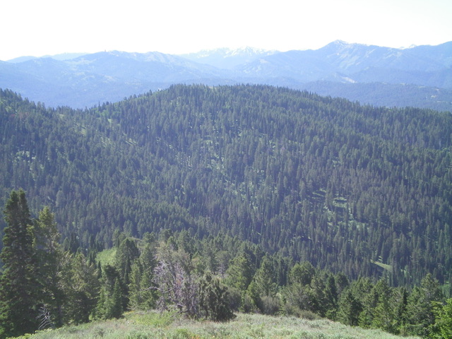
Peak 7800 (forested in mid-ground) as viewed from the northwest. Livingston Douglas Photo
Access
Drake Creek Road/FSR-548 is located just west of Victor at a sharp bend in ID-31. It is signed as W9000S Road and is located along ID-31 exactly 3.1 miles east of Pine Creek Pass and 17.0 miles east of Swan Valley. Turn west onto Drake Creek Road and drive 1.3 miles (go straight at a junction at 0.6 miles) to reach the small parking area at the trailhead for the Drake Creek Trail/FST-238. Park here (6,440 feet).
Map Errors
First, the USGS map shows two trails coming up from Drake Creek Road to the main ridge crest. However, the east shoulder trail (the northern of the two trails) no longer exists. Drake Creek Trail/FST-238 follows the southern of the two trails shown on the USGS topo map. Second, the USGS map fails to show FST-230 heading south on (or near) the ridge crest from FST-238. There is a trail (official or not) that runs from FST-238 all the way south to Pine Creek Pass. It is not shown on the USGS map. It gets within 20-30 vertical feet of the summit of Peak 7800.
Northeast Face, Class 2
The Climb
From the trailhead, hike west up the gradual then steep Drake Creek Trail for 1.5 miles to the main north-south ridge crest that connects Squirrel Mountain to Pine Creek Pass. There is a “T” junction here with FST-230 (which heads south) and FST-217 (which heads north). Go south on FST-230 for 0.2 miles to where it peaks just underneath (and east/left of) Peak 7800. Leave the trail and bushwhack up through a few aspens plus sagebrush to reach the easy, open ridgeline and open Peak 7800. There was no summit cairn on top, so I built one.
The summit area of Peak 7800, looking south. Livingston Douglas Photo
The summit cairn atop Peak 7800, looking north into the thick forest. Livingston Douglas Photo
Additional Resources
Mountain Range: Big Hole and Snake River Mountains
Year Climbed: 1982, 2017
Longitude: -111.22601 Latitude: 43.58989